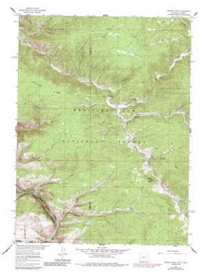
Horatio Rock Topo Map Wyoming
To zoom in, hover over the map of Horatio Rock
USGS Topo Quad 41106a3 - 1:24,000 scale
| Topo Map Name: | Horatio Rock |
| USGS Topo Quad ID: | 41106a3 |
| Print Size: | ca. 21 1/4" wide x 27" high |
| Southeast Coordinates: | 41° N latitude / 106.25° W longitude |
| Map Center Coordinates: | 41.0625° N latitude / 106.3125° W longitude |
| U.S. States: | WY, CO |
| Filename: | o41106a3.jpg |
| Download Map JPG Image: | Horatio Rock topo map 1:24,000 scale |
| Map Type: | Topographic |
| Topo Series: | 7.5´ |
| Map Scale: | 1:24,000 |
| Source of Map Images: | United States Geological Survey (USGS) |
| Alternate Map Versions: |
Horatio Rock WY 1961, updated 1963 Download PDF Buy paper map Horatio Rock WY 1961, updated 1970 Download PDF Buy paper map Horatio Rock WY 1961, updated 1984 Download PDF Buy paper map Horatio Rock WY 1961, updated 1984 Download PDF Buy paper map Horatio Rock WY 1961, updated 1984 Download PDF Buy paper map Horatio Rock WY 2012 Download PDF Buy paper map Horatio Rock WY 2015 Download PDF Buy paper map |
| FStopo: | US Forest Service topo Horatio Rock is available: Download FStopo PDF Download FStopo TIF |
1:24,000 Topo Quads surrounding Horatio Rock
> Back to 41106a1 at 1:100,000 scale
> Back to 41106a1 at 1:250,000 scale
> Back to U.S. Topo Maps home
Horatio Rock topo map: Gazetteer
Horatio Rock: Mines
Fairview Claim-Tenderfoot Mountain Mine elevation 2781m 9124′Magnolia Lode elevation 2670m 8759′
Many Values Prospect elevation 2590m 8497′
Pelton Creek Mine elevation 2562m 8405′
Horatio Rock: Parks
Pelton Park elevation 2586m 8484′Horatio Rock: Ridges
Platte Ridge elevation 2745m 9005′Horatio Rock: Streams
Anderson Creek elevation 2508m 8228′Bert Creek elevation 2584m 8477′
Devils Gate Creek elevation 2421m 7942′
East Walbright Creek elevation 2511m 8238′
Elkhorn Creek elevation 2359m 7739′
Hans Creek elevation 2476m 8123′
Illinois Creek elevation 2524m 8280′
Mowberg Creek elevation 2583m 8474′
Pelton Creek elevation 2513m 8244′
Porter Creek elevation 2352m 7716′
West Fork Devils Gate Creek elevation 2489m 8166′
Horatio Rock: Summits
Castle Rock elevation 2606m 8549′Horatio Rock elevation 2669m 8756′
Horatio Rock: Valleys
Spruce Gulch elevation 2554m 8379′Horatio Rock digital topo map on disk
Buy this Horatio Rock topo map showing relief, roads, GPS coordinates and other geographical features, as a high-resolution digital map file on DVD:
Eastern Wyoming & Western South Dakota
Buy digital topo maps: Eastern Wyoming & Western South Dakota


