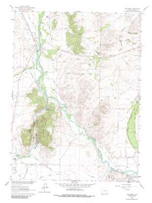
Cow Creek Topo Map Wyoming
To zoom in, hover over the map of Cow Creek
USGS Topo Quad 41106c6 - 1:24,000 scale
| Topo Map Name: | Cow Creek |
| USGS Topo Quad ID: | 41106c6 |
| Print Size: | ca. 21 1/4" wide x 27" high |
| Southeast Coordinates: | 41.25° N latitude / 106.625° W longitude |
| Map Center Coordinates: | 41.3125° N latitude / 106.6875° W longitude |
| U.S. State: | WY |
| Filename: | o41106c6.jpg |
| Download Map JPG Image: | Cow Creek topo map 1:24,000 scale |
| Map Type: | Topographic |
| Topo Series: | 7.5´ |
| Map Scale: | 1:24,000 |
| Source of Map Images: | United States Geological Survey (USGS) |
| Alternate Map Versions: |
Cow Creek WY 1961, updated 1963 Download PDF Buy paper map Cow Creek WY 1961, updated 1972 Download PDF Buy paper map Cow Creek WY 1961, updated 1985 Download PDF Buy paper map Cow Creek WY 2012 Download PDF Buy paper map Cow Creek WY 2015 Download PDF Buy paper map |
1:24,000 Topo Quads surrounding Cow Creek
> Back to 41106a1 at 1:100,000 scale
> Back to 41106a1 at 1:250,000 scale
> Back to U.S. Topo Maps home
Cow Creek topo map: Gazetteer
Cow Creek: Canals
Brush Creek Supply Ditch elevation 2209m 7247′Cyclops Ditch elevation 2162m 7093′
Donzelman and Tilton Ditch elevation 2144m 7034′
Elk Hollow Ditch elevation 2311m 7582′
Encampment Platte Valley Ditch elevation 2122m 6961′
Hopkins Number 1 Ditch elevation 2134m 7001′
Loski Ditch elevation 2143m 7030′
Ridding Number 1 Ditch elevation 2123m 6965′
Windall Ditch elevation 2224m 7296′
Cow Creek: Mines
Paine Deposit elevation 2148m 7047′Cow Creek: Streams
Beaver Creek elevation 2149m 7050′Cherokee Creek elevation 2146m 7040′
Cow Creek elevation 2110m 6922′
Elk Hollow Creek elevation 2109m 6919′
Encampment River elevation 2121m 6958′
Harrison Creek elevation 2134m 7001′
Reynolds Run elevation 2236m 7335′
Cow Creek: Summits
Baggot Rocks elevation 2343m 7687′Needle Peak elevation 2365m 7759′
Cow Creek: Valleys
Antelope Draw elevation 2202m 7224′Big Springs Draw elevation 2240m 7349′
Cornerstone Draw elevation 2254m 7395′
McCold Draw elevation 2128m 6981′
North Draw elevation 2260m 7414′
Pearce Draw elevation 2122m 6961′
Rainbow Canyon elevation 2121m 6958′
Sixteen Gulch elevation 2139m 7017′
Wood Draw elevation 2109m 6919′
Cow Creek digital topo map on disk
Buy this Cow Creek topo map showing relief, roads, GPS coordinates and other geographical features, as a high-resolution digital map file on DVD:
Eastern Wyoming & Western South Dakota
Buy digital topo maps: Eastern Wyoming & Western South Dakota


