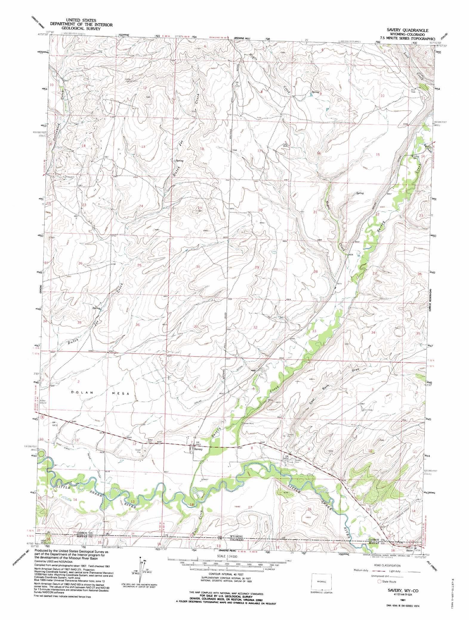
Savery Topo Map Wyoming
To zoom in, hover over the map of Savery
USGS Topo Quad 41107a4 - 1:24,000 scale
| Topo Map Name: | Savery |
| USGS Topo Quad ID: | 41107a4 |
| Print Size: | ca. 21 1/4" wide x 27" high |
| Southeast Coordinates: | 41° N latitude / 107.375° W longitude |
| Map Center Coordinates: | 41.0625° N latitude / 107.4375° W longitude |
| U.S. States: | WY, CO |
| Filename: | o41107a4.jpg |
| Download Map JPG Image: | Savery topo map 1:24,000 scale |
| Map Type: | Topographic |
| Topo Series: | 7.5´ |
| Map Scale: | 1:24,000 |
| Source of Map Images: | United States Geological Survey (USGS) |
| Alternate Map Versions: |
Savery WY 1961, updated 1963 Download PDF Buy paper map Savery WY 1961, updated 1963 Download PDF Buy paper map Savery WY 1961, updated 1995 Download PDF Buy paper map Savery WY 2010 Download PDF Buy paper map Savery WY 2012 Download PDF Buy paper map Savery WY 2015 Download PDF Buy paper map |
1:24,000 Topo Quads surrounding Savery
Blue Gap |
Garden Gulch |
Ketchum Buttes |
Mccarty Ranch |
Divide Peak |
Peach Orchard Flat |
Smiley Draw |
Browns Hill |
Tullis |
Singer Peak |
Baggs |
Dixon |
Savery |
Grieve Reservoir |
Cottonwood Rim |
Pole Gulch |
Fortification Ne |
Bakers Peak |
Fly Creek |
Tumble Mountain |
East Timberlake Creek |
Fortification |
Freeman Reservoir |
Buck Point |
Bears Ears Peaks |
> Back to 41107a1 at 1:100,000 scale
> Back to 41106a1 at 1:250,000 scale
> Back to U.S. Topo Maps home
Savery topo map: Gazetteer
Savery: Airports
Dixon Airport elevation 1974m 6476′Savery: Mines
Angier Mine elevation 2016m 6614′Beeler Mine elevation 2014m 6607′
Company Bank Mine elevation 1992m 6535′
Darling Mine elevation 2053m 6735′
Easom Mine elevation 2032m 6666′
Pioneer Mine elevation 2005m 6578′
Savery: Populated Places
Savery elevation 1971m 6466′Savery: Streams
Negro Creek elevation 2016m 6614′Putt Creek elevation 1965m 6446′
Savery Creek elevation 1962m 6437′
Savery: Summits
Dolan Mesa elevation 1984m 6509′Savery: Valleys
Big Gulch elevation 2042m 6699′Coal Bank Draw elevation 1979m 6492′
McIntosh Draw elevation 2019m 6624′
Savery digital topo map on disk
Buy this Savery topo map showing relief, roads, GPS coordinates and other geographical features, as a high-resolution digital map file on DVD:
Eastern Wyoming & Western South Dakota
Buy digital topo maps: Eastern Wyoming & Western South Dakota