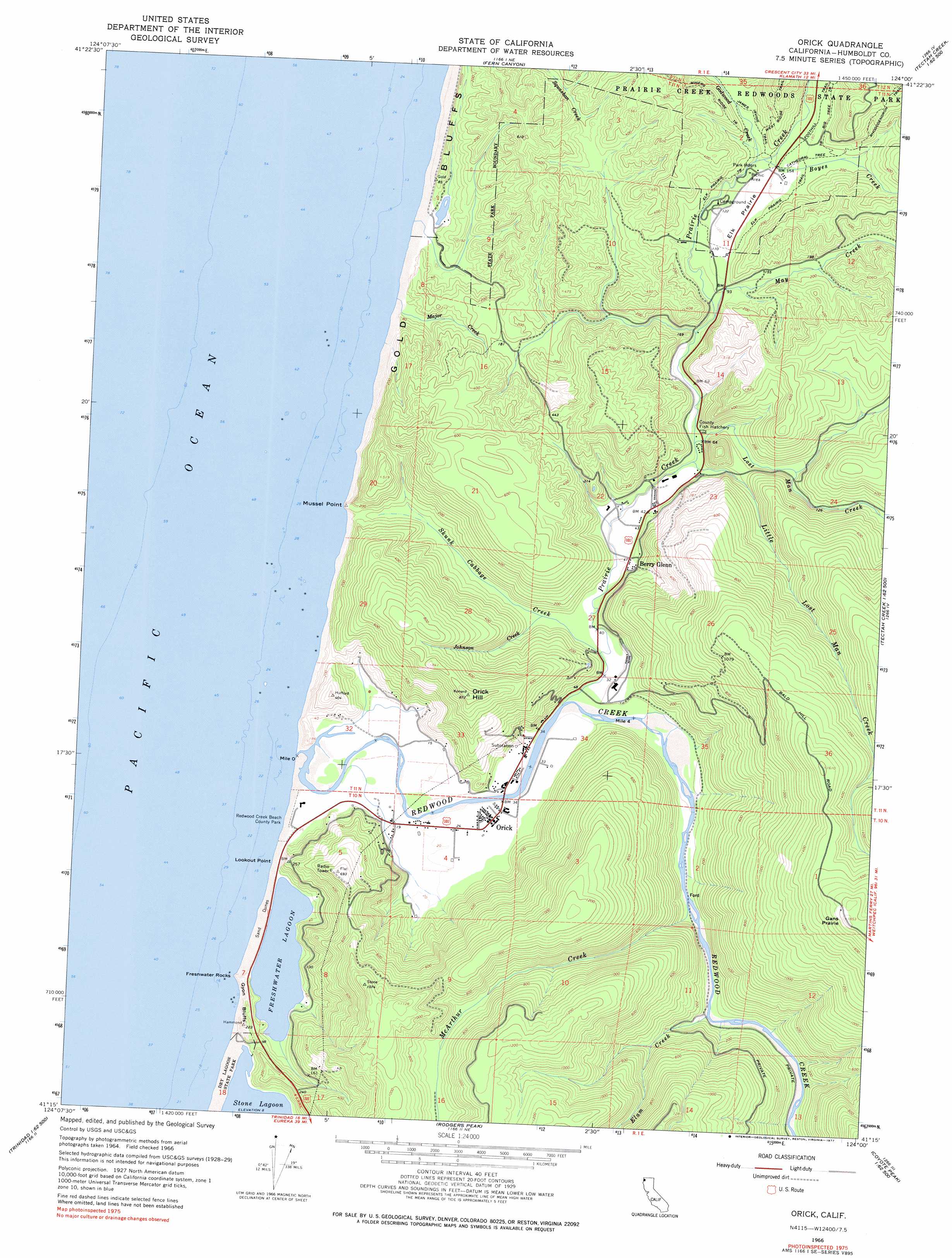
Orick Topo Map California
To zoom in, hover over the map of Orick
USGS Topo Quad 41124c1 - 1:24,000 scale
| Topo Map Name: | Orick |
| USGS Topo Quad ID: | 41124c1 |
| Print Size: | ca. 21 1/4" wide x 27" high |
| Southeast Coordinates: | 41.25° N latitude / 124° W longitude |
| Map Center Coordinates: | 41.3125° N latitude / 124.0625° W longitude |
| U.S. State: | CA |
| Filename: | o41124c1.jpg |
| Download Map JPG Image: | Orick topo map 1:24,000 scale |
| Map Type: | Topographic |
| Topo Series: | 7.5´ |
| Map Scale: | 1:24,000 |
| Source of Map Images: | United States Geological Survey (USGS) |
| Alternate Map Versions: |
Orick CA 1966, updated 1968 Download PDF Buy paper map Orick CA 1966, updated 1977 Download PDF Buy paper map Orick CA 2012 Download PDF Buy paper map Orick CA 2015 Download PDF Buy paper map |
1:24,000 Topo Quads surrounding Orick
Requa |
Klamath Glen |
Summit Valley |
||
Fern Canyon |
Ah Pah Ridge |
Blue Creek Mountain |
||
Orick |
Holter Ridge |
Johnsons |
||
Rodgers Peak |
Bald Hills |
French Camp Ridge |
||
Trinidad |
Crannell |
Panther Creek |
Hupa Mountain |
> Back to 41124a1 at 1:100,000 scale
> Back to 41124a1 at 1:250,000 scale
> Back to U.S. Topo Maps home
Orick topo map: Gazetteer
Orick: Areas
Elk Prairie elevation 41m 134′Gans Prairie elevation 562m 1843′
Orick: Capes
Lookout Point elevation 2m 6′Mussel Point elevation 0m 0′
Orick: Cliffs
Freshwater Rocks elevation 0m 0′Gold Bluffs elevation 8m 26′
Gyon Bluffs elevation 30m 98′
Orick: Lakes
Espa Lagoon elevation 5m 16′Freshwater Lagoon elevation 3m 9′
Orick: Parks
Redwood Creek Beach County Park elevation 2m 6′Orick: Populated Places
Berry Glenn elevation 16m 52′Elk Grove (historical) elevation 46m 150′
Ore'q (historical) elevation 9m 29′
Orick elevation 8m 26′
Orick: Streams
Boyes Creek elevation 45m 147′Elam Creek elevation 20m 65′
Godwood Creek elevation 43m 141′
Johnson Creek elevation 12m 39′
Little Lost Man Creek elevation 14m 45′
Lost Man Creek elevation 19m 62′
Major Creek elevation 0m 0′
May Creek elevation 20m 65′
McArthur Creek elevation 17m 55′
Prairie Creek elevation 12m 39′
Redwood Creek elevation 0m 0′
Skunk Cabbage Creek elevation 12m 39′
Orick: Summits
Orick Hill elevation 263m 862′Orick: Trails
Big Tree Trail elevation 61m 200′Cathedral Tree Trail elevation 59m 193′
Elk Prairie Trail elevation 46m 150′
Miners Ridge Trail elevation 143m 469′
Orick digital topo map on disk
Buy this Orick topo map showing relief, roads, GPS coordinates and other geographical features, as a high-resolution digital map file on DVD: