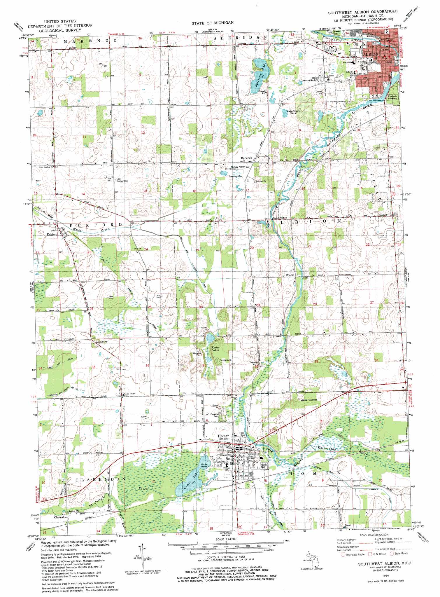
Southwest Albion Topo Map Michigan
To zoom in, hover over the map of Southwest Albion
USGS Topo Quad 42084b7 - 1:24,000 scale
| Topo Map Name: | Southwest Albion |
| USGS Topo Quad ID: | 42084b7 |
| Print Size: | ca. 21 1/4" wide x 27" high |
| Southeast Coordinates: | 42.125° N latitude / 84.75° W longitude |
| Map Center Coordinates: | 42.1875° N latitude / 84.8125° W longitude |
| U.S. State: | MI |
| Filename: | o42084b7.jpg |
| Download Map JPG Image: | Southwest Albion topo map 1:24,000 scale |
| Map Type: | Topographic |
| Topo Series: | 7.5´ |
| Map Scale: | 1:24,000 |
| Source of Map Images: | United States Geological Survey (USGS) |
| Alternate Map Versions: |
Southwest Albion MI 1980, updated 1980 Download PDF Buy paper map Southwest Albion MI 1995, updated 1999 Download PDF Buy paper map Southwest Albion MI 2011 Download PDF Buy paper map Southwest Albion MI 2014 Download PDF Buy paper map Southwest Albion MI 2017 Download PDF Buy paper map |
1:24,000 Topo Quads surrounding Southwest Albion
Bellevue |
Olivet |
Duck Lake |
Springport |
Onondaga |
Ceresco |
Marshall |
Northwest Albion |
Northeast Albion |
Parma |
Ellis Corners |
Lyon Lake |
Southwest Albion |
Southeast Albion |
Spring Arbor |
Burlington |
Tekonsha |
Litchfield |
Mosherville |
Hanover |
Coldwater West |
Coldwater East |
Allen |
Hillsdale |
North Adams |
> Back to 42084a1 at 1:100,000 scale
> Back to 42084a1 at 1:250,000 scale
> Back to U.S. Topo Maps home
Southwest Albion topo map: Gazetteer
Southwest Albion: Airports
Midway Airport elevation 292m 958′Southwest Albion: Canals
Andrus Drain elevation 302m 990′Ball and Patterson Drain elevation 292m 958′
Benham Drain elevation 299m 980′
Champion Drain elevation 302m 990′
Southwest Albion: Lakes
Homer Lake elevation 295m 967′Kesler Lake elevation 296m 971′
Spectacle Lake elevation 288m 944′
Southwest Albion: Populated Places
Albion elevation 290m 951′Babcock elevation 295m 967′
Clarendon elevation 296m 971′
Condit elevation 293m 961′
Eckford elevation 289m 948′
Homer elevation 302m 990′
Southwest Albion digital topo map on disk
Buy this Southwest Albion topo map showing relief, roads, GPS coordinates and other geographical features, as a high-resolution digital map file on DVD:
Northern Illinois, Northern Indiana & Southwestern Michigan
Buy digital topo maps: Northern Illinois, Northern Indiana & Southwestern Michigan