South Milwaukee Topo Map Wisconsin
To zoom in, hover over the map of South Milwaukee
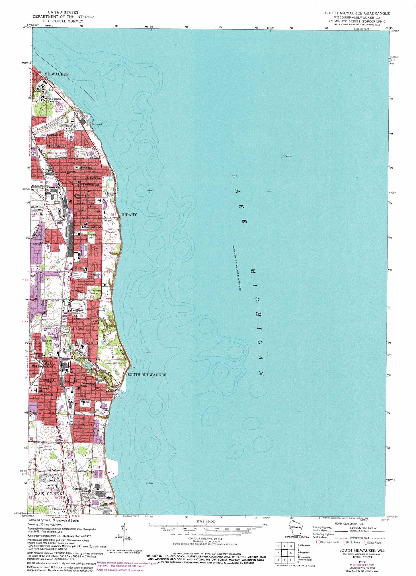
USGS Topo Quad 42087h7 - 1:24,000 scale
| Topo Map Name: | South Milwaukee |
| USGS Topo Quad ID: | 42087h7 |
| Print Size: | ca. 21 1/4" wide x 27" high |
| Southeast Coordinates: | 42.875° N latitude / 87.75° W longitude |
| Map Center Coordinates: | 42.9375° N latitude / 87.8125° W longitude |
| U.S. State: | WI |
| Filename: | o42087h7.jpg |
| Download Map JPG Image: | South Milwaukee topo map 1:24,000 scale |
| Map Type: | Topographic |
| Topo Series: | 7.5´ |
| Map Scale: | 1:24,000 |
| Source of Map Images: | United States Geological Survey (USGS) |
| Alternate Map Versions: |
South Milwaukee WI 1958, updated 1960 Download PDF Buy paper map South Milwaukee WI 1958, updated 1973 Download PDF Buy paper map South Milwaukee WI 1958, updated 1976 Download PDF Buy paper map South Milwaukee WI 1958, updated 1994 Download PDF Buy paper map South Milwaukee WI 2010 Download PDF Buy paper map South Milwaukee WI 2013 Download PDF Buy paper map South Milwaukee WI 2016 Download PDF Buy paper map |
1:24,000 Topo Quads surrounding South Milwaukee
Menomonee Falls |
Thiensville |
|||
Wauwatosa |
Milwaukee |
|||
Hales Corners |
Greendale |
South Milwaukee |
||
North Cape |
Franksville |
Racine North |
||
Union Grove |
Sturtevant |
Racine South |
> Back to 42087e1 at 1:100,000 scale
> Back to 42086a1 at 1:250,000 scale
> Back to U.S. Topo Maps home
South Milwaukee topo map: Gazetteer
South Milwaukee: Islands
Texas Rock elevation 178m 583′South Milwaukee: Parks
Bayview Park elevation 179m 587′Carrollton Park elevation 219m 718′
Cudahy Park elevation 210m 688′
Cudahy Stadium elevation 212m 695′
Grant Park elevation 195m 639′
Greene Park elevation 210m 688′
Ladish Park elevation 213m 698′
Pulaski Park elevation 214m 702′
Rawson Park elevation 204m 669′
Saint Francis Memorial Park elevation 197m 646′
Sheridan Park elevation 206m 675′
Warnimont Park elevation 209m 685′
South Milwaukee: Populated Places
Carrollville elevation 215m 705′Cudahy elevation 220m 721′
Oak Creek elevation 214m 702′
South Milwaukee elevation 204m 669′
South Milwaukee: Post Offices
South Milwaukee Post Office elevation 204m 669′South Milwaukee: Streams
Oak Creek elevation 177m 580′South Milwaukee digital topo map on disk
Buy this South Milwaukee topo map showing relief, roads, GPS coordinates and other geographical features, as a high-resolution digital map file on DVD:
Northern Illinois, Northern Indiana & Southwestern Michigan
Buy digital topo maps: Northern Illinois, Northern Indiana & Southwestern Michigan