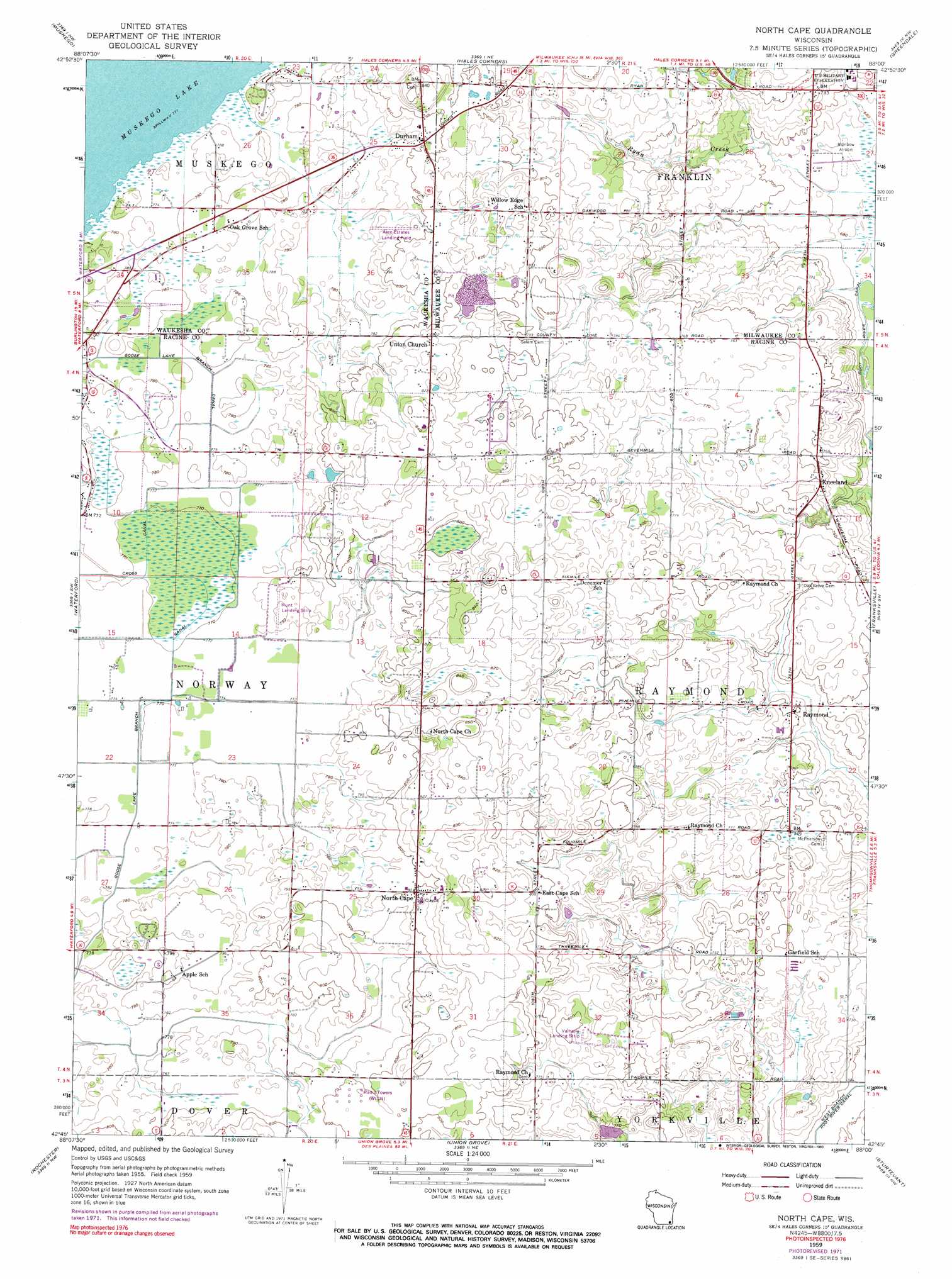
North Cape Topo Map Wisconsin
To zoom in, hover over the map of North Cape
USGS Topo Quad 42088g1 - 1:24,000 scale
| Topo Map Name: | North Cape |
| USGS Topo Quad ID: | 42088g1 |
| Print Size: | ca. 21 1/4" wide x 27" high |
| Southeast Coordinates: | 42.75° N latitude / 88° W longitude |
| Map Center Coordinates: | 42.8125° N latitude / 88.0625° W longitude |
| U.S. State: | WI |
| Filename: | o42088g1.jpg |
| Download Map JPG Image: | North Cape topo map 1:24,000 scale |
| Map Type: | Topographic |
| Topo Series: | 7.5´ |
| Map Scale: | 1:24,000 |
| Source of Map Images: | United States Geological Survey (USGS) |
| Alternate Map Versions: |
North Cape WI 1959, updated 1960 Download PDF Buy paper map North Cape WI 1959, updated 1973 Download PDF Buy paper map North Cape WI 1959, updated 1990 Download PDF Buy paper map North Cape WI 2010 Download PDF Buy paper map North Cape WI 2013 Download PDF Buy paper map North Cape WI 2016 Download PDF Buy paper map |
1:24,000 Topo Quads surrounding North Cape
Hartland |
Waukesha |
Wauwatosa |
Milwaukee |
|
Genesee |
Muskego |
Hales Corners |
Greendale |
South Milwaukee |
Mukwonago |
Waterford |
North Cape |
Franksville |
Racine North |
Burlington |
Rochester |
Union Grove |
Sturtevant |
Racine South |
Genoa City |
Silver Lake |
Paddock Lake |
Pleasant Prairie |
Kenosha |
> Back to 42088e1 at 1:100,000 scale
> Back to 42088a1 at 1:250,000 scale
> Back to U.S. Topo Maps home
North Cape topo map: Gazetteer
North Cape: Airports
Aero Estates Airport elevation 245m 803′Aero Estates Landing Field elevation 241m 790′
Cindy Guntley Memorial Airport elevation 236m 774′
Hunt Landing Strip (historical) elevation 241m 790′
Rainbow Airport (historical) elevation 207m 679′
Valhalla Airport elevation 235m 770′
North Cape: Canals
Goose Lake Branch Canal elevation 235m 770′North Cape: Parks
Franklin Park Savanna State Natural Area elevation 235m 770′North Cape: Populated Places
Durham elevation 242m 793′Kneeland elevation 228m 748′
North Cape elevation 244m 800′
Raymond elevation 227m 744′
Union Church elevation 249m 816′
North Cape digital topo map on disk
Buy this North Cape topo map showing relief, roads, GPS coordinates and other geographical features, as a high-resolution digital map file on DVD:
Northern Illinois, Northern Indiana & Southwestern Michigan
Buy digital topo maps: Northern Illinois, Northern Indiana & Southwestern Michigan