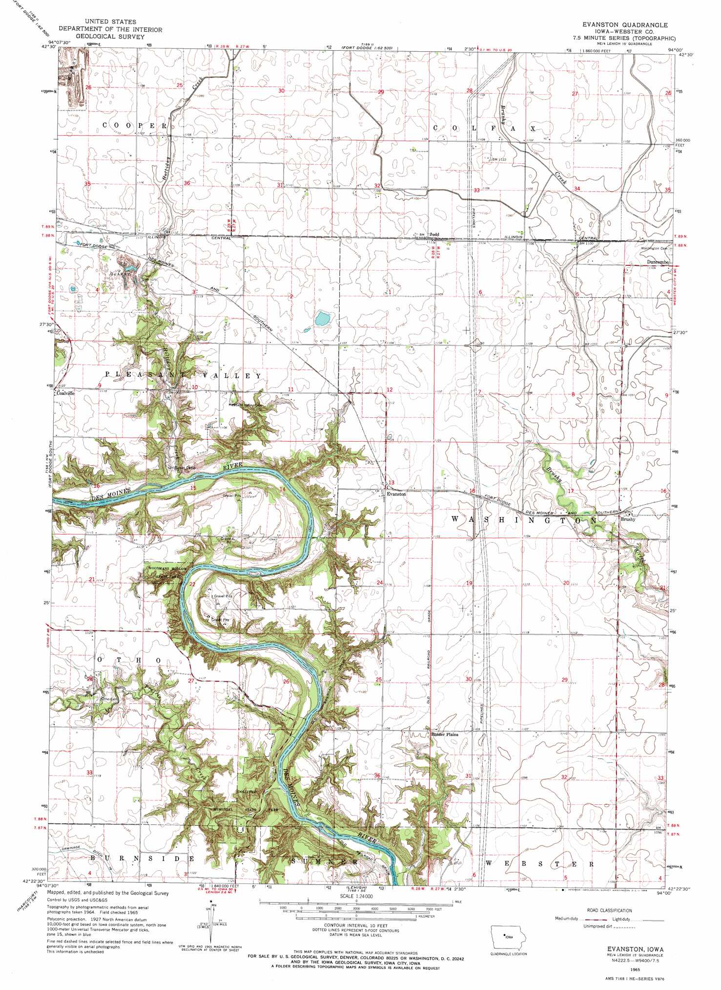
Evanston Topo Map Iowa
To zoom in, hover over the map of Evanston
USGS Topo Quad 42094d1 - 1:24,000 scale
| Topo Map Name: | Evanston |
| USGS Topo Quad ID: | 42094d1 |
| Print Size: | ca. 21 1/4" wide x 27" high |
| Southeast Coordinates: | 42.375° N latitude / 94° W longitude |
| Map Center Coordinates: | 42.4375° N latitude / 94.0625° W longitude |
| U.S. State: | IA |
| Filename: | o42094d1.jpg |
| Download Map JPG Image: | Evanston topo map 1:24,000 scale |
| Map Type: | Topographic |
| Topo Series: | 7.5´ |
| Map Scale: | 1:24,000 |
| Source of Map Images: | United States Geological Survey (USGS) |
| Alternate Map Versions: |
Evanston IA 1965, updated 1966 Download PDF Buy paper map Evanston IA 2010 Download PDF Buy paper map Evanston IA 2013 Download PDF Buy paper map Evanston IA 2015 Download PDF Buy paper map |
1:24,000 Topo Quads surrounding Evanston
Umque |
Humboldt |
Thor |
Eagle Grove |
Holmes |
Clare |
Fort Dodge North |
Vincent |
Eagle Grove Sw |
Woolstock |
Moorland |
Fort Dodge South |
Evanston |
Duncombe |
Webster City |
Gowrie |
Harcourt |
Lehigh |
Stratford |
Stanhope |
Paton |
Lanyon |
Boxholm |
Fraser |
Mackey |
> Back to 42094a1 at 1:100,000 scale
> Back to 42094a1 at 1:250,000 scale
> Back to U.S. Topo Maps home
Evanston topo map: Gazetteer
Evanston: Canals
Drainage Ditch Number 57 elevation 336m 1102′Evanston: Parks
Dolliver Memorial State Park elevation 300m 984′Holliday Creek Area Park elevation 315m 1033′
Woodmans Hollow State Park elevation 304m 997′
Evanston: Populated Places
Border Plains elevation 331m 1085′Brushy elevation 335m 1099′
Evanston elevation 338m 1108′
Judd elevation 339m 1112′
Evanston: Post Offices
Border Plains Post Office (historical) elevation 331m 1085′Brushy Post Office (historical) elevation 335m 1099′
Evanston Post Office (historical) elevation 338m 1108′
Judd Post Office (historical) elevation 339m 1112′
Ortho Post Office (historical) elevation 344m 1128′
Evanston: Streams
Holliday Creek elevation 289m 948′Prairie Creek elevation 286m 938′
Evanston digital topo map on disk
Buy this Evanston topo map showing relief, roads, GPS coordinates and other geographical features, as a high-resolution digital map file on DVD: