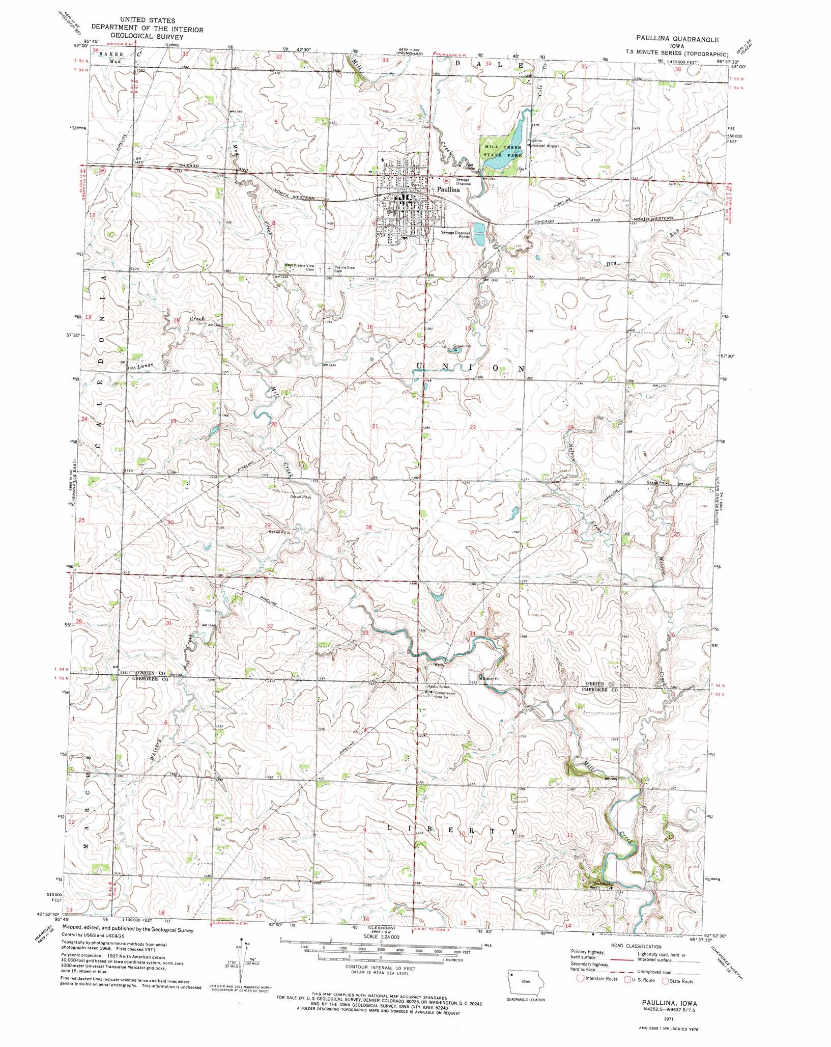
Paullina Topo Map Iowa
To zoom in, hover over the map of Paullina
USGS Topo Quad 42095h6 - 1:24,000 scale
| Topo Map Name: | Paullina |
| USGS Topo Quad ID: | 42095h6 |
| Print Size: | ca. 21 1/4" wide x 27" high |
| Southeast Coordinates: | 42.875° N latitude / 95.625° W longitude |
| Map Center Coordinates: | 42.9375° N latitude / 95.6875° W longitude |
| U.S. State: | IA |
| Filename: | o42095h6.jpg |
| Download Map JPG Image: | Paullina topo map 1:24,000 scale |
| Map Type: | Topographic |
| Topo Series: | 7.5´ |
| Map Scale: | 1:24,000 |
| Source of Map Images: | United States Geological Survey (USGS) |
| Alternate Map Versions: |
Paullina IA 1971, updated 1973 Download PDF Buy paper map Paullina IA 2010 Download PDF Buy paper map Paullina IA 2013 Download PDF Buy paper map Paullina IA 2015 Download PDF Buy paper map |
1:24,000 Topo Quads surrounding Paullina
Matlock |
Sheldon |
Sanborn |
Plessis |
Hartley |
Hospers |
Sheldon Se |
Primghar |
Gaza |
Hartley Sw |
Granville West |
Granville East |
Paullina |
Sutherland West |
Sutherland East |
Remsen |
Marcus |
Cleghorn |
Cherokee North |
Peterson Sw |
Kingsley Nw |
Fielding |
Quimby |
Cherokee South |
Aurelia |
> Back to 42095e1 at 1:100,000 scale
> Back to 42094a1 at 1:250,000 scale
> Back to U.S. Topo Maps home
Paullina topo map: Gazetteer
Paullina: Airports
Paullina Municipal Airport elevation 419m 1374′Paullina: Parks
Mill Creek State Park elevation 417m 1368′Railroad Area elevation 423m 1387′
Paullina: Populated Places
Paullina elevation 430m 1410′Paullina: Post Offices
Paullina Post Office elevation 430m 1410′Paullina: Streams
Cole Creek elevation 412m 1351′Dry Run elevation 409m 1341′
Lange Creek elevation 402m 1318′
Mud Creek elevation 402m 1318′
Nelson Creek elevation 399m 1309′
Whiskey Creek elevation 399m 1309′
Whiskey Creek elevation 412m 1351′
Willow Creek elevation 390m 1279′
Paullina digital topo map on disk
Buy this Paullina topo map showing relief, roads, GPS coordinates and other geographical features, as a high-resolution digital map file on DVD: