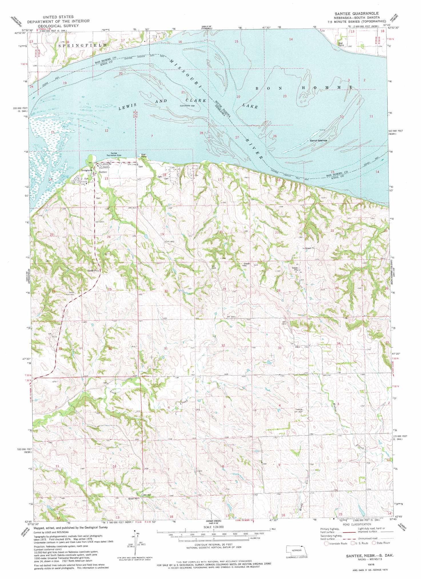
Santee Topo Map Nebraska
To zoom in, hover over the map of Santee
USGS Topo Quad 42097g7 - 1:24,000 scale
| Topo Map Name: | Santee |
| USGS Topo Quad ID: | 42097g7 |
| Print Size: | ca. 21 1/4" wide x 27" high |
| Southeast Coordinates: | 42.75° N latitude / 97.75° W longitude |
| Map Center Coordinates: | 42.8125° N latitude / 97.8125° W longitude |
| U.S. States: | NE, SD |
| Filename: | O42097G7.jpg |
| Download Map JPG Image: | Santee topo map 1:24,000 scale |
| Map Type: | Topographic |
| Topo Series: | 7.5´ |
| Map Scale: | 1:24,000 |
| Source of Map Images: | United States Geological Survey (USGS) |
| Alternate Map Versions: |
Santee NE 1978, updated 1978 Download PDF Buy paper map Santee NE 2011 Download PDF Buy paper map Santee NE 2014 Download PDF Buy paper map |
1:24,000 Topo Quads surrounding Santee
Avon |
Haucks Lake |
Tripp Se |
Kloucek Lake |
Lesterville |
Niobrara Ne |
Kingsburg |
Tyndall |
Tabor |
Tabor Ne |
Niobrara |
Springfield |
Santee |
Bon Homme Colony |
Tabor Se |
Verdigre Ne |
Sparta |
Howe Creek |
Lindy |
Bloomfield Ne |
Verdigre |
Center West |
Center East |
Bloomfield |
Bloomfield Se |
> Back to 42097e1 at 1:100,000 scale
> Back to 42096a1 at 1:250,000 scale
> Back to U.S. Topo Maps home
Santee topo map: Gazetteer
Santee: Bends
Dodsons Bend (historical) elevation 367m 1204′Santee: Islands
Sand Islands elevation 368m 1207′Santee: Parks
Sand Creek Recreation Area elevation 369m 1210′Santee Sioux Recreation Park elevation 372m 1220′
Santee: Populated Places
Santee elevation 379m 1243′Santee: Post Offices
Santee Post Office (historical) elevation 379m 1243′Santee: Streams
Silver Creek elevation 367m 1204′Santee digital topo map on disk
Buy this Santee topo map showing relief, roads, GPS coordinates and other geographical features, as a high-resolution digital map file on DVD: