Trumbull Lake Topo Map Nebraska
To zoom in, hover over the map of Trumbull Lake
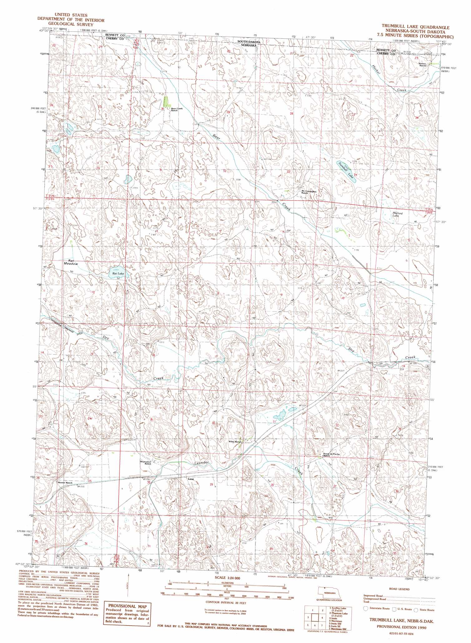
USGS Topo Quad 42101h7 - 1:24,000 scale
| Topo Map Name: | Trumbull Lake |
| USGS Topo Quad ID: | 42101h7 |
| Print Size: | ca. 21 1/4" wide x 27" high |
| Southeast Coordinates: | 42.875° N latitude / 101.75° W longitude |
| Map Center Coordinates: | 42.9375° N latitude / 101.8125° W longitude |
| U.S. States: | NE, SD |
| Filename: | O42101H7.jpg |
| Download Map JPG Image: | Trumbull Lake topo map 1:24,000 scale |
| Map Type: | Topographic |
| Topo Series: | 7.5´ |
| Map Scale: | 1:24,000 |
| Source of Map Images: | United States Geological Survey (USGS) |
| Alternate Map Versions: |
Trumbull Lake NE 1990, updated 1990 Download PDF Buy paper map Trumbull Lake NE 2011 Download PDF Buy paper map Trumbull Lake NE 2014 Download PDF Buy paper map |
1:24,000 Topo Quads surrounding Trumbull Lake
Batesland |
Swett Ne |
Deadmans Lake |
||
Two Lance Lake |
Allan Dam |
Phantom Lake |
||
Hog Island |
Irwin |
Trumbull Lake |
Merriman |
Merriman Ne |
Gordon Se |
Irwin Sw |
Irwin Se |
Merriman Sw |
Merriman Se |
Rushville 4 Ne |
Pole Creek Valley |
Bornemann Lake |
Wild Mare Lake Nw |
Wild Mare Lake |
> Back to 42101e1 at 1:100,000 scale
> Back to 42100a1 at 1:250,000 scale
> Back to U.S. Topo Maps home
Trumbull Lake topo map: Gazetteer
Trumbull Lake: Flats
Rat Meadow elevation 1035m 3395′Trumbull Lake: Lakes
Mallard Lake elevation 1011m 3316′Rat Lake elevation 1034m 3392′
Trumbull Lake elevation 1015m 3330′
Trumbull Lake: Populated Places
Leat elevation 1025m 3362′Trumbull Lake: Post Offices
Leat Post Office (historical) elevation 1025m 3362′Trumbull Lake digital topo map on disk
Buy this Trumbull Lake topo map showing relief, roads, GPS coordinates and other geographical features, as a high-resolution digital map file on DVD: