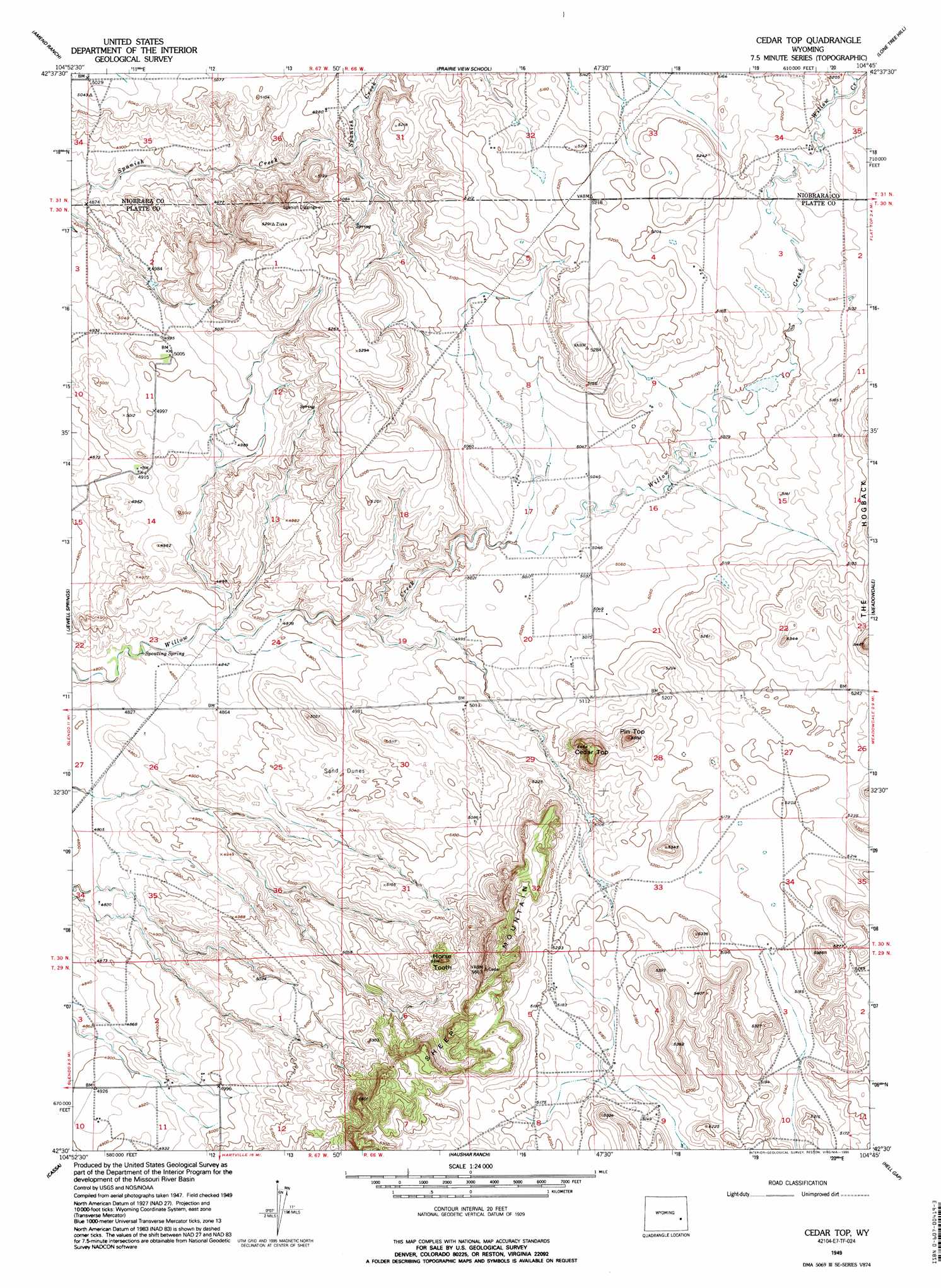
Cedar Top Topo Map Wyoming
To zoom in, hover over the map of Cedar Top
USGS Topo Quad 42104e7 - 1:24,000 scale
| Topo Map Name: | Cedar Top |
| USGS Topo Quad ID: | 42104e7 |
| Print Size: | ca. 21 1/4" wide x 27" high |
| Southeast Coordinates: | 42.5° N latitude / 104.75° W longitude |
| Map Center Coordinates: | 42.5625° N latitude / 104.8125° W longitude |
| U.S. State: | WY |
| Filename: | o42104e7.jpg |
| Download Map JPG Image: | Cedar Top topo map 1:24,000 scale |
| Map Type: | Topographic |
| Topo Series: | 7.5´ |
| Map Scale: | 1:24,000 |
| Source of Map Images: | United States Geological Survey (USGS) |
| Alternate Map Versions: |
Cedar Top WY 1949, updated 1963 Download PDF Buy paper map Cedar Top WY 1949, updated 1995 Download PDF Buy paper map Cedar Top WY 1950 Download PDF Buy paper map Cedar Top WY 2012 Download PDF Buy paper map Cedar Top WY 2015 Download PDF Buy paper map |
1:24,000 Topo Quads surrounding Cedar Top
The Park |
Lost Springs |
Keeline |
Bills Creek |
Manville |
Shawnee |
Amend Ranch |
Prairie View School |
Lone Tree Hill |
Silver Springs |
Glendo |
Jewel Springs |
Cedar Top |
Meadowdale |
Rawhide Butte West |
Sibley Peak |
Cassa |
Haushar Ranch |
Hell Gap |
Moore Spring |
Coleman Butte |
Herman Ranch |
Guernsey Reservoir |
Guernsey |
Casebier Hill |
> Back to 42104e1 at 1:100,000 scale
> Back to 42104a1 at 1:250,000 scale
> Back to U.S. Topo Maps home
Cedar Top topo map: Gazetteer
Cedar Top: Dams
Cundall Dam elevation 1540m 5052′Cedar Top: Mines
Spanish Diggings elevation 1575m 5167′Cedar Top: Pillars
Horse Tooth elevation 1656m 5433′Cedar Top: Reservoirs
Cundall Reservoir elevation 1540m 5052′Cedar Top: Springs
Spouting Spring elevation 1473m 4832′Cedar Top: Summits
Cedar Top elevation 1651m 5416′Pin Top elevation 1632m 5354′
Cedar Top digital topo map on disk
Buy this Cedar Top topo map showing relief, roads, GPS coordinates and other geographical features, as a high-resolution digital map file on DVD:
Eastern Wyoming & Western South Dakota
Buy digital topo maps: Eastern Wyoming & Western South Dakota