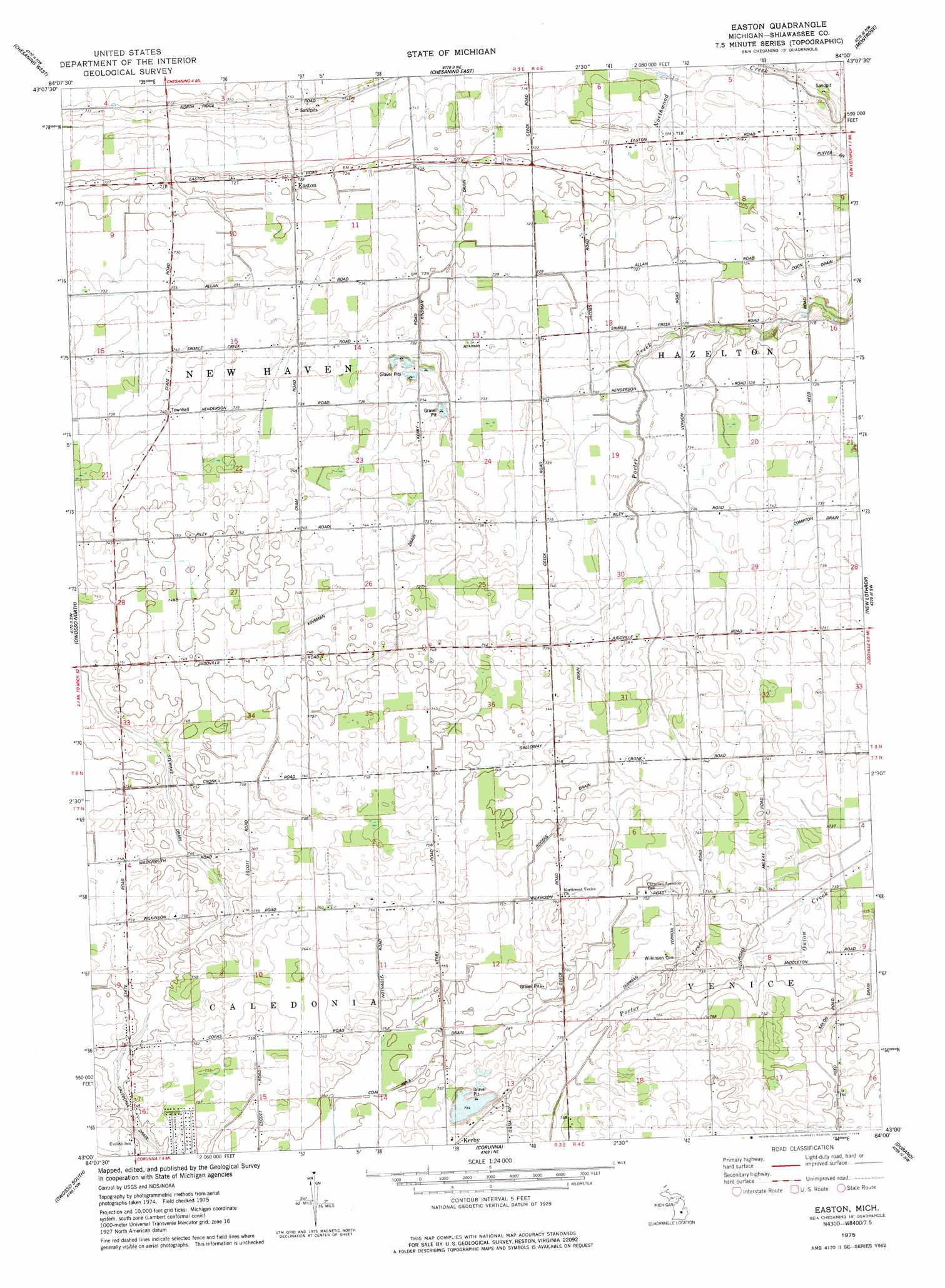
Easton Topo Map Michigan
To zoom in, hover over the map of Easton
USGS Topo Quad 43084a1 - 1:24,000 scale
| Topo Map Name: | Easton |
| USGS Topo Quad ID: | 43084a1 |
| Print Size: | ca. 21 1/4" wide x 27" high |
| Southeast Coordinates: | 43° N latitude / 84° W longitude |
| Map Center Coordinates: | 43.0625° N latitude / 84.0625° W longitude |
| U.S. State: | MI |
| Filename: | o43084a1.jpg |
| Download Map JPG Image: | Easton topo map 1:24,000 scale |
| Map Type: | Topographic |
| Topo Series: | 7.5´ |
| Map Scale: | 1:24,000 |
| Source of Map Images: | United States Geological Survey (USGS) |
| Alternate Map Versions: |
Easton MI 1975, updated 1978 Download PDF Buy paper map Easton MI 2011 Download PDF Buy paper map Easton MI 2014 Download PDF Buy paper map Easton MI 2016 Download PDF Buy paper map |
1:24,000 Topo Quads surrounding Easton
Lakefield |
Saint Charles |
Alicia |
Bridgeport |
Birch Run North |
Chapin |
Chesaning West |
Chesaning East |
Montrose |
Birch Run South |
Ovid East |
Owosso North |
Easton |
New Lothrop |
Flushing |
Laingsburg |
Owosso South |
Corunna |
Durand |
Swartz Creek |
Shaftsburg |
Perry |
Corunna Se |
Byron |
Linden |
> Back to 43084a1 at 1:100,000 scale
> Back to 43084a1 at 1:250,000 scale
> Back to U.S. Topo Maps home
Easton topo map: Gazetteer
Easton: Canals
Coal Mine Drain elevation 228m 748′Coon Drain elevation 218m 715′
Galloway Drain elevation 225m 738′
Kinsman Drain elevation 221m 725′
Rogers Drain elevation 227m 744′
Saxon Drain elevation 223m 731′
Stewart Drain elevation 225m 738′
Easton: Parks
Kerby Road Park elevation 234m 767′Easton: Populated Places
Easton elevation 221m 725′Easton: Post Offices
Easton Post Office (historical) elevation 221m 725′Easton digital topo map on disk
Buy this Easton topo map showing relief, roads, GPS coordinates and other geographical features, as a high-resolution digital map file on DVD: