Hartford East Topo Map Wisconsin
To zoom in, hover over the map of Hartford East
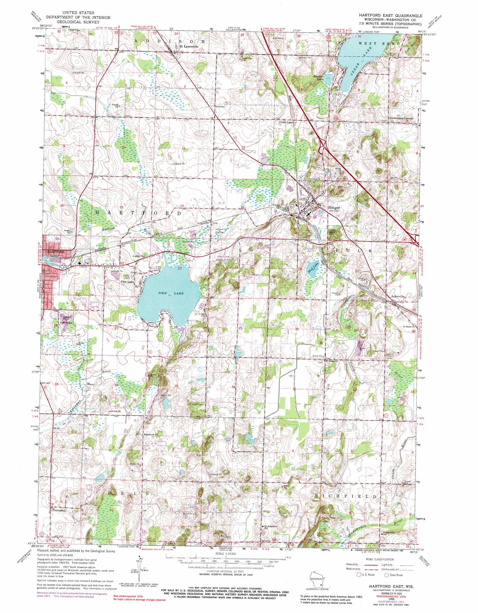
USGS Topo Quad 43088c3 - 1:24,000 scale
| Topo Map Name: | Hartford East |
| USGS Topo Quad ID: | 43088c3 |
| Print Size: | ca. 21 1/4" wide x 27" high |
| Southeast Coordinates: | 43.25° N latitude / 88.25° W longitude |
| Map Center Coordinates: | 43.3125° N latitude / 88.3125° W longitude |
| U.S. State: | WI |
| Filename: | o43088c3.jpg |
| Download Map JPG Image: | Hartford East topo map 1:24,000 scale |
| Map Type: | Topographic |
| Topo Series: | 7.5´ |
| Map Scale: | 1:24,000 |
| Source of Map Images: | United States Geological Survey (USGS) |
| Alternate Map Versions: |
Hartford East WI 1959, updated 1964 Download PDF Buy paper map Hartford East WI 1959, updated 1973 Download PDF Buy paper map Hartford East WI 1959, updated 1989 Download PDF Buy paper map Hartford East WI 2010 Download PDF Buy paper map Hartford East WI 2013 Download PDF Buy paper map Hartford East WI 2015 Download PDF Buy paper map |
1:24,000 Topo Quads surrounding Hartford East
Mayville North |
Lomira |
Campbellsport |
Kewaskum |
Batavia |
Mayville South |
Nenno |
Allenton |
West Bend |
Newburg |
Hustisford |
Hartford West |
Hartford East |
Jackson |
Five Corners |
Ixonia |
Stonebank |
Merton |
Sussex |
Menomonee Falls |
Oconomowoc West |
Oconomowoc East |
Hartland |
Waukesha |
Wauwatosa |
> Back to 43088a1 at 1:100,000 scale
> Back to 43088a1 at 1:250,000 scale
> Back to U.S. Topo Maps home
Hartford East topo map: Gazetteer
Hartford East: Crossings
Interchange 64 elevation 336m 1102′Interchange 66 elevation 344m 1128′
Interchange 68 elevation 317m 1040′
Hartford East: Dams
Pike Lake 2WP1323 Dam elevation 305m 1000′Hartford East: Lakes
Mud Lake elevation 322m 1056′Mueller Lake elevation 315m 1033′
Pike Lake elevation 303m 994′
Hartford East: Parks
Pike Lake State Park elevation 315m 1033′Hartford East: Populated Places
Ackerville elevation 320m 1049′Cedar Lake elevation 318m 1043′
Diefenbach Corners elevation 345m 1131′
Pike Lake elevation 308m 1010′
Saint Lawrence elevation 334m 1095′
Slinger elevation 323m 1059′
Thompson elevation 313m 1026′
Hartford East: Reservoirs
Pike Lake 13 elevation 305m 1000′Hartford East: Summits
Fox Hill elevation 359m 1177′Hartford East digital topo map on disk
Buy this Hartford East topo map showing relief, roads, GPS coordinates and other geographical features, as a high-resolution digital map file on DVD: