Crowley Ridge Topo Map Wisconsin
To zoom in, hover over the map of Crowley Ridge
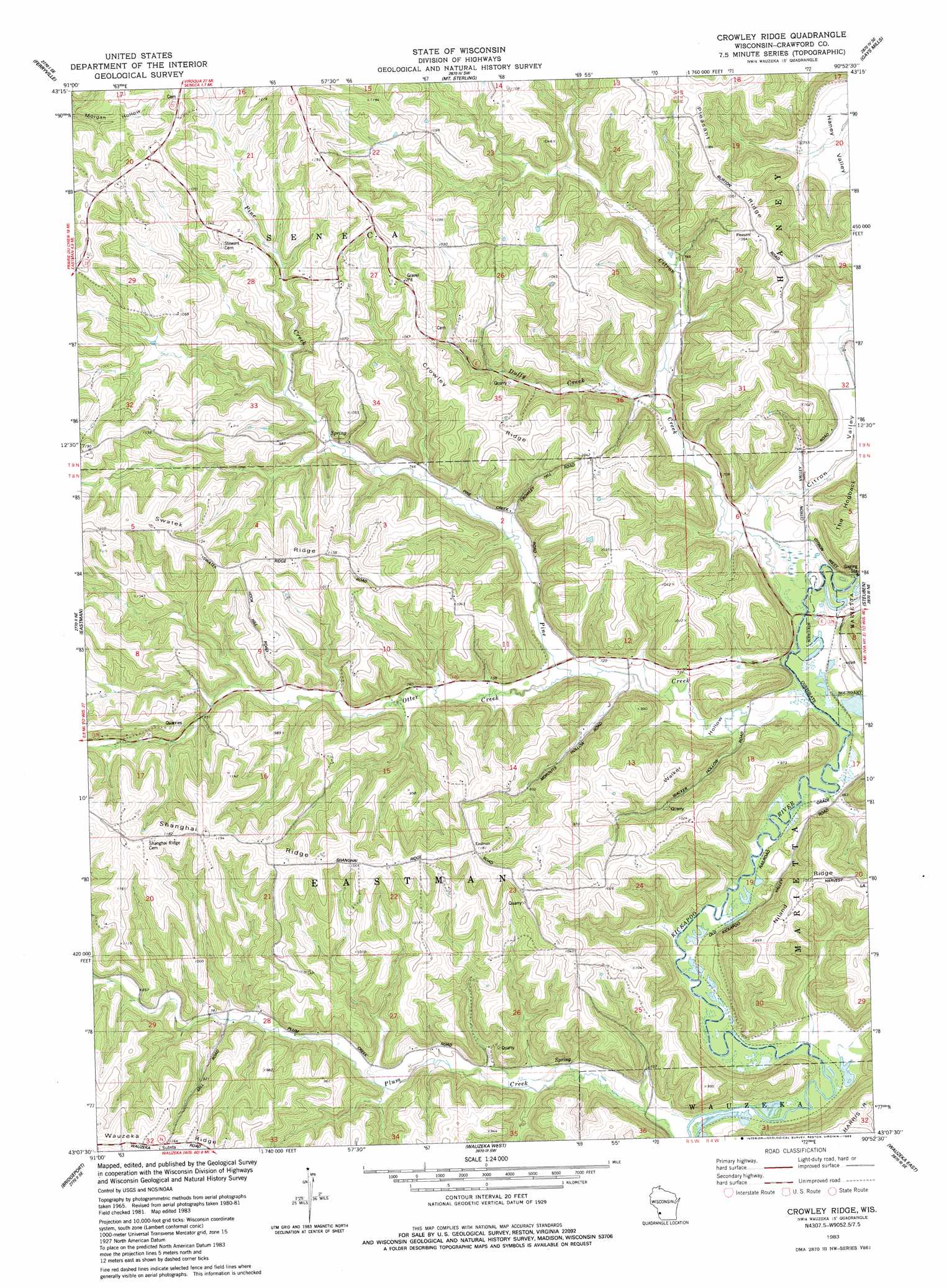
USGS Topo Quad 43090b8 - 1:24,000 scale
| Topo Map Name: | Crowley Ridge |
| USGS Topo Quad ID: | 43090b8 |
| Print Size: | ca. 21 1/4" wide x 27" high |
| Southeast Coordinates: | 43.125° N latitude / 90.875° W longitude |
| Map Center Coordinates: | 43.1875° N latitude / 90.9375° W longitude |
| U.S. State: | WI |
| Filename: | o43090b8.jpg |
| Download Map JPG Image: | Crowley Ridge topo map 1:24,000 scale |
| Map Type: | Topographic |
| Topo Series: | 7.5´ |
| Map Scale: | 1:24,000 |
| Source of Map Images: | United States Geological Survey (USGS) |
| Alternate Map Versions: |
Crowley Ridge WI 1983, updated 1983 Download PDF Buy paper map Crowley Ridge WI 2010 Download PDF Buy paper map Crowley Ridge WI 2013 Download PDF Buy paper map Crowley Ridge WI 2016 Download PDF Buy paper map |
1:24,000 Topo Quads surrounding Crowley Ridge
De Soto |
Retreat |
Rising Sun |
Readstown |
Sugar Grove |
Lansing |
Ferryville |
Mount Sterling |
Gays Mills |
Mount Zion |
Harpers Ferry |
Eastman |
Crowley Ridge |
Steuben |
Boscobel |
Prairie Du Chien |
Bridgeport |
Wauzeka West |
Wauzeka East |
Long Hollow |
Clayton |
Bagley |
Bloomington |
Mount Hope |
Fennimore |
> Back to 43090a1 at 1:100,000 scale
> Back to 43090a1 at 1:250,000 scale
> Back to U.S. Topo Maps home
Crowley Ridge topo map: Gazetteer
Crowley Ridge: Ridges
Crowley Ridge elevation 322m 1056′Niland Ridge elevation 307m 1007′
Pleasant Ridge elevation 345m 1131′
Shanghai Ridge elevation 361m 1184′
Swatek Ridge elevation 343m 1125′
Crowley Ridge: Streams
Citron Creek elevation 200m 656′Duffy Creek elevation 214m 702′
Otter Creek elevation 223m 731′
Pine Creek elevation 199m 652′
Crowley Ridge: Valleys
Citron Valley elevation 206m 675′Walker Hollow elevation 198m 649′
Crowley Ridge digital topo map on disk
Buy this Crowley Ridge topo map showing relief, roads, GPS coordinates and other geographical features, as a high-resolution digital map file on DVD: