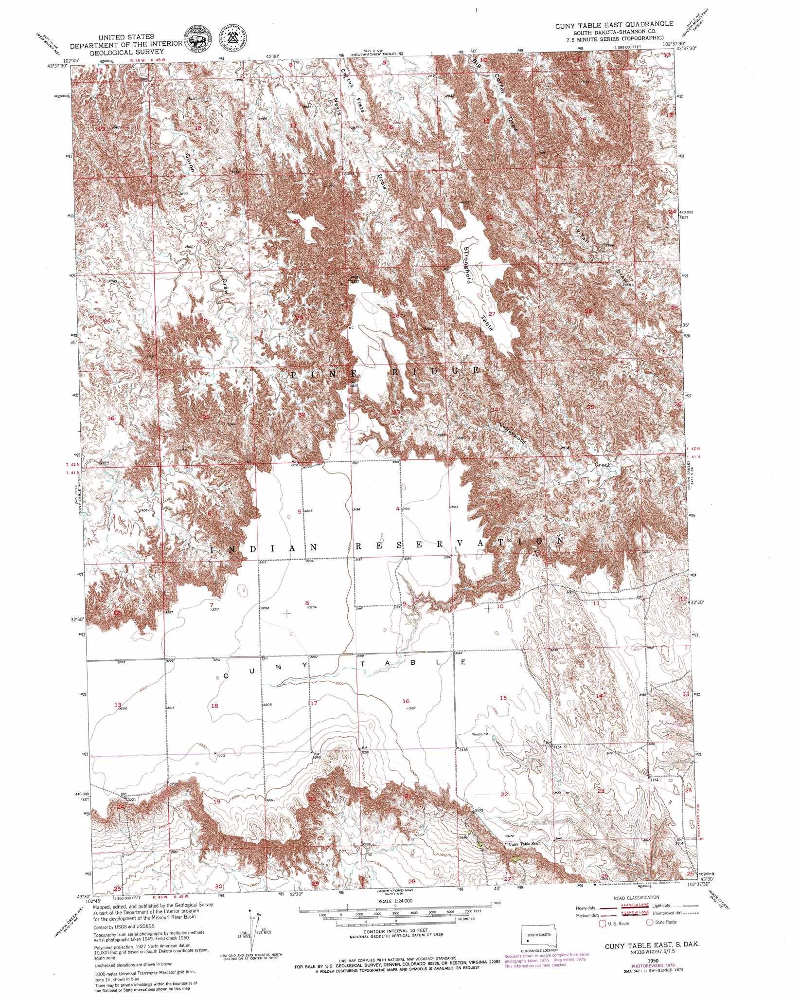
Cuny Table East Topo Map South Dakota
To zoom in, hover over the map of Cuny Table East
USGS Topo Quad 43102e6 - 1:24,000 scale
| Topo Map Name: | Cuny Table East |
| USGS Topo Quad ID: | 43102e6 |
| Print Size: | ca. 21 1/4" wide x 27" high |
| Southeast Coordinates: | 43.5° N latitude / 102.625° W longitude |
| Map Center Coordinates: | 43.5625° N latitude / 102.6875° W longitude |
| U.S. State: | SD |
| Filename: | o43102e6.jpg |
| Download Map JPG Image: | Cuny Table East topo map 1:24,000 scale |
| Map Type: | Topographic |
| Topo Series: | 7.5´ |
| Map Scale: | 1:24,000 |
| Source of Map Images: | United States Geological Survey (USGS) |
| Alternate Map Versions: |
Cuny Table East SD 1950, updated 1952 Download PDF Buy paper map Cuny Table East SD 1950, updated 1973 Download PDF Buy paper map Cuny Table East SD 1950, updated 1979 Download PDF Buy paper map Cuny Table East SD 2012 Download PDF Buy paper map Cuny Table East SD 2015 Download PDF Buy paper map |
1:24,000 Topo Quads surrounding Cuny Table East
Caputa Sw |
Folsom |
Scenic Sw |
Scenic |
Quinn Table Sw |
Red Shirt |
Red Shirt Ne |
Heutmacher Table |
Sheep Mountain Table |
Imlay |
Red Shirt Sw |
Cuny Table West |
Cuny Table East |
Stirk Table |
Imlay Sw |
Willow Creek Nw |
Willow Creek Ne |
Rockyford Nw |
Rockyford |
Sharpes Corner |
Willow Creek Sw |
Willow Creek |
Rockyford Sw |
Rockyford Se |
> Back to 43102e1 at 1:100,000 scale
> Back to 43102a1 at 1:250,000 scale
> Back to U.S. Topo Maps home
Cuny Table East topo map: Gazetteer
Cuny Table East: Benches
Stronghold Table elevation 976m 3202′Cuny Table East: Summits
Cuny Table elevation 974m 3195′Galigo Table elevation 975m 3198′
Cuny Table East digital topo map on disk
Buy this Cuny Table East topo map showing relief, roads, GPS coordinates and other geographical features, as a high-resolution digital map file on DVD:
Eastern Wyoming & Western South Dakota
Buy digital topo maps: Eastern Wyoming & Western South Dakota