Red Shirt Ne Topo Map South Dakota
To zoom in, hover over the map of Red Shirt Ne
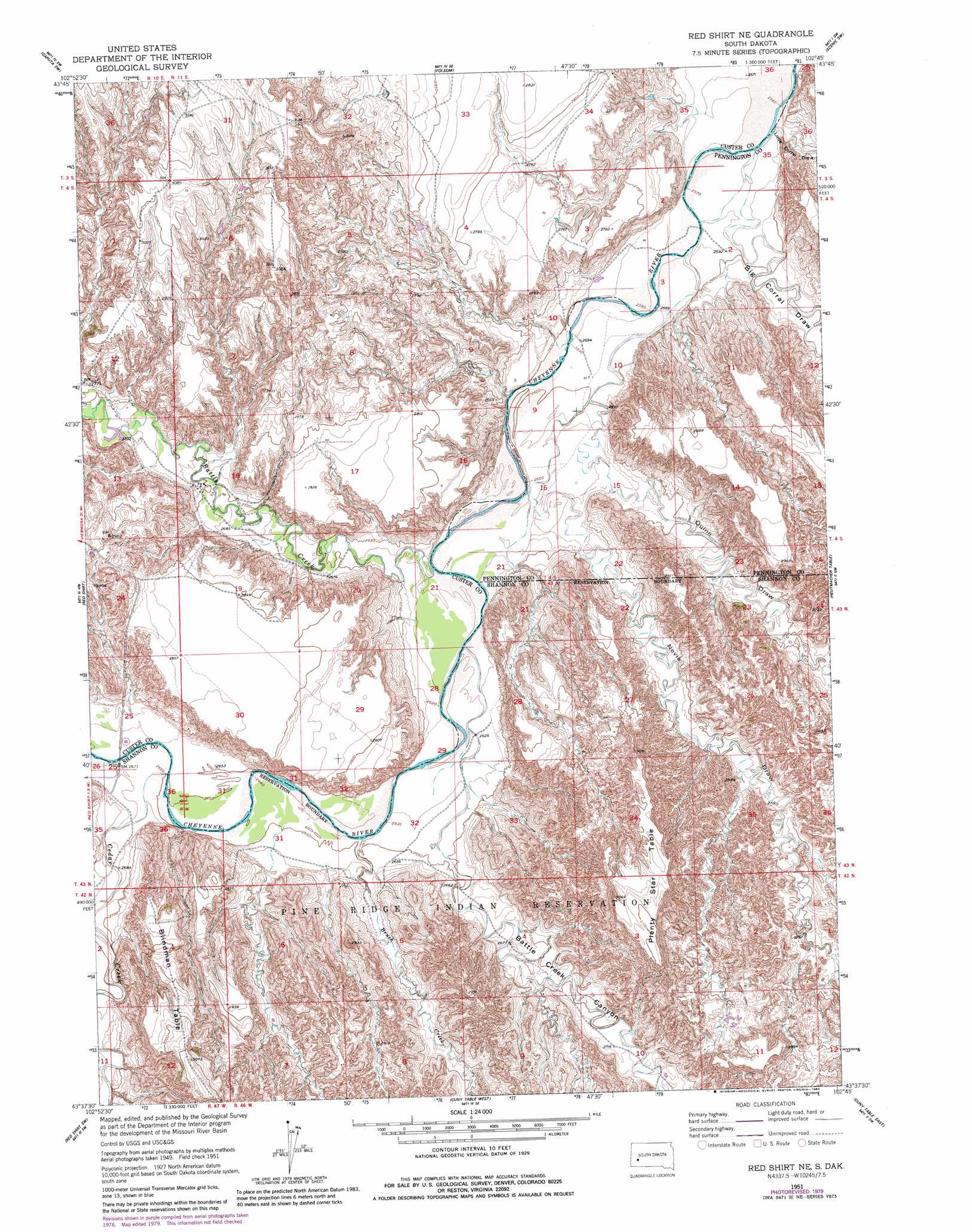
USGS Topo Quad 43102f7 - 1:24,000 scale
| Topo Map Name: | Red Shirt Ne |
| USGS Topo Quad ID: | 43102f7 |
| Print Size: | ca. 21 1/4" wide x 27" high |
| Southeast Coordinates: | 43.625° N latitude / 102.75° W longitude |
| Map Center Coordinates: | 43.6875° N latitude / 102.8125° W longitude |
| U.S. State: | SD |
| Filename: | o43102f7.jpg |
| Download Map JPG Image: | Red Shirt Ne topo map 1:24,000 scale |
| Map Type: | Topographic |
| Topo Series: | 7.5´ |
| Map Scale: | 1:24,000 |
| Source of Map Images: | United States Geological Survey (USGS) |
| Alternate Map Versions: |
Red Shirt NE SD 1951, updated 1953 Download PDF Buy paper map Red Shirt NE SD 1951, updated 1984 Download PDF Buy paper map Red Shirt NE SD 2012 Download PDF Buy paper map Red Shirt NE SD 2015 Download PDF Buy paper map |
| FStopo: | US Forest Service topo Red Shirt NE is available: Download FStopo PDF Download FStopo TIF |
1:24,000 Topo Quads surrounding Red Shirt Ne
Hermosa Ne |
Caputa |
Caputa Ne |
Creston |
Brennan Flat |
Hermosa Se |
Caputa Sw |
Folsom |
Scenic Sw |
Scenic |
Fairburn Ne |
Red Shirt |
Red Shirt Ne |
Heutmacher Table |
Sheep Mountain Table |
Fairburn Se |
Red Shirt Sw |
Cuny Table West |
Cuny Table East |
Stirk Table |
Smithwick Ne |
Willow Creek Nw |
Willow Creek Ne |
Rockyford Nw |
Rockyford |
> Back to 43102e1 at 1:100,000 scale
> Back to 43102a1 at 1:250,000 scale
> Back to U.S. Topo Maps home
Red Shirt Ne topo map: Gazetteer
Red Shirt Ne: Streams
Battle Creek elevation 796m 2611′Brush Creek elevation 804m 2637′
Cedar Creek elevation 808m 2650′
Red Shirt Ne: Summits
Plenty Star Table elevation 935m 3067′Red Shirt Ne: Valleys
Battle Creek Canyon elevation 808m 2650′Big Corral Draw elevation 786m 2578′
Little Corral Draw elevation 783m 2568′
Nevis Draw elevation 802m 2631′
Quinn Draw elevation 801m 2627′
Red Shirt Ne digital topo map on disk
Buy this Red Shirt Ne topo map showing relief, roads, GPS coordinates and other geographical features, as a high-resolution digital map file on DVD:
Eastern Wyoming & Western South Dakota
Buy digital topo maps: Eastern Wyoming & Western South Dakota