Heise Topo Map Idaho
To zoom in, hover over the map of Heise
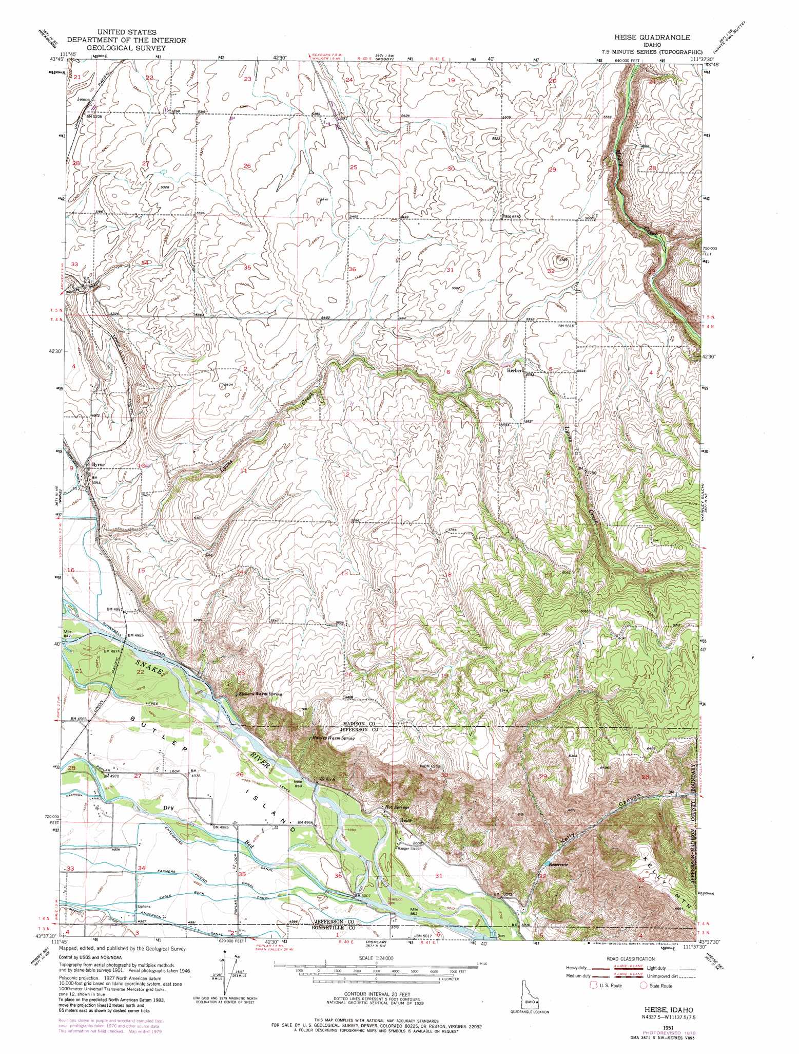
USGS Topo Quad 43111f6 - 1:24,000 scale
| Topo Map Name: | Heise |
| USGS Topo Quad ID: | 43111f6 |
| Print Size: | ca. 21 1/4" wide x 27" high |
| Southeast Coordinates: | 43.625° N latitude / 111.625° W longitude |
| Map Center Coordinates: | 43.6875° N latitude / 111.6875° W longitude |
| U.S. State: | ID |
| Filename: | o43111f6.jpg |
| Download Map JPG Image: | Heise topo map 1:24,000 scale |
| Map Type: | Topographic |
| Topo Series: | 7.5´ |
| Map Scale: | 1:24,000 |
| Source of Map Images: | United States Geological Survey (USGS) |
| Alternate Map Versions: |
Heise ID 1951, updated 1952 Download PDF Buy paper map Heise ID 1951, updated 1971 Download PDF Buy paper map Heise ID 1951, updated 1979 Download PDF Buy paper map Heise ID 2011 Download PDF Buy paper map Heise ID 2013 Download PDF Buy paper map |
| FStopo: | US Forest Service topo Heise is available: Download FStopo PDF Download FStopo TIF |
1:24,000 Topo Quads surrounding Heise
Plano |
Parker |
Saint Anthony |
Newdale |
Linderman Dam |
Menan Buttes |
Rexburg |
Moody |
White Owl Butte |
Wright Creek |
Rigby |
Ririe |
Heise |
Hawley Gulch |
Temple Peak |
Ucon |
Rigby Se |
Poplar |
Heise Se |
Wheaton Mountain |
Ammon |
Ozone |
Lone Pine Ridge |
Point Lookout |
Conant Valley |
> Back to 43111e1 at 1:100,000 scale
> Back to 43110a1 at 1:250,000 scale
> Back to U.S. Topo Maps home
Heise topo map: Gazetteer
Heise: Bends
Tie Bend elevation 1524m 5000′Heise: Dams
Leatham Dam elevation 1703m 5587′Heise: Islands
Butler Island elevation 1514m 4967′Heise: Pillars
Bertha Rock elevation 1543m 5062′Blanche Rock elevation 1718m 5636′
Heise: Populated Places
Byrne elevation 1534m 5032′Heise elevation 1525m 5003′
Herbert elevation 1705m 5593′
Jensen elevation 1587m 5206′
Heise: Springs
Elkhorn Warm Spring elevation 1574m 5164′Hawley Warm Spring elevation 1618m 5308′
Heise Hot Springs elevation 1558m 5111′
Hot Springs elevation 1557m 5108′
Heise: Streams
Lyons Creek elevation 1517m 4977′Heise: Valleys
Coyote Canyon elevation 1566m 5137′Kelly Canyon elevation 1534m 5032′
Heise digital topo map on disk
Buy this Heise topo map showing relief, roads, GPS coordinates and other geographical features, as a high-resolution digital map file on DVD: