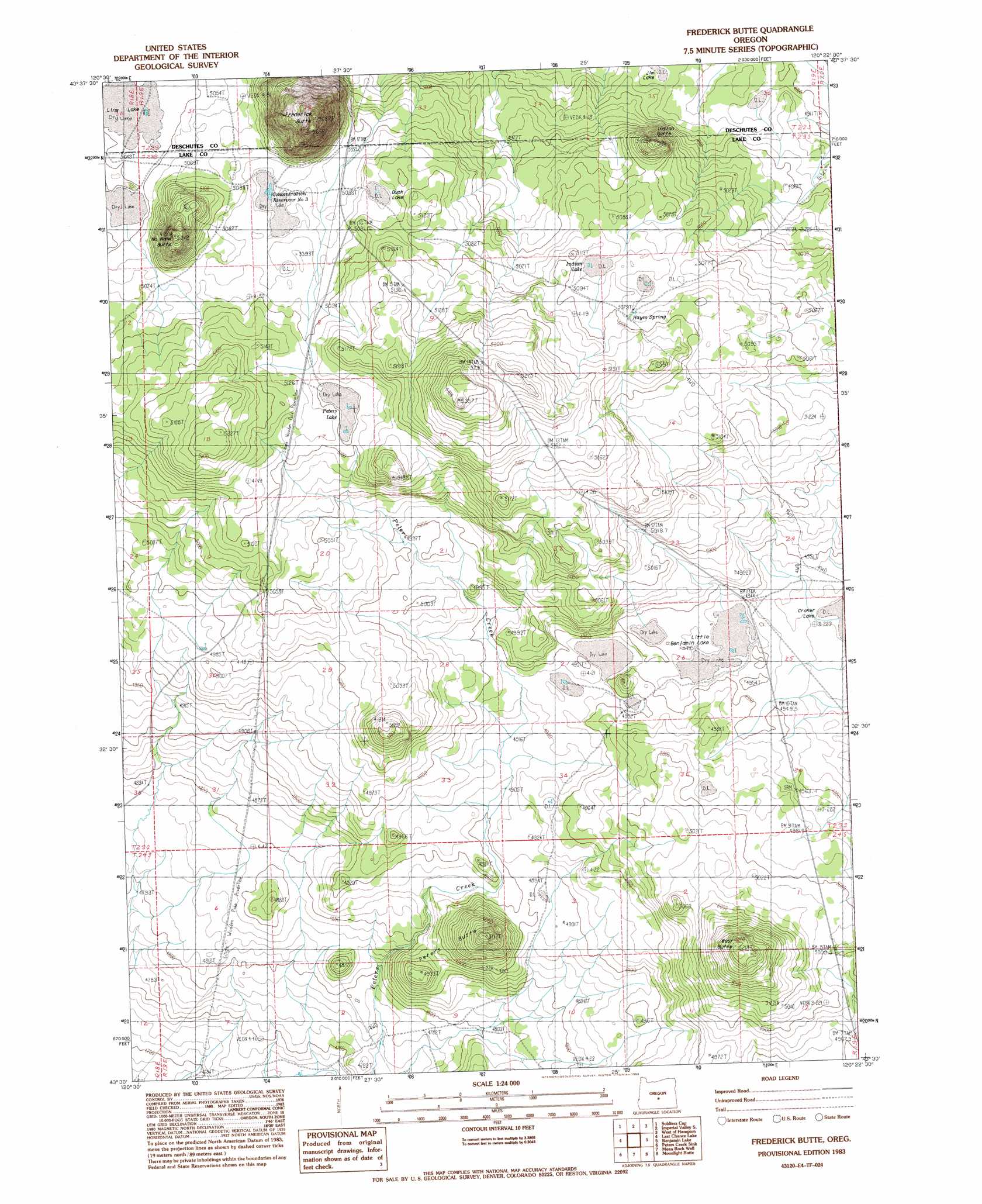
Frederick Butte Topo Map Oregon
To zoom in, hover over the map of Frederick Butte
USGS Topo Quad 43120e4 - 1:24,000 scale
| Topo Map Name: | Frederick Butte |
| USGS Topo Quad ID: | 43120e4 |
| Print Size: | ca. 21 1/4" wide x 27" high |
| Southeast Coordinates: | 43.5° N latitude / 120.375° W longitude |
| Map Center Coordinates: | 43.5625° N latitude / 120.4375° W longitude |
| U.S. State: | OR |
| Filename: | o43120e4.jpg |
| Download Map JPG Image: | Frederick Butte topo map 1:24,000 scale |
| Map Type: | Topographic |
| Topo Series: | 7.5´ |
| Map Scale: | 1:24,000 |
| Source of Map Images: | United States Geological Survey (USGS) |
| Alternate Map Versions: |
Frederick Butte OR 1983, updated 1983 Download PDF Buy paper map Frederick Butte OR 2011 Download PDF Buy paper map Frederick Butte OR 2014 Download PDF Buy paper map |
1:24,000 Topo Quads surrounding Frederick Butte
Brothers Sw |
Brothers |
Imperial Valley North |
Hampton Butte |
Long Barn |
Dickerson Flat |
Soldiers Gap |
Imperial Valley South |
West Of Hampston |
Hampton |
Walker Butte |
Last Chance Lake |
Frederick Butte |
Benjamin Lake |
Potato Lake |
Jacks Place |
Peters Creek Sink |
Mean Rock Well |
Moonlight Butte |
Chicago Valley |
Crack In The Ground |
Christmas Lake |
Fossil Lake |
Sand Rock |
Elk Butte |
> Back to 43120e1 at 1:100,000 scale
> Back to 43120a1 at 1:250,000 scale
> Back to U.S. Topo Maps home
Frederick Butte topo map: Gazetteer
Frederick Butte: Flats
Duck Lake elevation 1549m 5082′Indian Lake elevation 1549m 5082′
Jim Lake elevation 1503m 4931′
Line Lake elevation 1540m 5052′
Little Benjamin Lake elevation 1507m 4944′
Frederick Butte: Reservoirs
Concentration Reservoir Number Three elevation 1546m 5072′Frederick Butte: Springs
Hayes Spring elevation 1552m 5091′Frederick Butte: Summits
Frederick Butte elevation 1540m 5052′Indian Butte elevation 1565m 5134′
No Name Butte elevation 1627m 5337′
Peters Butte elevation 1555m 5101′
West Butte elevation 1583m 5193′
Frederick Butte digital topo map on disk
Buy this Frederick Butte topo map showing relief, roads, GPS coordinates and other geographical features, as a high-resolution digital map file on DVD: