Natural Dam Topo Map New York
To zoom in, hover over the map of Natural Dam
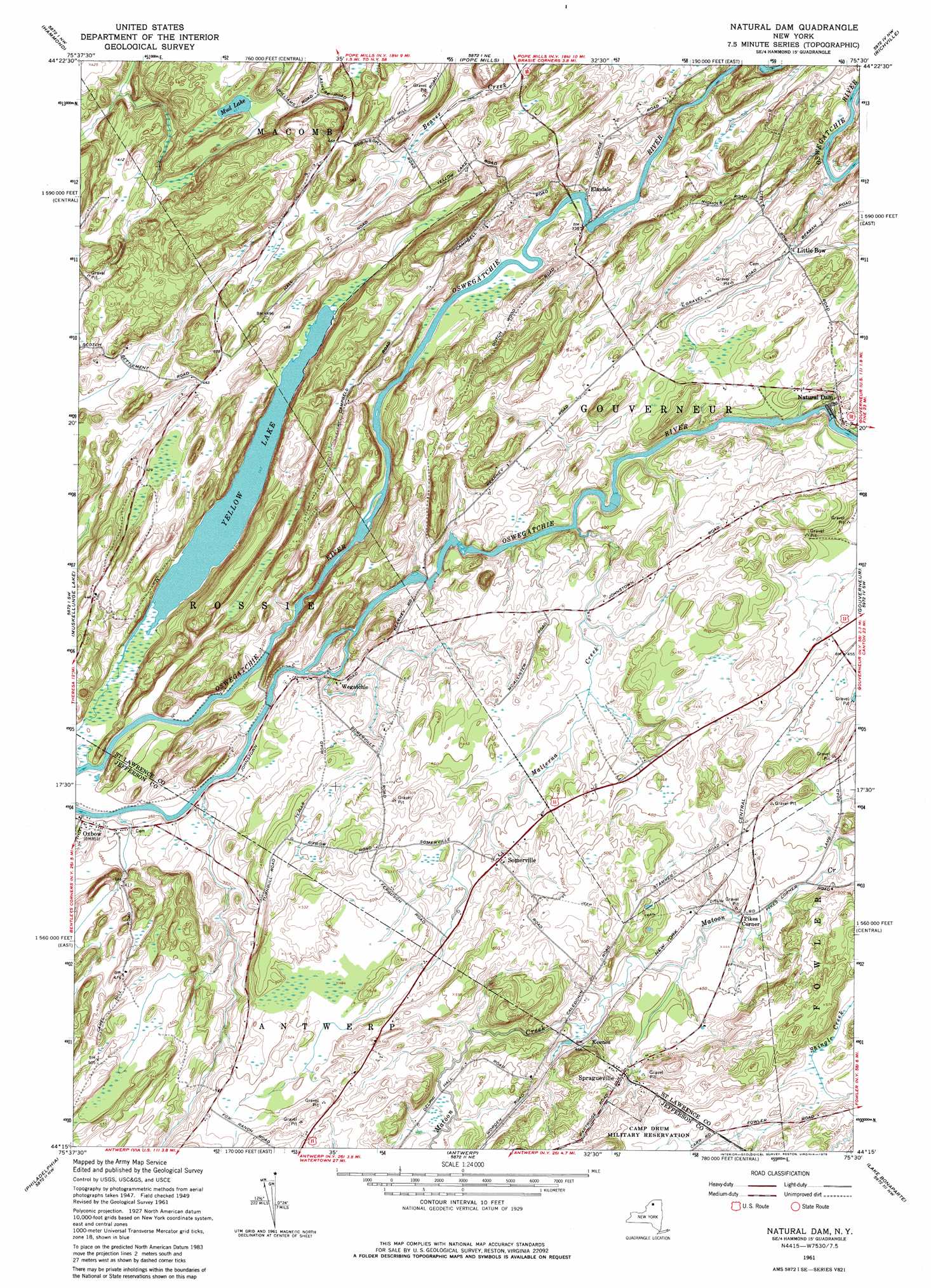
USGS Topo Quad 44075c5 - 1:24,000 scale
| Topo Map Name: | Natural Dam |
| USGS Topo Quad ID: | 44075c5 |
| Print Size: | ca. 21 1/4" wide x 27" high |
| Southeast Coordinates: | 44.25° N latitude / 75.5° W longitude |
| Map Center Coordinates: | 44.3125° N latitude / 75.5625° W longitude |
| U.S. State: | NY |
| Filename: | o44075c5.jpg |
| Download Map JPG Image: | Natural Dam topo map 1:24,000 scale |
| Map Type: | Topographic |
| Topo Series: | 7.5´ |
| Map Scale: | 1:24,000 |
| Source of Map Images: | United States Geological Survey (USGS) |
| Alternate Map Versions: |
Natural Dam NY 1951 Download PDF Buy paper map Natural Dam NY 1961, updated 1964 Download PDF Buy paper map Natural Dam NY 1961, updated 1979 Download PDF Buy paper map Natural Dam NY 1961, updated 1979 Download PDF Buy paper map Natural Dam NY 2010 Download PDF Buy paper map Natural Dam NY 2013 Download PDF Buy paper map Natural Dam NY 2016 Download PDF Buy paper map |
1:24,000 Topo Quads surrounding Natural Dam
Morristown |
Edwardsville |
Heuvelton |
Rensselaer Falls |
|
Chippewa Bay |
Hammond |
Pope Mills |
Richville |
Bigelow |
Redwood |
Muskellunge Lake |
Natural Dam |
Gouverneur |
Edwards |
Theresa |
Philadelphia |
Antwerp |
Lake Bonaparte |
Harrisville |
Black River |
Deferiet |
North Wilna |
Natural Bridge |
Remington Corners |
> Back to 44075a1 at 1:100,000 scale
> Back to 44074a1 at 1:250,000 scale
> Back to U.S. Topo Maps home
Natural Dam topo map: Gazetteer
Natural Dam: Lakes
Mud Lake elevation 125m 410′Yellow Lake elevation 104m 341′
Natural Dam: Populated Places
Elmdale elevation 104m 341′Keenes elevation 140m 459′
Little Bow elevation 119m 390′
Natural Dam elevation 134m 439′
Oxbow elevation 108m 354′
Pikes Corner elevation 134m 439′
Somerville elevation 140m 459′
Spragueville elevation 148m 485′
Wegatchie elevation 108m 354′
Natural Dam: Streams
Malterna Creek elevation 107m 351′Vrooman Creek elevation 103m 337′
Natural Dam digital topo map on disk
Buy this Natural Dam topo map showing relief, roads, GPS coordinates and other geographical features, as a high-resolution digital map file on DVD:
New York, Vermont, Connecticut & Western Massachusetts
Buy digital topo maps: New York, Vermont, Connecticut & Western Massachusetts