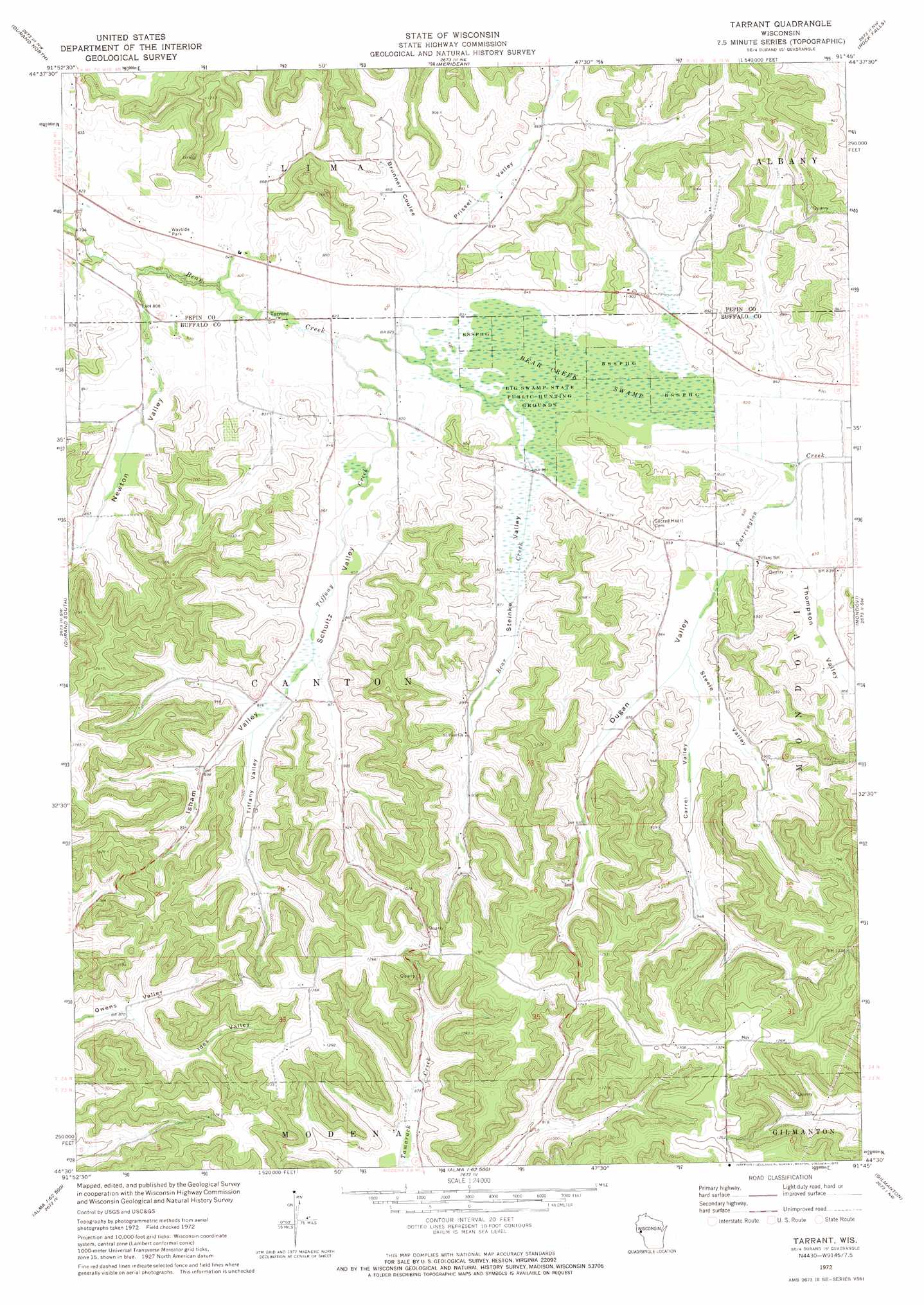
Tarrant Topo Map Wisconsin
To zoom in, hover over the map of Tarrant
USGS Topo Quad 44091e7 - 1:24,000 scale
| Topo Map Name: | Tarrant |
| USGS Topo Quad ID: | 44091e7 |
| Print Size: | ca. 21 1/4" wide x 27" high |
| Southeast Coordinates: | 44.5° N latitude / 91.75° W longitude |
| Map Center Coordinates: | 44.5625° N latitude / 91.8125° W longitude |
| U.S. State: | WI |
| Filename: | o44091e7.jpg |
| Download Map JPG Image: | Tarrant topo map 1:24,000 scale |
| Map Type: | Topographic |
| Topo Series: | 7.5´ |
| Map Scale: | 1:24,000 |
| Source of Map Images: | United States Geological Survey (USGS) |
| Alternate Map Versions: |
Tarrant WI 1972, updated 1975 Download PDF Buy paper map Tarrant WI 2010 Download PDF Buy paper map Tarrant WI 2013 Download PDF Buy paper map Tarrant WI 2015 Download PDF Buy paper map |
1:24,000 Topo Quads surrounding Tarrant
Weston |
Menomonie South |
Falls City |
Elk Creek Lake |
Eau Claire West |
Arkansaw |
Durand North |
Meridean |
Rock Falls |
Mondovi Ne |
Ella |
Durand South |
Tarrant |
Mondovi |
Rossman Creek |
Wabasha North |
Urne |
Modena |
Gilmanton |
Lookout |
Wabasha South |
Alma |
Cream |
Waumandee |
Swinns Valley |
> Back to 44091e1 at 1:100,000 scale
> Back to 44090a1 at 1:250,000 scale
> Back to U.S. Topo Maps home
Tarrant topo map: Gazetteer
Tarrant: Parks
Big Swamp State Public Hunting Grounds elevation 254m 833′Tarrant: Populated Places
Springdale (historical) elevation 293m 961′Tarrant elevation 250m 820′
Tarrant: Streams
Tiffany Creek elevation 250m 820′Tarrant: Swamps
Bear Creek Swamp elevation 254m 833′Tarrant: Valleys
Brunner Coulee elevation 253m 830′Carrel Valley elevation 265m 869′
Dugan Valley elevation 255m 836′
Ides Valley elevation 266m 872′
Isham Valley elevation 261m 856′
Newton Valley elevation 252m 826′
Prissel Valley elevation 250m 820′
Schultz Valley elevation 257m 843′
Steele Valley elevation 260m 853′
Steinke Valley elevation 257m 843′
Thompson Valley elevation 255m 836′
Tiffany Valley elevation 266m 872′
Tarrant digital topo map on disk
Buy this Tarrant topo map showing relief, roads, GPS coordinates and other geographical features, as a high-resolution digital map file on DVD: