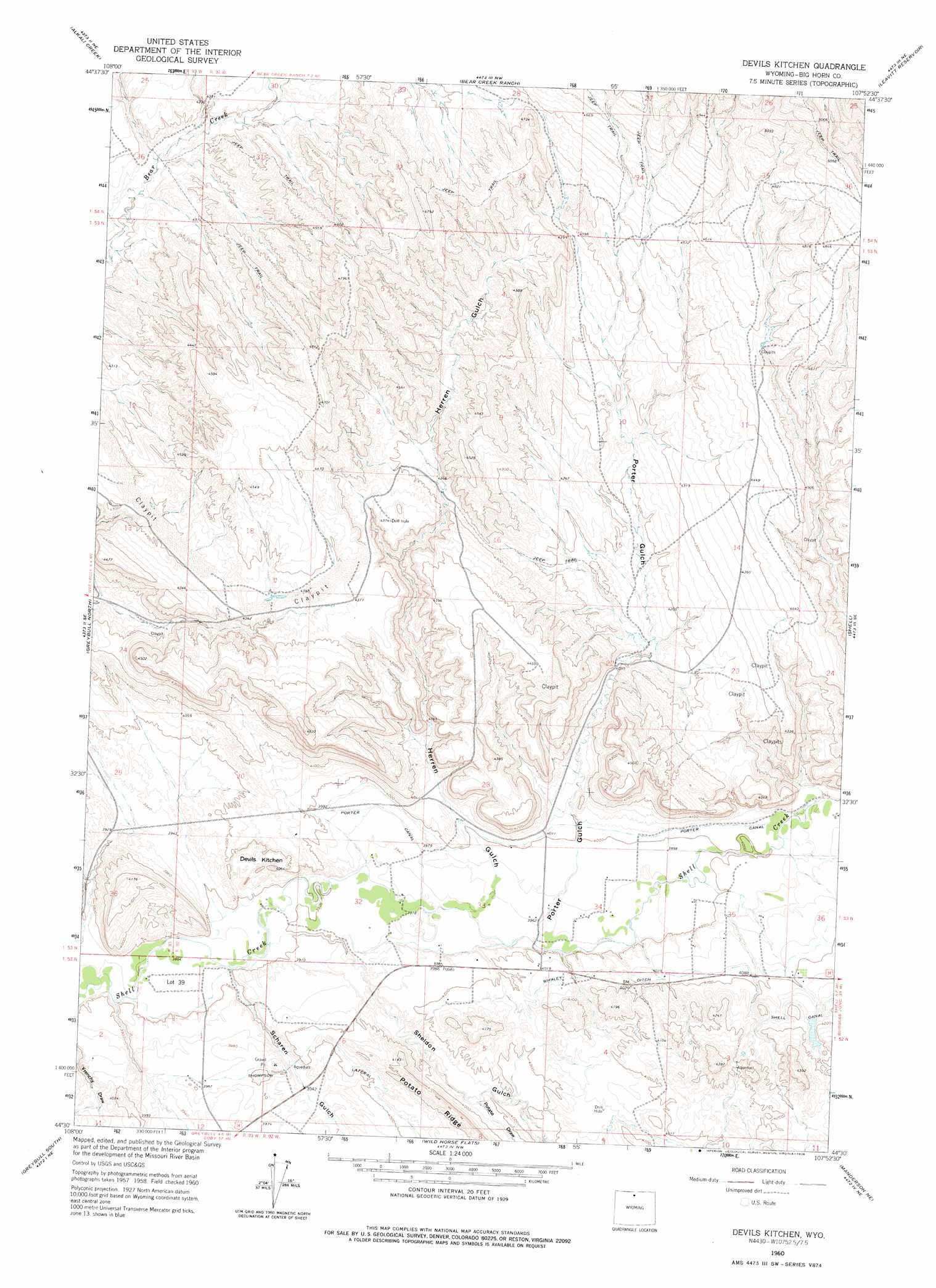
Devils Kitchen Topo Map Wyoming
To zoom in, hover over the map of Devils Kitchen
USGS Topo Quad 44107e8 - 1:24,000 scale
| Topo Map Name: | Devils Kitchen |
| USGS Topo Quad ID: | 44107e8 |
| Print Size: | ca. 21 1/4" wide x 27" high |
| Southeast Coordinates: | 44.5° N latitude / 107.875° W longitude |
| Map Center Coordinates: | 44.5625° N latitude / 107.9375° W longitude |
| U.S. State: | WY |
| Filename: | o44107e8.jpg |
| Download Map JPG Image: | Devils Kitchen topo map 1:24,000 scale |
| Map Type: | Topographic |
| Topo Series: | 7.5´ |
| Map Scale: | 1:24,000 |
| Source of Map Images: | United States Geological Survey (USGS) |
| Alternate Map Versions: |
Devils Kitchen WY 1960, updated 1962 Download PDF Buy paper map Devils Kitchen WY 1960, updated 1976 Download PDF Buy paper map Devils Kitchen WY 2012 Download PDF Buy paper map Devils Kitchen WY 2015 Download PDF Buy paper map |
1:24,000 Topo Quads surrounding Devils Kitchen
Kane |
Cottonwood Canyon |
Medicine Wheel |
Bald Mountain |
Ice Creek |
Spence |
Alkali Creek |
Bear Creek Ranch |
Leavitt Reservoir |
Hidden Tepee Creek |
Sheep Canyon |
Greybull North |
Devils Kitchen |
Shell |
Black Mountain |
Gould Butte |
Greybull South |
Wild Horse Flats |
Manderson Ne |
White Sulphur Spring |
Jones Reservoir |
Orchard Bench |
Manderson |
Manderson Se |
Flitner Reservoir |
> Back to 44107e1 at 1:100,000 scale
> Back to 44106a1 at 1:250,000 scale
> Back to U.S. Topo Maps home
Devils Kitchen topo map: Gazetteer
Devils Kitchen: Basins
Devils Kitchen elevation 1207m 3959′Devils Kitchen: Canals
Porter Canal elevation 1225m 4019′Thompson Lateral elevation 1226m 4022′
Whaley Ditch elevation 1232m 4041′
Devils Kitchen: Mines
Bear Creek Number Two Mine elevation 1354m 4442′Greybull Area Number One Mine elevation 1350m 4429′
Shell Canal Mine elevation 1230m 4035′
Snake Mine elevation 1383m 4537′
Devils Kitchen: Valleys
Herren Gulch elevation 1201m 3940′Porter Gulch elevation 1205m 3953′
Potato Draw elevation 1205m 3953′
Scharen Gulch elevation 1182m 3877′
Sheldon Gulch elevation 1184m 3884′
Devils Kitchen digital topo map on disk
Buy this Devils Kitchen topo map showing relief, roads, GPS coordinates and other geographical features, as a high-resolution digital map file on DVD:
Eastern Wyoming & Western South Dakota
Buy digital topo maps: Eastern Wyoming & Western South Dakota