Cowley Topo Map Wyoming
To zoom in, hover over the map of Cowley
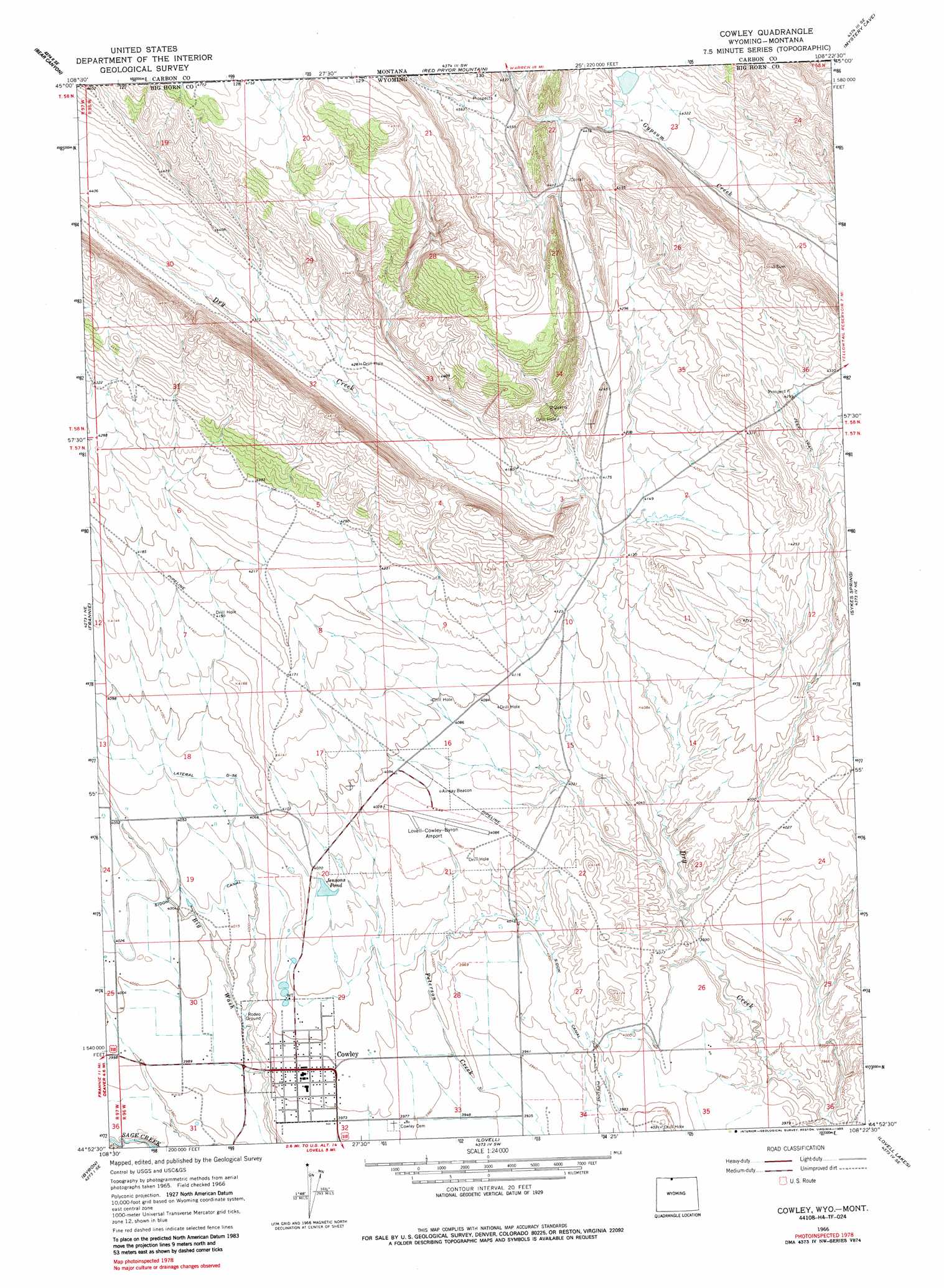
USGS Topo Quad 44108h4 - 1:24,000 scale
| Topo Map Name: | Cowley |
| USGS Topo Quad ID: | 44108h4 |
| Print Size: | ca. 21 1/4" wide x 27" high |
| Southeast Coordinates: | 44.875° N latitude / 108.375° W longitude |
| Map Center Coordinates: | 44.9375° N latitude / 108.4375° W longitude |
| U.S. States: | WY, MT |
| Filename: | o44108h4.jpg |
| Download Map JPG Image: | Cowley topo map 1:24,000 scale |
| Map Type: | Topographic |
| Topo Series: | 7.5´ |
| Map Scale: | 1:24,000 |
| Source of Map Images: | United States Geological Survey (USGS) |
| Alternate Map Versions: |
Cowley WY 1966, updated 1969 Download PDF Buy paper map Cowley WY 1966, updated 1985 Download PDF Buy paper map Cowley WY 1966, updated 1985 Download PDF Buy paper map Cowley WY 2011 Download PDF Buy paper map Cowley WY 2012 Download PDF Buy paper map Cowley WY 2015 Download PDF Buy paper map |
1:24,000 Topo Quads surrounding Cowley
Bowler |
Indian Spring |
Big Ice Cave |
East Pryor Mountain |
Dead Indian Hill |
Warren |
Bear Canyon |
Red Pryor Mountain |
Mystery Cave |
Hillsboro |
Deaver Reservoir |
Frannie |
Cowley |
Sykes Spring |
Natural Trap Cave |
Garland |
Byron |
Lovell |
Lovell Lakes |
Kane |
Gilmore Hill Nw |
Gilmore Hill Ne |
Jack Horner Reservoir |
North Emblem Reservoir |
Spence |
> Back to 44108e1 at 1:100,000 scale
> Back to 44108a1 at 1:250,000 scale
> Back to U.S. Topo Maps home
Cowley topo map: Gazetteer
Cowley: Airports
North Big Horn County Airport elevation 1244m 4081′Cowley: Dams
Gyp Reservoir Dam elevation 1373m 4504′Teeples Dam elevation 1414m 4639′
Cowley: Lakes
Jensons Pond elevation 1237m 4058′Cowley: Mines
Dry Creek Number One Mine elevation 1339m 4393′Dry Creek Number Two Mine elevation 1380m 4527′
North of Cowley Mine elevation 1369m 4491′
Cowley: Populated Places
Cowley elevation 1216m 3989′Cowley: Reservoirs
Gyp Reservoir elevation 1373m 4504′Teeples Reservoir elevation 1414m 4639′
Cowley: Valleys
Petroglyph Canyon elevation 1304m 4278′Petroglyph Canyon elevation 1304m 4278′
Cowley digital topo map on disk
Buy this Cowley topo map showing relief, roads, GPS coordinates and other geographical features, as a high-resolution digital map file on DVD: