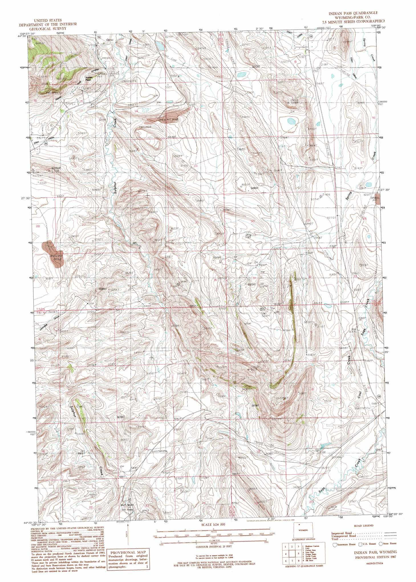
Indian Pass Topo Map Wyoming
To zoom in, hover over the map of Indian Pass
USGS Topo Quad 44109d1 - 1:24,000 scale
| Topo Map Name: | Indian Pass |
| USGS Topo Quad ID: | 44109d1 |
| Print Size: | ca. 21 1/4" wide x 27" high |
| Southeast Coordinates: | 44.375° N latitude / 109° W longitude |
| Map Center Coordinates: | 44.4375° N latitude / 109.0625° W longitude |
| U.S. State: | WY |
| Filename: | o44109d1.jpg |
| Download Map JPG Image: | Indian Pass topo map 1:24,000 scale |
| Map Type: | Topographic |
| Topo Series: | 7.5´ |
| Map Scale: | 1:24,000 |
| Source of Map Images: | United States Geological Survey (USGS) |
| Alternate Map Versions: |
Indian Pass WY 1987, updated 1988 Download PDF Buy paper map Indian Pass WY 2012 Download PDF Buy paper map Indian Pass WY 2015 Download PDF Buy paper map |
1:24,000 Topo Quads surrounding Indian Pass
Pat O' Hara Mountain |
Goff Lake |
Eaglenest Basin |
Vocation |
Ralston |
Logan Mountain |
Shoshone Canyon |
Cody |
Corbett Dam |
Stone Barn Camp |
Castle Rock Creek |
Irma Flats |
Indian Pass |
Oregon Basin |
Eagle Pass |
Belknap Creek |
Devils Tooth |
Horner Creek |
Elk Butte |
Sleepers Ranch |
North Fork Pickett Creek |
Thomas Reservoir |
Tonopah Ridge |
Meeteetse West |
Meeteetse East |
> Back to 44109a1 at 1:100,000 scale
> Back to 44108a1 at 1:250,000 scale
> Back to U.S. Topo Maps home
Indian Pass topo map: Gazetteer
Indian Pass: Canals
Indian Pass Lateral elevation 1604m 5262′Indian Pass: Dams
Cedar Ridge Dam elevation 1605m 5265′Indian Pass: Gaps
Indian Pass elevation 1639m 5377′Indian Pass: Mines
Big Horn Gypsum Company Quarry elevation 1612m 5288′Pat O'Hara Gypsum Quarry Number One elevation 1626m 5334′
Spirit Mountain Uranium Company Mine elevation 1632m 5354′
Indian Pass: Reservoirs
Cedar Ridge Reservoir elevation 1605m 5265′Indian Pass: Streams
Coal Creek elevation 1627m 5337′Indian Pass digital topo map on disk
Buy this Indian Pass topo map showing relief, roads, GPS coordinates and other geographical features, as a high-resolution digital map file on DVD: