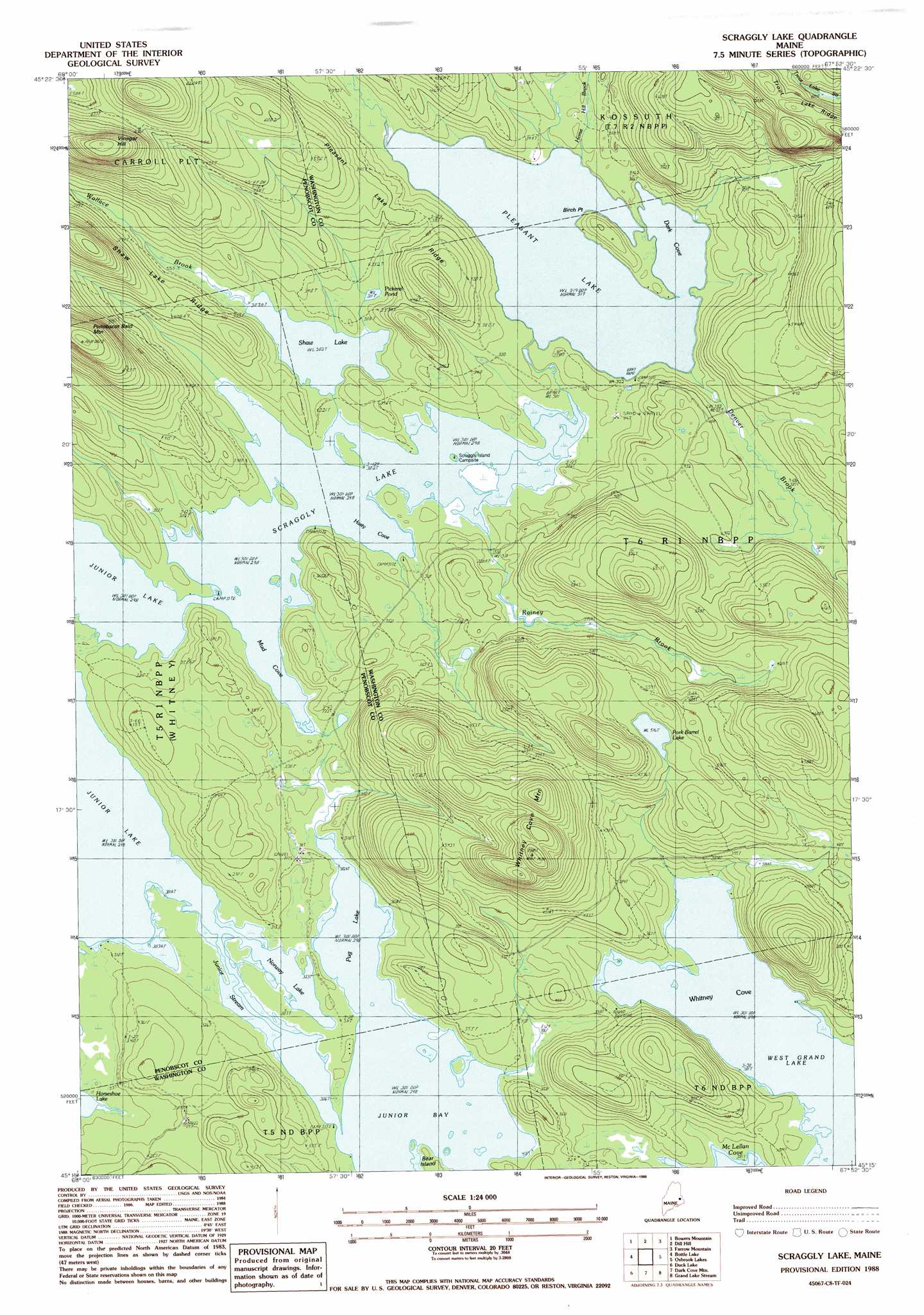
Scraggly Lake Topo Map Maine
To zoom in, hover over the map of Scraggly Lake
USGS Topo Quad 45067c8 - 1:24,000 scale
| Topo Map Name: | Scraggly Lake |
| USGS Topo Quad ID: | 45067c8 |
| Print Size: | ca. 21 1/4" wide x 27" high |
| Southeast Coordinates: | 45.25° N latitude / 67.875° W longitude |
| Map Center Coordinates: | 45.3125° N latitude / 67.9375° W longitude |
| U.S. State: | ME |
| Filename: | o45067c8.jpg |
| Download Map JPG Image: | Scraggly Lake topo map 1:24,000 scale |
| Map Type: | Topographic |
| Topo Series: | 7.5´ |
| Map Scale: | 1:24,000 |
| Source of Map Images: | United States Geological Survey (USGS) |
| Alternate Map Versions: |
Scraggly Lake SW ME 1975, updated 1980 Download PDF Buy paper map Scraggly Lake ME 1988, updated 1988 Download PDF Buy paper map Scraggly Lake ME 2011 Download PDF Buy paper map Scraggly Lake ME 2014 Download PDF Buy paper map |
1:24,000 Topo Quads surrounding Scraggly Lake
Kingman |
Potter Hill |
Stetson Mountain |
Brookton |
Forest |
Springfield |
Bowers Mountain |
Dill Hill |
Farrow Mountain |
Tomah Mountain |
Weir Pond |
Bottle Lake |
Scraggly Lake |
Oxbrook Lakes |
Waite |
Spring Lake |
Duck Lake |
Dark Cove Mountain |
Grand Lake Stream |
Big Lake |
West Lake |
Gassabias Lake |
Fletcher Peak |
Monroe Lake |
Clifford Lake |
> Back to 45067a1 at 1:100,000 scale
> Back to 45066a1 at 1:250,000 scale
> Back to U.S. Topo Maps home
Scraggly Lake topo map: Gazetteer
Scraggly Lake: Bays
Dark Cove elevation 97m 318′Horse Hill Brook elevation 91m 298′
Junior Bay elevation 91m 298′
Mud Cove elevation 91m 298′
Whitney Cove elevation 91m 298′
Scraggly Lake: Capes
Birch Point elevation 98m 321′Scraggly Lake: Lakes
Norway Lake elevation 91m 298′Pickerel Pond elevation 95m 311′
Pleasant Lake elevation 97m 318′
Pork Barrel Lake elevation 157m 515′
Pug Lake elevation 91m 298′
Scraggly Lake elevation 91m 298′
Shaw Lake elevation 92m 301′
Scraggly Lake: Ridges
Pleasant Lake Ridge elevation 170m 557′Shaw Lake Ridge elevation 216m 708′
Trout Lake Ridge elevation 267m 875′
Scraggly Lake: Streams
Denver Brook elevation 97m 318′Horsehill Brook elevation 97m 318′
Junior Stream elevation 91m 298′
Rainey Brook elevation 91m 298′
Wallace Brook elevation 93m 305′
Scraggly Lake: Summits
Penobscot Bald Mountain elevation 252m 826′Vinegar Hill elevation 284m 931′
Whitney Cove Mountain elevation 247m 810′
Scraggly Lake digital topo map on disk
Buy this Scraggly Lake topo map showing relief, roads, GPS coordinates and other geographical features, as a high-resolution digital map file on DVD:
Maine, New Hampshire, Rhode Island & Eastern Massachusetts
Buy digital topo maps: Maine, New Hampshire, Rhode Island & Eastern Massachusetts