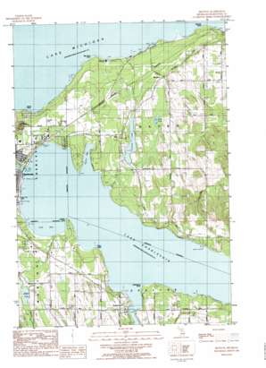
Ironton Topo Map Michigan
To zoom in, hover over the map of Ironton
USGS Topo Quad 45085c2 - 1:25,000 scale
| Topo Map Name: | Ironton |
| USGS Topo Quad ID: | 45085c2 |
| Print Size: | ca. 21 1/4" wide x 27" high |
| Southeast Coordinates: | 45.25° N latitude / 85.125° W longitude |
| Map Center Coordinates: | 45.3125° N latitude / 85.1875° W longitude |
| U.S. State: | MI |
| Filename: | l45085c2.jpg |
| Download Map JPG Image: | Ironton topo map 1:25,000 scale |
| Map Type: | Topographic |
| Topo Series: | 7.5´ |
| Map Scale: | 1:25,000 |
| Source of Map Images: | United States Geological Survey (USGS) |
| Alternate Map Versions: |
Ironton MI 1983, updated 1984 Download PDF Buy paper map |
1:24,000 Topo Quads surrounding Ironton
Goodhart |
Larks Lake |
|||
Forest Beach |
Harbor Springs |
|||
Charlevoix |
Ironton |
Bayshore |
Petoskey |
|
Atwood |
Ellsworth |
Boyne City |
Boyne Falls |
|
Central Lake |
Scotts Lake |
Chestonia |
Deadmans Hill |
> Back to 45085a1 at 1:100,000 scale
> Back to 45084a1 at 1:250,000 scale
> Back to U.S. Topo Maps home
Ironton topo map: Gazetteer
Ironton: Bays
Loeb Bay elevation 177m 580′Oyster Bay elevation 177m 580′
Ironton: Capes
Big Rock Point elevation 178m 583′Hemingway Point elevation 177m 580′
Loeb Point elevation 178m 583′
Ninemile Point elevation 177m 580′
North Point elevation 177m 580′
Twomile Point elevation 177m 580′
Ironton: Islands
Park Island elevation 179m 587′Ironton: Lakes
Adams Lake elevation 198m 649′Lake Charlevoix elevation 177m 580′
Mud Lake elevation 206m 675′
Susan Lake elevation 203m 666′
Ironton: Parks
Big Rock Point Nuclear Power Plant Historical elevation 180m 590′Depot Beach Park elevation 179m 587′
Ferry Avenue Park elevation 179m 587′
Greensky Hill Mission Historical Marker elevation 222m 728′
Shannon Field elevation 219m 718′
Ironton: Populated Places
Burgess elevation 210m 688′Ironton elevation 189m 620′
Lake Terrace Mobile Court elevation 179m 587′
Ironton: Post Offices
Bedwin Post Office (historical) elevation 211m 692′Burgess Post Office (historical) elevation 210m 688′
Ironton Post Office (historical) elevation 188m 616′
Undine Post Office (historical) elevation 209m 685′
Ironton: Streams
Adams Creek elevation 198m 649′Loeb Creek elevation 177m 580′
Stover Creek elevation 177m 580′
Susan Creek elevation 177m 580′
Woods Creek elevation 178m 583′
Ironton: Summits
Mount McSauba elevation 198m 649′Ironton digital topo map on disk
Buy this Ironton topo map showing relief, roads, GPS coordinates and other geographical features, as a high-resolution digital map file on DVD:


