Charlevoix Topo Map Michigan
To zoom in, hover over the map of Charlevoix
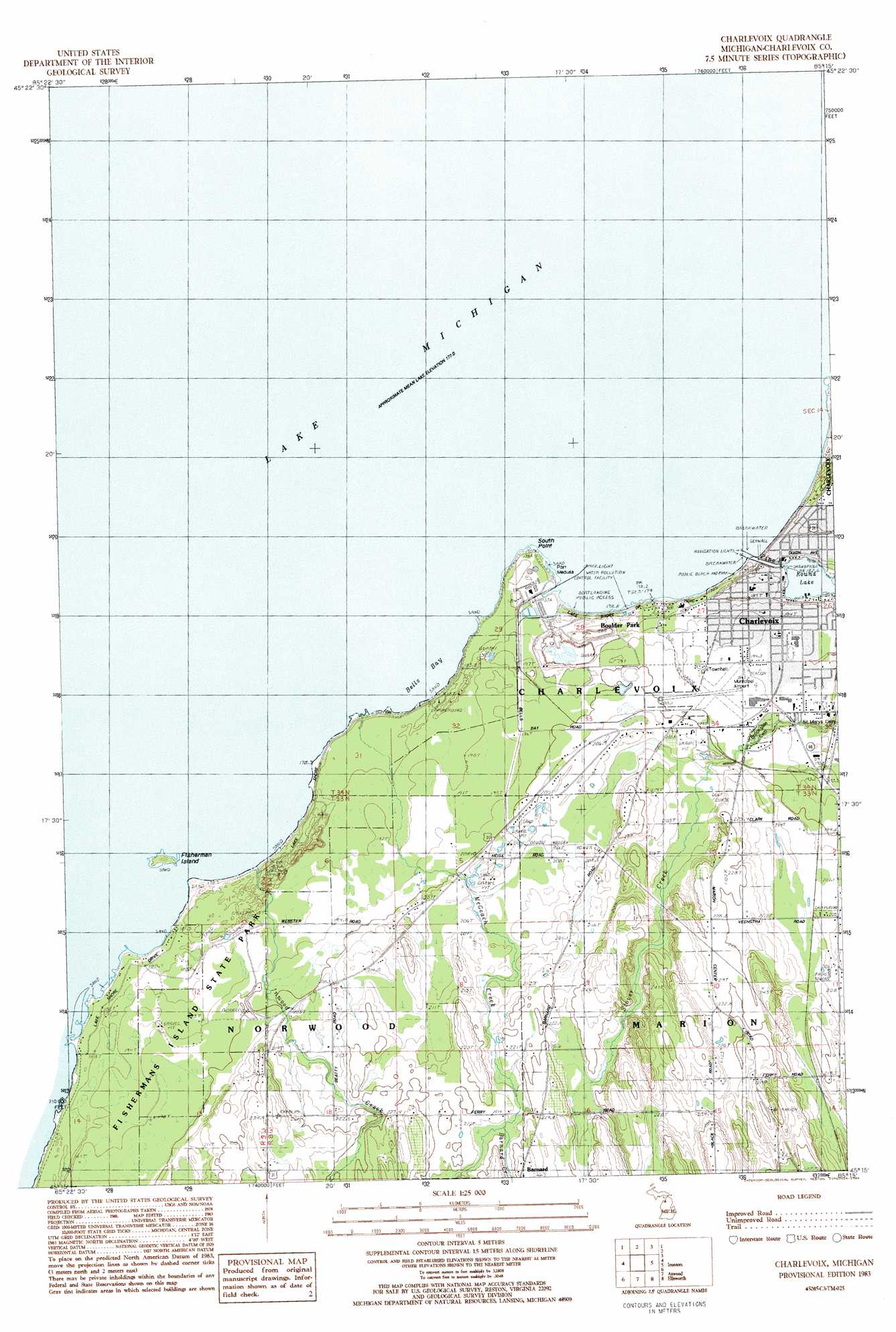
USGS Topo Quad 45085c3 - 1:25,000 scale
| Topo Map Name: | Charlevoix |
| USGS Topo Quad ID: | 45085c3 |
| Print Size: | ca. 21 1/4" wide x 27" high |
| Southeast Coordinates: | 45.25° N latitude / 85.25° W longitude |
| Map Center Coordinates: | 45.3125° N latitude / 85.3125° W longitude |
| U.S. State: | MI |
| Filename: | l45085c3.jpg |
| Download Map JPG Image: | Charlevoix topo map 1:25,000 scale |
| Map Type: | Topographic |
| Topo Series: | 7.5´ |
| Map Scale: | 1:25,000 |
| Source of Map Images: | United States Geological Survey (USGS) |
| Alternate Map Versions: |
Charlevoix MI 1983, updated 1984 Download PDF Buy paper map |
1:24,000 Topo Quads surrounding Charlevoix
Beaver Island South |
Goodhart |
|||
Forest Beach |
||||
Charlevoix |
Ironton |
Bayshore |
||
Northport |
Atwood |
Ellsworth |
Boyne City |
|
Omena |
Central Lake |
Scotts Lake |
Chestonia |
> Back to 45085a1 at 1:100,000 scale
> Back to 45084a1 at 1:250,000 scale
> Back to U.S. Topo Maps home
Charlevoix topo map: Gazetteer
Charlevoix: Airports
Charlevoix Municipal Airport elevation 197m 646′Charlevoix: Bays
Bells Bay elevation 177m 580′Charlevoix: Beaches
Lake Michigan Beach elevation 184m 603′Charlevoix: Capes
South Point elevation 179m 587′Charlevoix: Harbors
Port Medusa elevation 177m 580′Charlevoix: Islands
Fisherman Island elevation 179m 587′Charlevoix: Lakes
Round Lake elevation 177m 580′Charlevoix: Parks
Bridge Park elevation 181m 593′East Park elevation 179m 587′
Fishermans Island State Park elevation 195m 639′
Mormon Kingdom Historical Marker elevation 181m 593′
Rotary Park elevation 196m 643′
Charlevoix: Populated Places
Barnard elevation 232m 761′Boulder Park elevation 183m 600′
Charlevoix elevation 181m 593′
Charlevoix Estates elevation 193m 633′
Lake Michigan Heights Mobile Home Park elevation 187m 613′
Charlevoix: Post Offices
Barnard Post Office (historical) elevation 232m 761′Belvedere Post Office (historical) elevation 190m 623′
Charlevoix Post Office elevation 191m 626′
Inwood Post Office (historical) elevation 236m 774′
Charlevoix: Streams
Barnard Creek elevation 218m 715′Inwood Creek elevation 178m 583′
McGeach Creek elevation 178m 583′
Pine River elevation 177m 580′
Charlevoix digital topo map on disk
Buy this Charlevoix topo map showing relief, roads, GPS coordinates and other geographical features, as a high-resolution digital map file on DVD: