Lower Vermillion Lake Topo Map Wisconsin
To zoom in, hover over the map of Lower Vermillion Lake
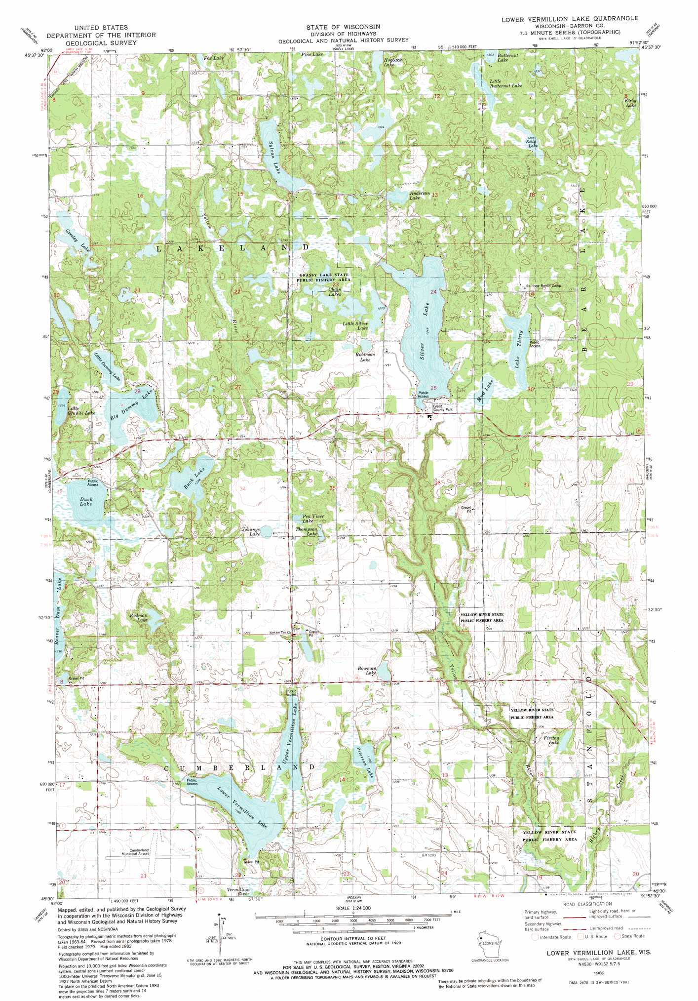
USGS Topo Quad 45091e8 - 1:24,000 scale
| Topo Map Name: | Lower Vermillion Lake |
| USGS Topo Quad ID: | 45091e8 |
| Print Size: | ca. 21 1/4" wide x 27" high |
| Southeast Coordinates: | 45.5° N latitude / 91.875° W longitude |
| Map Center Coordinates: | 45.5625° N latitude / 91.9375° W longitude |
| U.S. State: | WI |
| Filename: | o45091e8.jpg |
| Download Map JPG Image: | Lower Vermillion Lake topo map 1:24,000 scale |
| Map Type: | Topographic |
| Topo Series: | 7.5´ |
| Map Scale: | 1:24,000 |
| Source of Map Images: | United States Geological Survey (USGS) |
| Alternate Map Versions: |
Lower Vermillion Lake WI 1982, updated 1982 Download PDF Buy paper map Lower Vermillion Lake WI 2010 Download PDF Buy paper map Lower Vermillion Lake WI 2013 Download PDF Buy paper map Lower Vermillion Lake WI 2015 Download PDF Buy paper map |
1:24,000 Topo Quads surrounding Lower Vermillion Lake
Hertel |
Poquettes Lake |
Spooner |
Spooner Lake |
Potato Lake |
Indian Creek |
Timberland |
Shell Lake |
Sarona |
Nobleton |
Mckinley |
Cumberland |
Lower Vermillion Lake |
Haugen |
Rice Lake North |
Turtle Lake |
Almenia |
Poskin |
Barron |
Rice Lake South |
Clayton |
Arland |
Dority Creek |
Dallas |
Chetek |
> Back to 45091e1 at 1:100,000 scale
> Back to 45090a1 at 1:250,000 scale
> Back to U.S. Topo Maps home
Lower Vermillion Lake topo map: Gazetteer
Lower Vermillion Lake: Airports
Cumberland Municipal Airport elevation 377m 1236′Lower Vermillion Lake: Lakes
Anderson Lake elevation 398m 1305′Big Dummy Lake elevation 376m 1233′
Bowman Lake elevation 364m 1194′
Buck Lake elevation 374m 1227′
Chain Lakes elevation 383m 1256′
Duck Lake elevation 376m 1233′
Firetag Lake elevation 358m 1174′
Greeley Lake elevation 389m 1276′
Hogback Lake elevation 406m 1332′
Johnnys Lake elevation 387m 1269′
Kelly Lake elevation 398m 1305′
Lake Thirty elevation 386m 1266′
Little Butternut Lake elevation 398m 1305′
Little Dummy Lake elevation 376m 1233′
Little Granite Lake elevation 377m 1236′
Little Silver Lake elevation 387m 1269′
Lower Vermillion Lake elevation 360m 1181′
Mud Lake elevation 386m 1266′
Pea Viner Lake elevation 387m 1269′
Peterson Lake elevation 361m 1184′
Redman Lake elevation 371m 1217′
Robinson Lake elevation 380m 1246′
Silver Lake elevation 380m 1246′
Sylvan Lake elevation 383m 1256′
Thompson Lake elevation 381m 1250′
Upper Vermillion Lake elevation 361m 1184′
Lower Vermillion Lake: Parks
Grant County Park elevation 388m 1272′Grassy Lake State Public Fishery Area elevation 386m 1266′
Yellow River State Public Fishery Area elevation 351m 1151′
Lower Vermillion Lake: Streams
Hickey Creek elevation 349m 1145′Lower Vermillion Lake digital topo map on disk
Buy this Lower Vermillion Lake topo map showing relief, roads, GPS coordinates and other geographical features, as a high-resolution digital map file on DVD: