Dority Creek Topo Map Wisconsin
To zoom in, hover over the map of Dority Creek
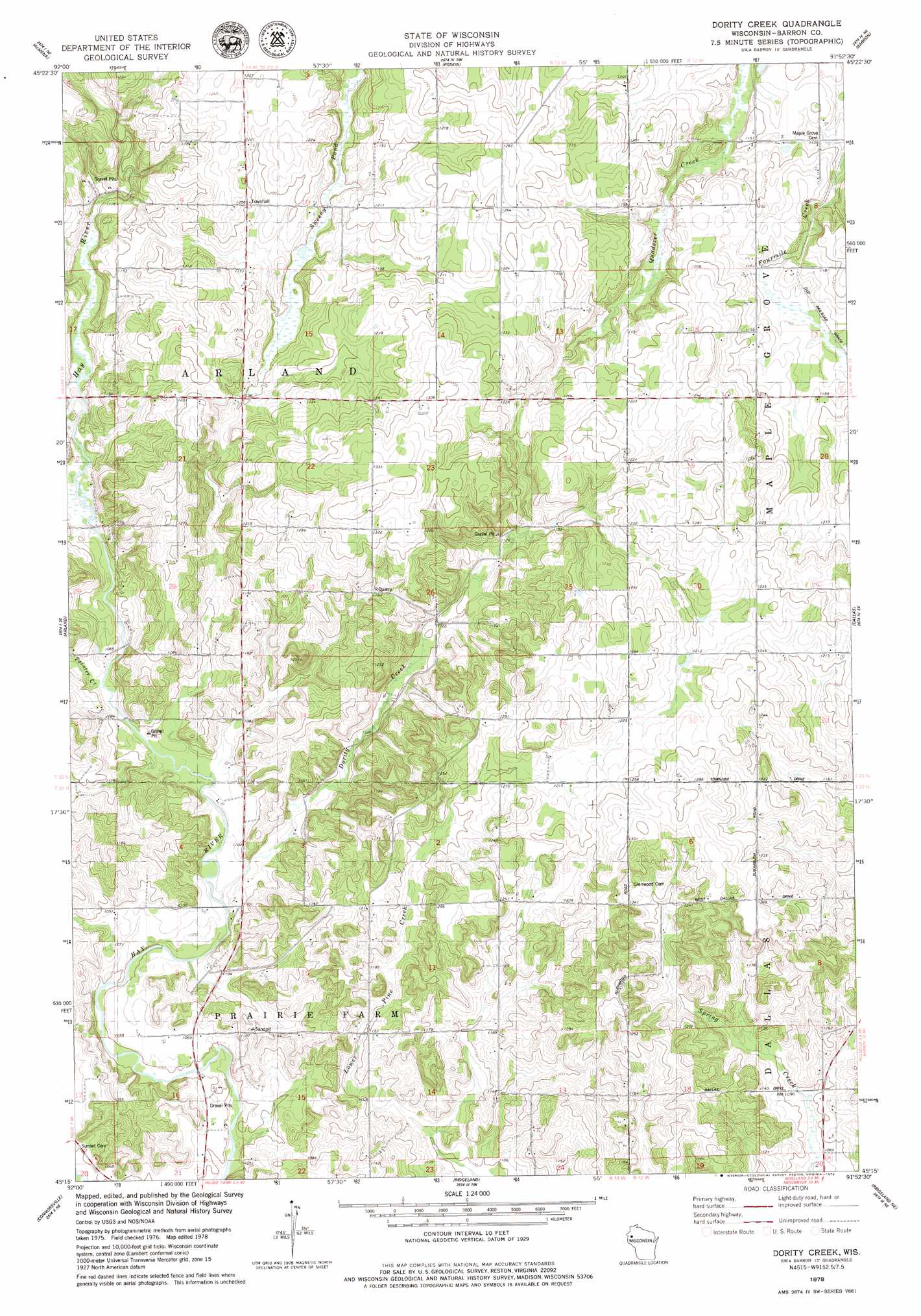
USGS Topo Quad 45091c8 - 1:24,000 scale
| Topo Map Name: | Dority Creek |
| USGS Topo Quad ID: | 45091c8 |
| Print Size: | ca. 21 1/4" wide x 27" high |
| Southeast Coordinates: | 45.25° N latitude / 91.875° W longitude |
| Map Center Coordinates: | 45.3125° N latitude / 91.9375° W longitude |
| U.S. State: | WI |
| Filename: | o45091c8.jpg |
| Download Map JPG Image: | Dority Creek topo map 1:24,000 scale |
| Map Type: | Topographic |
| Topo Series: | 7.5´ |
| Map Scale: | 1:24,000 |
| Source of Map Images: | United States Geological Survey (USGS) |
| Alternate Map Versions: |
Dority Creek WI 1978, updated 1979 Download PDF Buy paper map Dorrity Creek WI 2010 Download PDF Buy paper map Dorrity Creek WI 2013 Download PDF Buy paper map Dorrity Creek WI 2015 Download PDF Buy paper map |
1:24,000 Topo Quads surrounding Dority Creek
Mckinley |
Cumberland |
Lower Vermillion Lake |
Haugen |
Rice Lake North |
Turtle Lake |
Almenia |
Poskin |
Barron |
Rice Lake South |
Clayton |
Arland |
Dority Creek |
Dallas |
Chetek |
Graytown |
Connorsville |
Ridgeland |
Ridgeland Ne |
Sand Creek |
Glenwood City |
Boyceville |
Wheeler |
Norton |
Colfax North |
> Back to 45091a1 at 1:100,000 scale
> Back to 45090a1 at 1:250,000 scale
> Back to U.S. Topo Maps home
Dority Creek topo map: Gazetteer
Dority Creek: Dams
Miller G877 19 Dam elevation 331m 1085′Dority Creek: Reservoirs
0.05 Reservoir elevation 331m 1085′Dority Creek: Streams
Dorrity Creek elevation 323m 1059′Tainter Creek elevation 327m 1072′
Dority Creek digital topo map on disk
Buy this Dority Creek topo map showing relief, roads, GPS coordinates and other geographical features, as a high-resolution digital map file on DVD: