Boyceville Topo Map Wisconsin
To zoom in, hover over the map of Boyceville
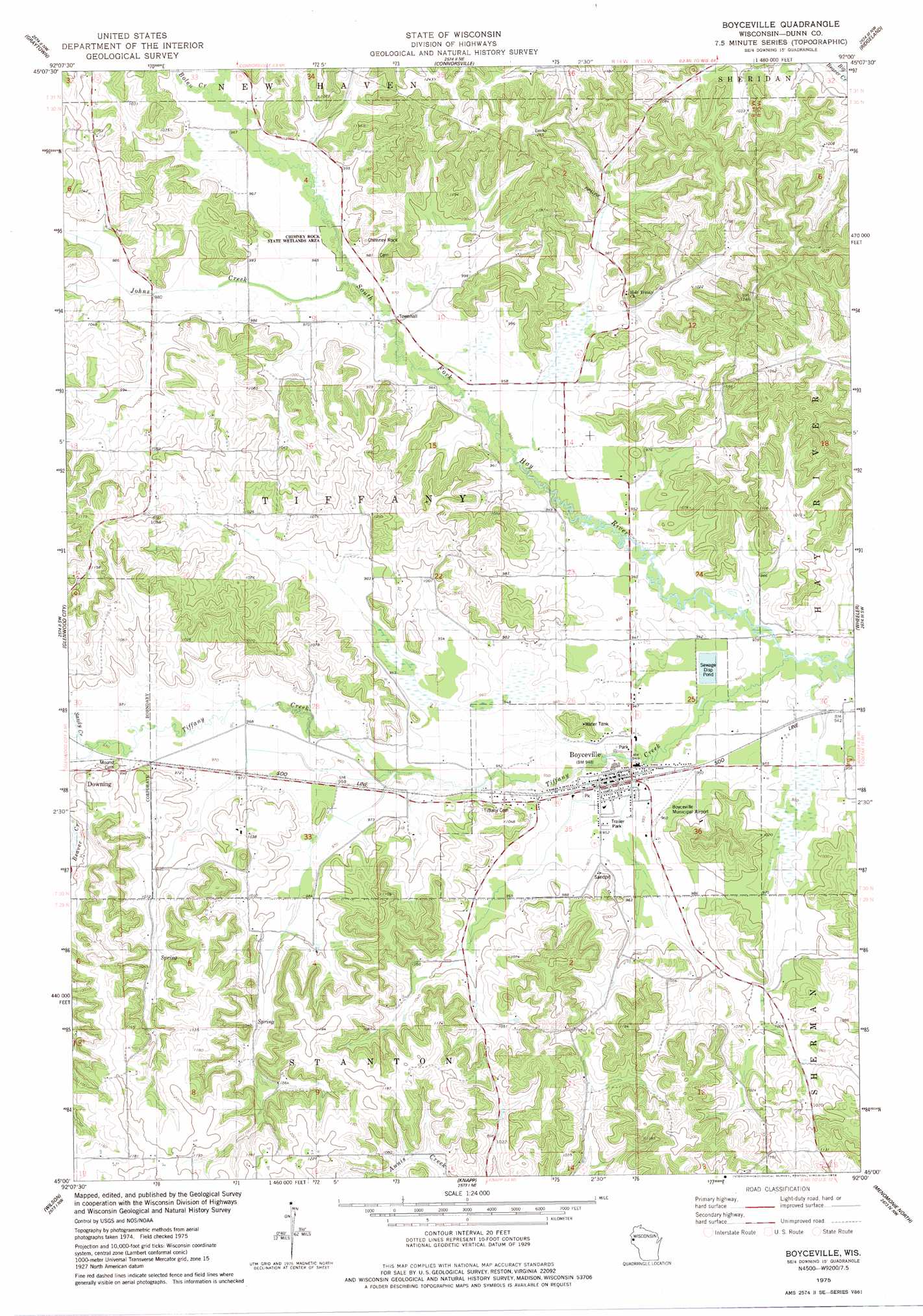
USGS Topo Quad 45092a1 - 1:24,000 scale
| Topo Map Name: | Boyceville |
| USGS Topo Quad ID: | 45092a1 |
| Print Size: | ca. 21 1/4" wide x 27" high |
| Southeast Coordinates: | 45° N latitude / 92° W longitude |
| Map Center Coordinates: | 45.0625° N latitude / 92.0625° W longitude |
| U.S. State: | WI |
| Filename: | o45092a1.jpg |
| Download Map JPG Image: | Boyceville topo map 1:24,000 scale |
| Map Type: | Topographic |
| Topo Series: | 7.5´ |
| Map Scale: | 1:24,000 |
| Source of Map Images: | United States Geological Survey (USGS) |
| Alternate Map Versions: |
Boyceville WI 1975, updated 1978 Download PDF Buy paper map Boyceville WI 2010 Download PDF Buy paper map Boyceville WI 2013 Download PDF Buy paper map Boyceville WI 2015 Download PDF Buy paper map |
1:24,000 Topo Quads surrounding Boyceville
Amery |
Clayton |
Arland |
Dority Creek |
Dallas |
Forest |
Graytown |
Connorsville |
Ridgeland |
Ridgeland Ne |
Emerald |
Glenwood City |
Boyceville |
Wheeler |
Norton |
Baldwin East |
Wilson |
Knapp |
Menomonie North |
Rusk |
El Paso |
Spring Valley |
Weston |
Menomonie South |
Falls City |
> Back to 45092a1 at 1:100,000 scale
> Back to 45092a1 at 1:250,000 scale
> Back to U.S. Topo Maps home
Boyceville topo map: Gazetteer
Boyceville: Airports
Boyceville Municipal Airport elevation 292m 958′Boyceville: Parks
Chimney Rock State Wetlands Area elevation 292m 958′Boyceville: Pillars
Chimney Rock elevation 310m 1017′Boyceville: Populated Places
Boyceville elevation 288m 944′Boyceville: Streams
Beaver Creek elevation 294m 964′Bolen Creek elevation 294m 964′
Johns Creek elevation 293m 961′
Sandy Creek elevation 294m 964′
Tiffany Creek elevation 286m 938′
Boyceville digital topo map on disk
Buy this Boyceville topo map showing relief, roads, GPS coordinates and other geographical features, as a high-resolution digital map file on DVD: