Black Horse Se Topo Map South Dakota
To zoom in, hover over the map of Black Horse Se
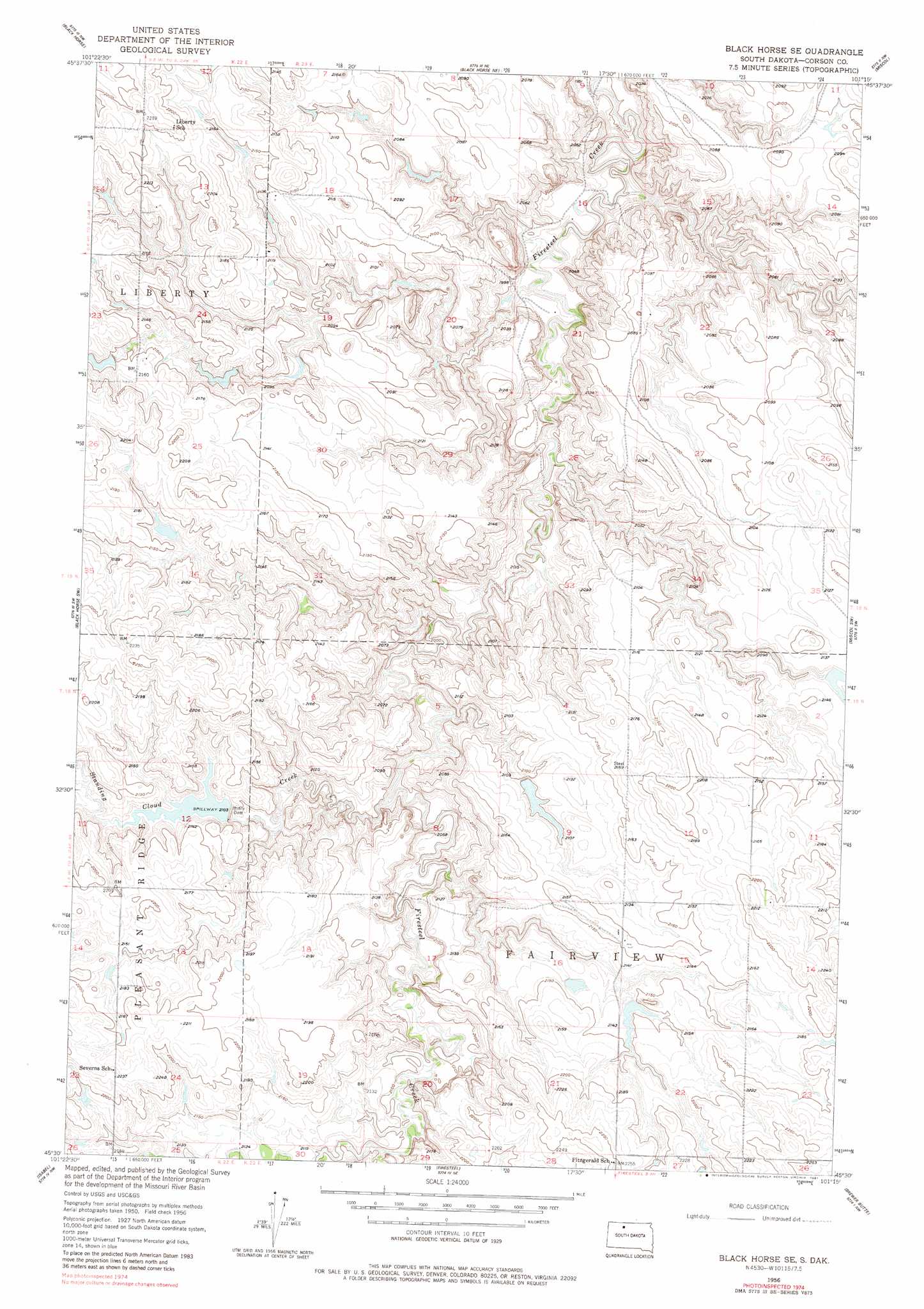
USGS Topo Quad 45101e3 - 1:24,000 scale
| Topo Map Name: | Black Horse Se |
| USGS Topo Quad ID: | 45101e3 |
| Print Size: | ca. 21 1/4" wide x 27" high |
| Southeast Coordinates: | 45.5° N latitude / 101.25° W longitude |
| Map Center Coordinates: | 45.5625° N latitude / 101.3125° W longitude |
| U.S. State: | SD |
| Filename: | o45101e3.jpg |
| Download Map JPG Image: | Black Horse Se topo map 1:24,000 scale |
| Map Type: | Topographic |
| Topo Series: | 7.5´ |
| Map Scale: | 1:24,000 |
| Source of Map Images: | United States Geological Survey (USGS) |
| Alternate Map Versions: |
Black Horse SE SD 1956, updated 1957 Download PDF Buy paper map Black Horse SE SD 1956, updated 1981 Download PDF Buy paper map Black Horse SE SD 2012 Download PDF Buy paper map Black Horse SE SD 2015 Download PDF Buy paper map |
1:24,000 Topo Quads surrounding Black Horse Se
Morristown Se |
Mcintosh Sw |
Mcintosh Se |
Bullhead Sw |
Bullhead |
Cottonwood Creek Ne |
Black Horse |
Black Horse Ne |
Miscol |
Miscol Ne |
Cottonwood Creek Se |
Black Horse Sw |
Black Horse Se |
Miscol Sw |
Miscol Se |
Irish Creek Ne |
Isabel |
Firesteel |
Brewer Butte |
Timber Lake |
Irish Creek Se |
Isabel Sw |
Peach Lake |
Livermant Lake |
Little Moreau Lake |
> Back to 45101e1 at 1:100,000 scale
> Back to 45100a1 at 1:250,000 scale
> Back to U.S. Topo Maps home
Black Horse Se topo map: Gazetteer
Black Horse Se: Dams
Bohle Dam elevation 652m 2139′Harold Meyer Dam elevation 643m 2109′
Harry Bickel Dam elevation 646m 2119′
Black Horse Se: Streams
Standing Cloud Creek elevation 619m 2030′Black Horse Se digital topo map on disk
Buy this Black Horse Se topo map showing relief, roads, GPS coordinates and other geographical features, as a high-resolution digital map file on DVD:
Eastern North Dakota & Eastern South Dakota
Buy digital topo maps: Eastern North Dakota & Eastern South Dakota