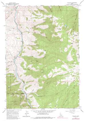
Pollock Topo Map Idaho
To zoom in, hover over the map of Pollock
USGS Topo Quad 45116c3 - 1:24,000 scale
| Topo Map Name: | Pollock |
| USGS Topo Quad ID: | 45116c3 |
| Print Size: | ca. 21 1/4" wide x 27" high |
| Southeast Coordinates: | 45.25° N latitude / 116.25° W longitude |
| Map Center Coordinates: | 45.3125° N latitude / 116.3125° W longitude |
| U.S. State: | ID |
| Filename: | o45116c3.jpg |
| Download Map JPG Image: | Pollock topo map 1:24,000 scale |
| Map Type: | Topographic |
| Topo Series: | 7.5´ |
| Map Scale: | 1:24,000 |
| Source of Map Images: | United States Geological Survey (USGS) |
| Alternate Map Versions: |
Pollock ID 1964, updated 1966 Download PDF Buy paper map Pollock ID 1964, updated 1987 Download PDF Buy paper map Pollock ID 1995, updated 1999 Download PDF Buy paper map Pollock ID 2011 Download PDF Buy paper map Pollock ID 2013 Download PDF Buy paper map |
| FStopo: | US Forest Service topo Pollock is available: Download FStopo PDF Download FStopo TIF |
1:24,000 Topo Quads surrounding Pollock
> Back to 45116a1 at 1:100,000 scale
> Back to 45116a1 at 1:250,000 scale
> Back to U.S. Topo Maps home
Pollock topo map: Gazetteer
Pollock: Basins
Devils Hole elevation 2264m 7427′Pollock: Cliffs
Devils Ladder elevation 2319m 7608′Lake Creek Point elevation 2258m 7408′
Pollock: Flats
Dempsey Flat elevation 1748m 5734′Mud Flat elevation 1663m 5456′
Pollock: Populated Places
Pinehurst elevation 826m 2709′Pollock elevation 711m 2332′
Pollock: Streams
Denny Creek elevation 725m 2378′Grouse Creek elevation 677m 2221′
Hat Creek elevation 714m 2342′
Indian Creek elevation 771m 2529′
Lockwood Creek elevation 799m 2621′
North Fork Rattlesnake Creek elevation 893m 2929′
North Fork Sheep Creek elevation 806m 2644′
Rapid River elevation 600m 1968′
Rattlesnake Creek elevation 798m 2618′
Sheep Creek elevation 653m 2142′
Wickiup Creek elevation 889m 2916′
Pollock: Summits
Indian Hill elevation 1655m 5429′Indian Mountain elevation 2131m 6991′
Sheep Mountain elevation 2254m 7395′
Pollock: Valleys
Ranyhan Gulch elevation 755m 2477′Slaughter Gulch elevation 769m 2522′
Pollock digital topo map on disk
Buy this Pollock topo map showing relief, roads, GPS coordinates and other geographical features, as a high-resolution digital map file on DVD:


