Bally Mountain Topo Map Idaho
To zoom in, hover over the map of Bally Mountain
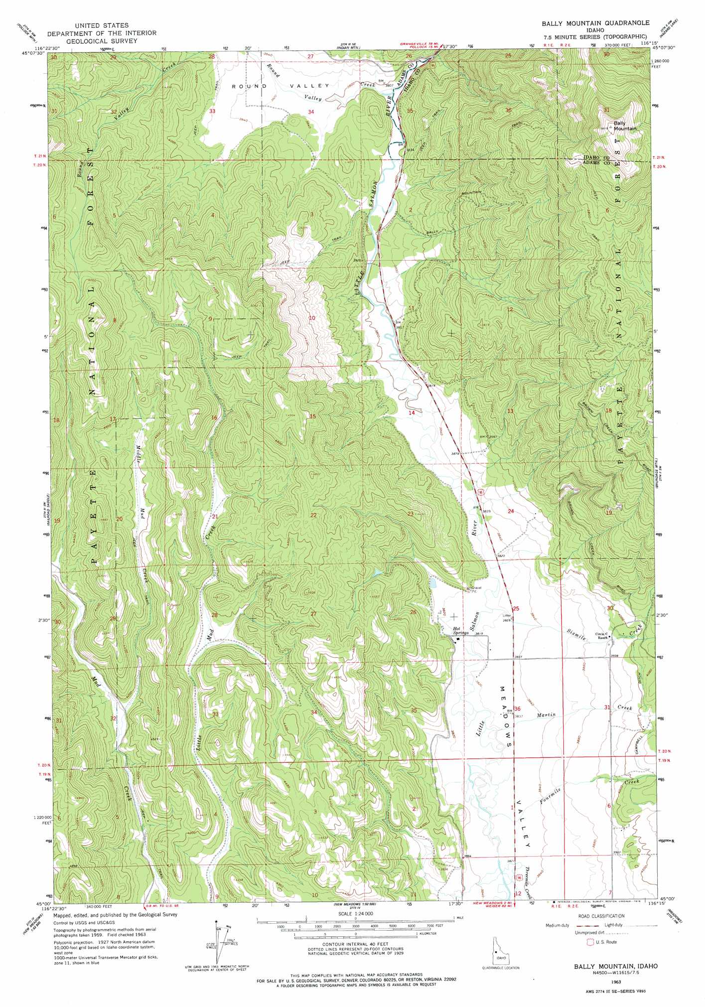
USGS Topo Quad 45116a3 - 1:24,000 scale
| Topo Map Name: | Bally Mountain |
| USGS Topo Quad ID: | 45116a3 |
| Print Size: | ca. 21 1/4" wide x 27" high |
| Southeast Coordinates: | 45° N latitude / 116.25° W longitude |
| Map Center Coordinates: | 45.0625° N latitude / 116.3125° W longitude |
| U.S. State: | ID |
| Filename: | o45116a3.jpg |
| Download Map JPG Image: | Bally Mountain topo map 1:24,000 scale |
| Map Type: | Topographic |
| Topo Series: | 7.5´ |
| Map Scale: | 1:24,000 |
| Source of Map Images: | United States Geological Survey (USGS) |
| Alternate Map Versions: |
Bally Mountain ID 1963, updated 1964 Download PDF Buy paper map Bally Mountain ID 1963, updated 1978 Download PDF Buy paper map Bally Mountain ID 2004, updated 2007 Download PDF Buy paper map Bally Mountain ID 2011 Download PDF Buy paper map Bally Mountain ID 2013 Download PDF Buy paper map |
| FStopo: | US Forest Service topo Bally Mountain is available: Download FStopo PDF Download FStopo TIF |
1:24,000 Topo Quads surrounding Bally Mountain
He Devil |
Heavens Gate |
Pollock |
Patrick Butte |
Hershey Point |
Purgatory Saddle |
Pollock Mountain |
Indian Mountain |
Hazard Lake |
Black Tip |
Butterfield Gulch |
Railroad Saddle |
Bally Mountain |
Brundage Mountain |
Granite Lake |
Weasel Gulch |
Tamarack |
New Meadows |
Meadows |
Mccall |
Peck Mountain |
Fruitvale |
Cold Spring Summit |
No Business Mountain |
Lake Fork |
> Back to 45116a1 at 1:100,000 scale
> Back to 45116a1 at 1:250,000 scale
> Back to U.S. Topo Maps home
Bally Mountain topo map: Gazetteer
Bally Mountain: Basins
Round Valley elevation 1169m 3835′Bally Mountain: Springs
Hot Springs elevation 1168m 3832′Bally Mountain: Streams
Fourmile Creek elevation 1165m 3822′Martin Creek elevation 1165m 3822′
Middle Mud Creek elevation 1253m 4110′
Round Valley Creek elevation 1171m 3841′
Sixmile Creek elevation 1165m 3822′
Threemile Creek elevation 1168m 3832′
Bally Mountain: Summits
Bally Mountain elevation 2080m 6824′Bally Mountain: Valleys
Meadows Valley elevation 1155m 3789′Bally Mountain digital topo map on disk
Buy this Bally Mountain topo map showing relief, roads, GPS coordinates and other geographical features, as a high-resolution digital map file on DVD: