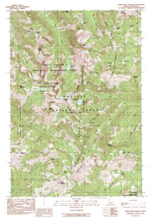
Purgatory Saddle Topo Map Idaho
To zoom in, hover over the map of Purgatory Saddle
USGS Topo Quad 45116b5 - 1:24,000 scale
| Topo Map Name: | Purgatory Saddle |
| USGS Topo Quad ID: | 45116b5 |
| Print Size: | ca. 21 1/4" wide x 27" high |
| Southeast Coordinates: | 45.125° N latitude / 116.5° W longitude |
| Map Center Coordinates: | 45.1875° N latitude / 116.5625° W longitude |
| U.S. State: | ID |
| Filename: | o45116b5.jpg |
| Download Map JPG Image: | Purgatory Saddle topo map 1:24,000 scale |
| Map Type: | Topographic |
| Topo Series: | 7.5´ |
| Map Scale: | 1:24,000 |
| Source of Map Images: | United States Geological Survey (USGS) |
| Alternate Map Versions: |
Purgatory Saddle ID 1990, updated 1990 Download PDF Buy paper map Purgatory Saddle ID 1990, updated 1990 Download PDF Buy paper map Purgatory Saddle ID 2004, updated 2007 Download PDF Buy paper map Purgatory Saddle ID 2011 Download PDF Buy paper map Purgatory Saddle ID 2013 Download PDF Buy paper map |
| FStopo: | US Forest Service topo Purgatory Saddle is available: Download FStopo PDF Download FStopo TIF |
1:24,000 Topo Quads surrounding Purgatory Saddle
> Back to 45116a1 at 1:100,000 scale
> Back to 45116a1 at 1:250,000 scale
> Back to U.S. Topo Maps home
Purgatory Saddle topo map: Gazetteer
Purgatory Saddle: Basins
Horse Pasture Basin elevation 2212m 7257′Lost Basin elevation 2249m 7378′
Six Lake Basin elevation 2254m 7395′
Purgatory Saddle: Flats
Paradise Flat elevation 1995m 6545′Purgatory Saddle: Gaps
Bear Saddle elevation 2141m 7024′Holbrook Saddle elevation 2447m 8028′
Joes Gap elevation 2446m 8024′
Oxbow Saddle elevation 2181m 7155′
Purgatory Saddle elevation 2417m 7929′
Purgatory Saddle: Lakes
Black Lake elevation 2199m 7214′Crystal Lake elevation 2473m 8113′
Emerald Lake elevation 2074m 6804′
Lake Winifred elevation 2260m 7414′
Ruth Lake elevation 2216m 7270′
Satan Lake elevation 2254m 7395′
Twin Lakes elevation 2096m 6876′
Purgatory Saddle: Springs
Casey Spring elevation 2182m 7158′Purgatory Saddle: Streams
Camp Creek elevation 1732m 5682′Granite Fork elevation 1701m 5580′
Lake Creek elevation 1673m 5488′
Ritchie Gulch elevation 1690m 5544′
Rock Creek elevation 1814m 5951′
Rose Creek elevation 1865m 6118′
Purgatory Saddle: Summits
Black Imp elevation 2412m 7913′Casey Mountain elevation 2637m 8651′
Curren Mountain elevation 2381m 7811′
Echols Mountain elevation 2521m 8270′
Emmett Mountain elevation 2533m 8310′
Jackley Mountain elevation 2659m 8723′
Middle Mountain elevation 2576m 8451′
Monument Peak elevation 2709m 8887′
Pepperbox Hill elevation 2371m 7778′
Pyramid Peak elevation 2548m 8359′
Smith Mountain elevation 2444m 8018′
White Mountain elevation 2589m 8494′
Purgatory Saddle: Trails
Deep Creek Trail elevation 1826m 5990′Rapid River Trail elevation 2155m 7070′
Purgatory Saddle: Valleys
Pactolian Gulch elevation 2004m 6574′Purgatory Saddle digital topo map on disk
Buy this Purgatory Saddle topo map showing relief, roads, GPS coordinates and other geographical features, as a high-resolution digital map file on DVD:


