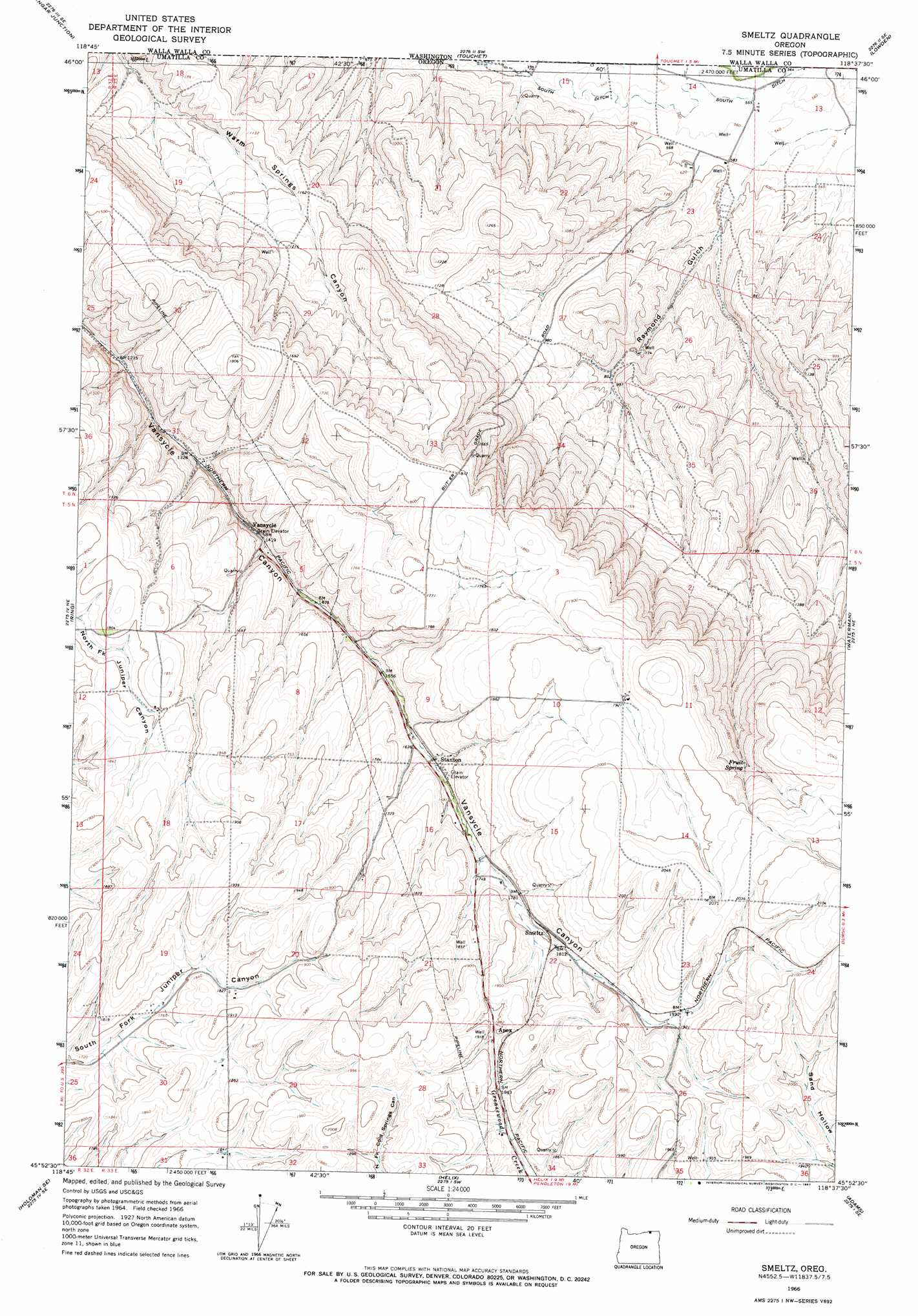
Smeltz Topo Map Oregon
To zoom in, hover over the map of Smeltz
USGS Topo Quad 45118h6 - 1:24,000 scale
| Topo Map Name: | Smeltz |
| USGS Topo Quad ID: | 45118h6 |
| Print Size: | ca. 21 1/4" wide x 27" high |
| Southeast Coordinates: | 45.875° N latitude / 118.625° W longitude |
| Map Center Coordinates: | 45.9375° N latitude / 118.6875° W longitude |
| U.S. State: | OR |
| Filename: | o45118h6.jpg |
| Download Map JPG Image: | Smeltz topo map 1:24,000 scale |
| Map Type: | Topographic |
| Topo Series: | 7.5´ |
| Map Scale: | 1:24,000 |
| Source of Map Images: | United States Geological Survey (USGS) |
| Alternate Map Versions: |
Smeltz OR 1966, updated 1967 Download PDF Buy paper map Smeltz OR 2011 Download PDF Buy paper map Smeltz OR 2014 Download PDF Buy paper map |
1:24,000 Topo Quads surrounding Smeltz
Humorist |
Slater |
Welland |
Rulo |
Hadley |
Wallula |
Zangar Junction |
Touchet |
Lowden |
College Place |
Juniper Canyon |
Ring |
Smeltz |
Waterman |
Milton-Freewater |
Holdman |
Holdman Se |
Helix |
Adams |
Athena |
Barnhart |
Pendleton |
Mission |
Cayuse |
Thorn Hollow |
> Back to 45118e1 at 1:100,000 scale
> Back to 45118a1 at 1:250,000 scale
> Back to U.S. Topo Maps home
Smeltz topo map: Gazetteer
Smeltz: Canals
South Ditch elevation 167m 547′Smeltz: Post Offices
Vansycle Post Office (historical) elevation 425m 1394′Smeltz: Springs
Fruit Spring elevation 549m 1801′Smeltz: Valleys
Raymond Gulch elevation 170m 557′Smeltz digital topo map on disk
Buy this Smeltz topo map showing relief, roads, GPS coordinates and other geographical features, as a high-resolution digital map file on DVD: