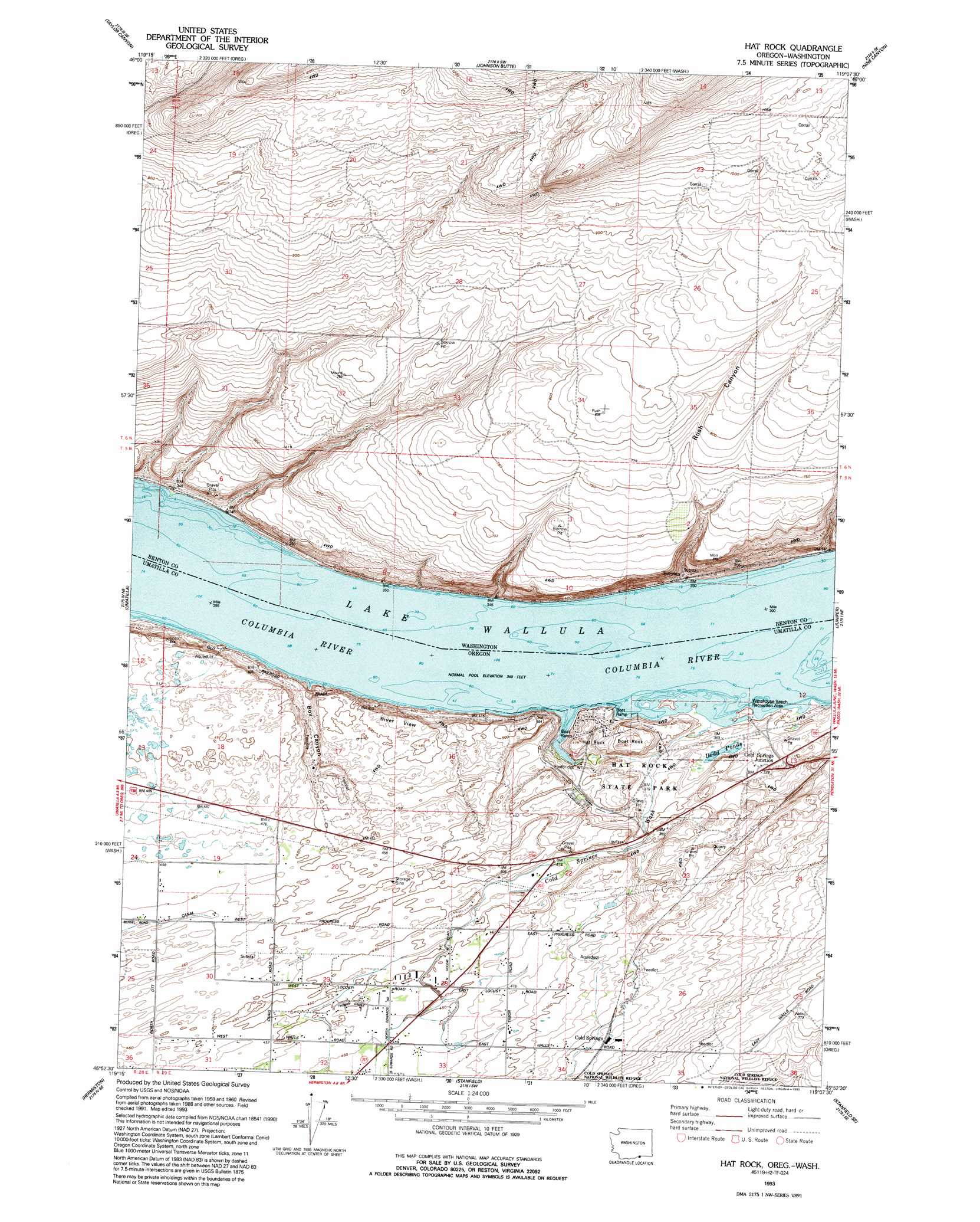
Hat Rock Topo Map Washington
To zoom in, hover over the map of Hat Rock
USGS Topo Quad 45119h2 - 1:24,000 scale
| Topo Map Name: | Hat Rock |
| USGS Topo Quad ID: | 45119h2 |
| Print Size: | ca. 21 1/4" wide x 27" high |
| Southeast Coordinates: | 45.875° N latitude / 119.125° W longitude |
| Map Center Coordinates: | 45.9375° N latitude / 119.1875° W longitude |
| U.S. States: | WA, OR |
| Filename: | o45119h2.jpg |
| Download Map JPG Image: | Hat Rock topo map 1:24,000 scale |
| Map Type: | Topographic |
| Topo Series: | 7.5´ |
| Map Scale: | 1:24,000 |
| Source of Map Images: | United States Geological Survey (USGS) |
| Alternate Map Versions: |
Hat Rock OR 1962, updated 1963 Download PDF Buy paper map Hat Rock OR 1962, updated 1963 Download PDF Buy paper map Hat Rock OR 1962, updated 1978 Download PDF Buy paper map Hat Rock OR 1993, updated 1993 Download PDF Buy paper map Hat Rock OR 2011 Download PDF Buy paper map Hat Rock OR 2014 Download PDF Buy paper map |
1:24,000 Topo Quads surrounding Hat Rock
Webber Canyon |
Badger Mountain |
Kennewick |
Pasco |
Humorist |
Prior Ranch |
Taylor Canyon |
Johnson Butte |
Nine Canyon |
Wallula |
Irrigon |
Umatilla |
Hat Rock |
Juniper |
Juniper Canyon |
Ordnance |
Hermiston |
Stanfield |
Stanfield Se |
Holdman |
Ward Butte |
Service Buttes |
Echo |
Nolin |
Barnhart |
> Back to 45119e1 at 1:100,000 scale
> Back to 45118a1 at 1:250,000 scale
> Back to U.S. Topo Maps home
Hat Rock topo map: Gazetteer
Hat Rock: Canals
T Canal elevation 144m 472′Hat Rock: Cliffs
River View elevation 157m 515′Hat Rock: Islands
Memaloose Island (historical) elevation 105m 344′Techumtas Island (historical) elevation 105m 344′
Hat Rock: Lakes
Dodd Ponds elevation 110m 360′Hat Rock: Parks
Hat Rock State Park elevation 124m 406′Warehouse Beach Recreation Center elevation 107m 351′
Hat Rock: Pillars
Boat Rock elevation 147m 482′Hat Rock elevation 142m 465′
Hat Rock: Populated Places
Berrian elevation 109m 357′Cold Springs elevation 175m 574′
Cold Springs Junction elevation 116m 380′
Hat Rock: Springs
Cold Springs elevation 111m 364′Hat Rock: Streams
Cold Springs Drain elevation 135m 442′Cold Springs Wash elevation 106m 347′
Hat Rock Drain elevation 135m 442′
Hat Rock: Valleys
Box Canyon elevation 105m 344′Rush Canyon elevation 130m 426′
Hat Rock digital topo map on disk
Buy this Hat Rock topo map showing relief, roads, GPS coordinates and other geographical features, as a high-resolution digital map file on DVD: