Badger Mountain Topo Map Washington
To zoom in, hover over the map of Badger Mountain
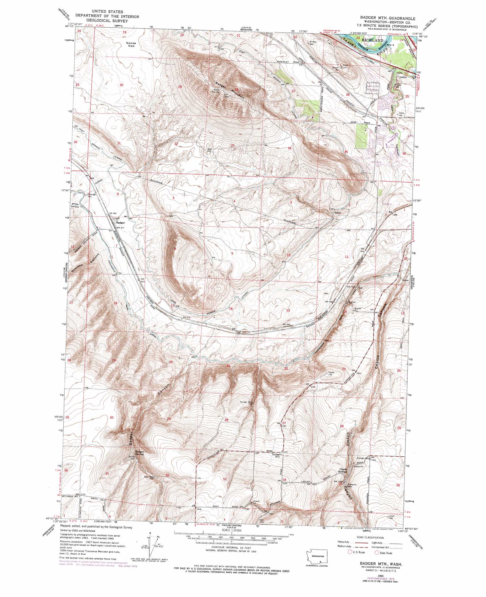
USGS Topo Quad 46119b3 - 1:24,000 scale
| Topo Map Name: | Badger Mountain |
| USGS Topo Quad ID: | 46119b3 |
| Print Size: | ca. 21 1/4" wide x 27" high |
| Southeast Coordinates: | 46.125° N latitude / 119.25° W longitude |
| Map Center Coordinates: | 46.1875° N latitude / 119.3125° W longitude |
| U.S. State: | WA |
| Filename: | o46119b3.jpg |
| Download Map JPG Image: | Badger Mountain topo map 1:24,000 scale |
| Map Type: | Topographic |
| Topo Series: | 7.5´ |
| Map Scale: | 1:24,000 |
| Source of Map Images: | United States Geological Survey (USGS) |
| Alternate Map Versions: |
Badger Mtn WA 1965, updated 1967 Download PDF Buy paper map Badger Mtn WA 1965, updated 1978 Download PDF Buy paper map Badger Mountain WA 2011 Download PDF Buy paper map Badger Mountain WA 2013 Download PDF Buy paper map |
1:24,000 Topo Quads surrounding Badger Mountain
Iowa Flats |
Horn Rapids Dam |
Wooded Island |
Mathews Corner |
Eltopia |
Corral Canyon |
Benton City |
Richland |
Columbia Point |
Glade |
Whitstran Ne |
Webber Canyon |
Badger Mountain |
Kennewick |
Pasco |
Whitstran Se |
Prior Ranch |
Taylor Canyon |
Johnson Butte |
Nine Canyon |
Paterson |
Irrigon |
Umatilla |
Hat Rock |
Juniper |
> Back to 46119a1 at 1:100,000 scale
> Back to 46118a1 at 1:250,000 scale
> Back to U.S. Topo Maps home
Badger Mountain topo map: Gazetteer
Badger Mountain: Canals
Columbia Canal elevation 121m 396′East Badger Lateral elevation 203m 666′
West Badger Lateral elevation 207m 679′
Badger Mountain: Dams
Meadow Springs Dam elevation 142m 465′Badger Mountain: Gaps
Goose Gap elevation 262m 859′Badger Mountain: Populated Places
Badger elevation 208m 682′Badger Mountain: Reservoirs
Meadow Springs Reservoir elevation 142m 465′Badger Mountain: Springs
Badger Spring elevation 423m 1387′Coyote Springs elevation 354m 1161′
Badger Mountain: Summits
Badger Mountain elevation 477m 1564′Badger Mountain: Valleys
Badger Canyon elevation 214m 702′Scouten Canyon elevation 228m 748′
Sheep Canyon elevation 213m 698′
Badger Mountain: Wells
Edwards Well elevation 363m 1190′Root Well elevation 456m 1496′
Youngs Well elevation 368m 1207′
Badger Mountain digital topo map on disk
Buy this Badger Mountain topo map showing relief, roads, GPS coordinates and other geographical features, as a high-resolution digital map file on DVD: