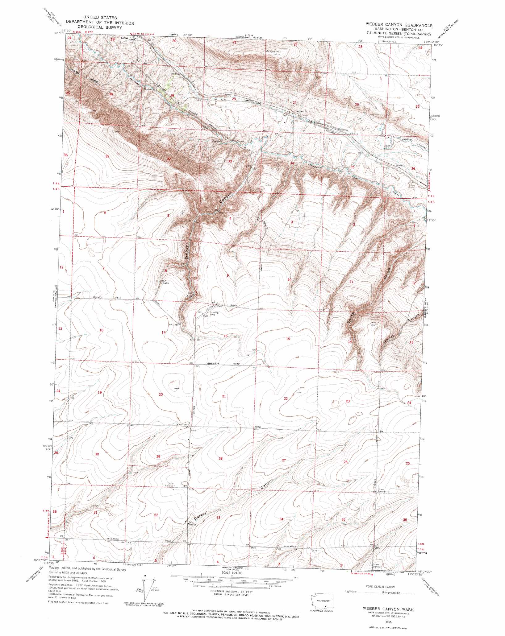
Webber Canyon Topo Map Washington
To zoom in, hover over the map of Webber Canyon
USGS Topo Quad 46119b4 - 1:24,000 scale
| Topo Map Name: | Webber Canyon |
| USGS Topo Quad ID: | 46119b4 |
| Print Size: | ca. 21 1/4" wide x 27" high |
| Southeast Coordinates: | 46.125° N latitude / 119.375° W longitude |
| Map Center Coordinates: | 46.1875° N latitude / 119.4375° W longitude |
| U.S. State: | WA |
| Filename: | o46119b4.jpg |
| Download Map JPG Image: | Webber Canyon topo map 1:24,000 scale |
| Map Type: | Topographic |
| Topo Series: | 7.5´ |
| Map Scale: | 1:24,000 |
| Source of Map Images: | United States Geological Survey (USGS) |
| Alternate Map Versions: |
Weber Canyon WA 1965, updated 1966 Download PDF Buy paper map Webber Canyon WA 2011 Download PDF Buy paper map Webber Canyon WA 2013 Download PDF Buy paper map |
1:24,000 Topo Quads surrounding Webber Canyon
Snively Basin |
Iowa Flats |
Horn Rapids Dam |
Wooded Island |
Mathews Corner |
Snipes Creek |
Corral Canyon |
Benton City |
Richland |
Columbia Point |
Whitstran |
Whitstran Ne |
Webber Canyon |
Badger Mountain |
Kennewick |
Lenzie Ranch |
Whitstran Se |
Prior Ranch |
Taylor Canyon |
Johnson Butte |
Blalock Island |
Paterson |
Irrigon |
Umatilla |
Hat Rock |
> Back to 46119a1 at 1:100,000 scale
> Back to 46118a1 at 1:250,000 scale
> Back to U.S. Topo Maps home
Webber Canyon topo map: Gazetteer
Webber Canyon: Canals
Kennewick Main Canal elevation 215m 705′Webber Canyon: Populated Places
Kiona elevation 158m 518′Webber Canyon: Summits
Goose Hill elevation 406m 1332′Webber Canyon: Valleys
Webber Canyon elevation 193m 633′Webber Canyon digital topo map on disk
Buy this Webber Canyon topo map showing relief, roads, GPS coordinates and other geographical features, as a high-resolution digital map file on DVD: