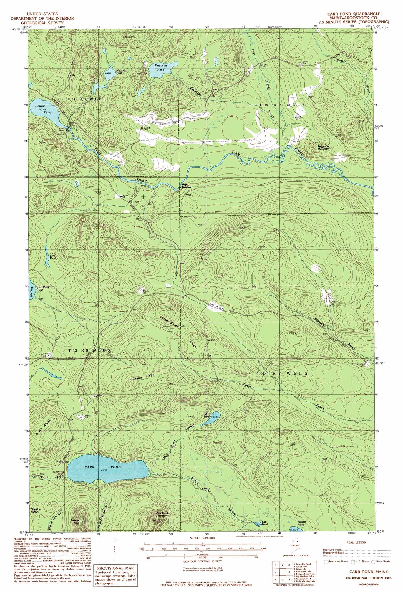
Carr Pond Topo Map Maine
To zoom in, hover over the map of Carr Pond
USGS Topo Quad 46068g6 - 1:24,000 scale
| Topo Map Name: | Carr Pond |
| USGS Topo Quad ID: | 46068g6 |
| Print Size: | ca. 21 1/4" wide x 27" high |
| Southeast Coordinates: | 46.75° N latitude / 68.625° W longitude |
| Map Center Coordinates: | 46.8125° N latitude / 68.6875° W longitude |
| U.S. State: | ME |
| Filename: | o46068g6.jpg |
| Download Map JPG Image: | Carr Pond topo map 1:24,000 scale |
| Map Type: | Topographic |
| Topo Series: | 7.5´ |
| Map Scale: | 1:24,000 |
| Source of Map Images: | United States Geological Survey (USGS) |
| Alternate Map Versions: |
Winterville SW ME 1975, updated 1981 Download PDF Buy paper map Carr Pond ME 1985, updated 1986 Download PDF Buy paper map Carr Pond ME 2011 Download PDF Buy paper map Carr Pond ME 2014 Download PDF Buy paper map |
1:24,000 Topo Quads surrounding Carr Pond
Second Lake |
Mclean Mountain |
Wallacrass Lakes |
Eagle Lake |
Square Lake West |
Gardner Pond |
Deboullie Pond |
Island Pond |
Winterville |
Mcclusky Lake |
Fish River Lake Sw |
Fish River Lake |
Carr Pond |
Portage Lake West |
Portage Lake East |
Farrar Pond |
Big Machias Lake |
Greenlaw Pond |
Little Machias Lake |
Ashland |
Mooseleuk Lake |
Round Mountain |
Jack Mountain |
Forks Of Machias |
Squa Pan |
> Back to 46068e1 at 1:100,000 scale
> Back to 46068a1 at 1:250,000 scale
> Back to U.S. Topo Maps home
Carr Pond topo map: Gazetteer
Carr Pond: Falls
Fish River Falls elevation 219m 718′Skew Falls elevation 211m 692′
Carr Pond: Lakes
Carr Pond elevation 235m 770′Ferguson Pond elevation 260m 853′
Long Pond elevation 236m 774′
Lost Pond elevation 270m 885′
Moccasin Pond elevation 286m 938′
Mud Pond elevation 263m 862′
Round Pond elevation 216m 708′
Carr Pond: Populated Places
High Landing elevation 200m 656′Carr Pond: Ridges
Chase Brook Ridge elevation 330m 1082′Freeman Ridge elevation 374m 1227′
North Ridge elevation 315m 1033′
Carr Pond: Streams
Bishop Pond Stream elevation 235m 770′East Branch Ferguson Brook elevation 200m 656′
Ferguson Brook elevation 195m 639′
Moose Pond Stream elevation 235m 770′
Mud Pond Stream elevation 235m 770′
Carr Pond: Summits
Bishop Mountain elevation 362m 1187′Carr Pond Mountain elevation 432m 1417′
Ferguson Mountain elevation 251m 823′
Carr Pond digital topo map on disk
Buy this Carr Pond topo map showing relief, roads, GPS coordinates and other geographical features, as a high-resolution digital map file on DVD:
Maine, New Hampshire, Rhode Island & Eastern Massachusetts
Buy digital topo maps: Maine, New Hampshire, Rhode Island & Eastern Massachusetts