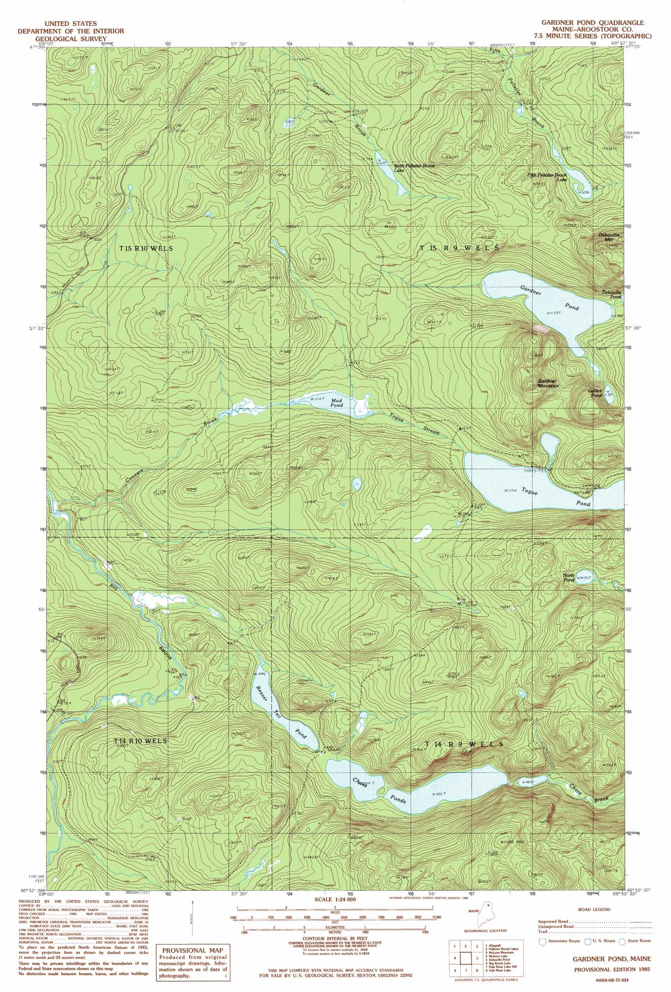
Gardner Pond Topo Map Maine
To zoom in, hover over the map of Gardner Pond
USGS Topo Quad 46068h8 - 1:24,000 scale
| Topo Map Name: | Gardner Pond |
| USGS Topo Quad ID: | 46068h8 |
| Print Size: | ca. 21 1/4" wide x 27" high |
| Southeast Coordinates: | 46.875° N latitude / 68.875° W longitude |
| Map Center Coordinates: | 46.9375° N latitude / 68.9375° W longitude |
| U.S. State: | ME |
| Filename: | o46068h8.jpg |
| Download Map JPG Image: | Gardner Pond topo map 1:24,000 scale |
| Map Type: | Topographic |
| Topo Series: | 7.5´ |
| Map Scale: | 1:24,000 |
| Source of Map Images: | United States Geological Survey (USGS) |
| Alternate Map Versions: |
Fish River Lake NW ME 1975, updated 1981 Download PDF Buy paper map Gardner Pond ME 1985, updated 1986 Download PDF Buy paper map Gardner Pond ME 2011 Download PDF Buy paper map Gardner Pond ME 2014 Download PDF Buy paper map |
1:24,000 Topo Quads surrounding Gardner Pond
Johnson Brook Mountain |
Falls Brook Lake |
Saint Francis |
Saint John |
Wheelock |
Big Rapids |
Allagash |
Second Lake |
Mclean Mountain |
Wallacrass Lakes |
Allagash Falls |
Mckeen Lake |
Gardner Pond |
Deboullie Pond |
Island Pond |
Five Finger Brook |
Big Brook Lake |
Fish River Lake Sw |
Fish River Lake |
Carr Pond |
First Musquacook Lake |
Upper Mcnally Pond |
Farrar Pond |
Big Machias Lake |
Greenlaw Pond |
> Back to 46068e1 at 1:100,000 scale
> Back to 46068a1 at 1:250,000 scale
> Back to U.S. Topo Maps home
Gardner Pond topo map: Gazetteer
Gardner Pond: Lakes
Beaver Tail Pond elevation 304m 997′Chase Ponds elevation 305m 1000′
Fifth Pelletier Brook Lake elevation 392m 1286′
Galilee Pond elevation 359m 1177′
Gardner Pond elevation 346m 1135′
Mud Pond elevation 340m 1115′
North Pond elevation 436m 1430′
Sixth Pelletier Brook Lake elevation 390m 1279′
Togue Pond elevation 364m 1194′
Gardner Pond: Populated Places
Wheelock Mill elevation 380m 1246′Gardner Pond: Streams
Conners Brook elevation 260m 853′Togue Stream elevation 341m 1118′
Gardner Pond: Summits
Deboullie Mountain elevation 591m 1938′Gardner Mountain elevation 531m 1742′
Gardner Pond digital topo map on disk
Buy this Gardner Pond topo map showing relief, roads, GPS coordinates and other geographical features, as a high-resolution digital map file on DVD:
Maine, New Hampshire, Rhode Island & Eastern Massachusetts
Buy digital topo maps: Maine, New Hampshire, Rhode Island & Eastern Massachusetts