Gurney Topo Map Wisconsin
To zoom in, hover over the map of Gurney
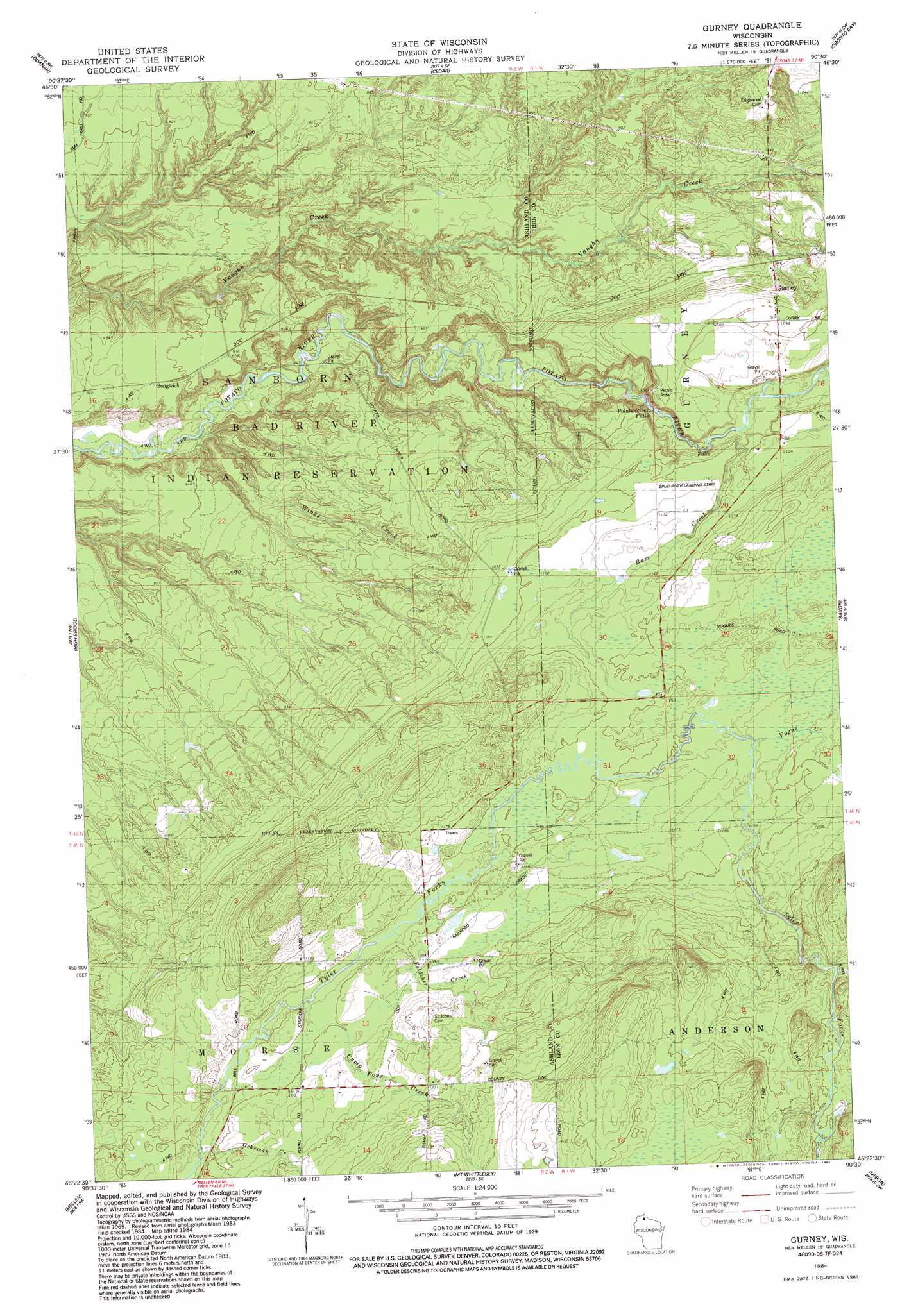
USGS Topo Quad 46090d5 - 1:24,000 scale
| Topo Map Name: | Gurney |
| USGS Topo Quad ID: | 46090d5 |
| Print Size: | ca. 21 1/4" wide x 27" high |
| Southeast Coordinates: | 46.375° N latitude / 90.5° W longitude |
| Map Center Coordinates: | 46.4375° N latitude / 90.5625° W longitude |
| U.S. State: | WI |
| Filename: | o46090d5.jpg |
| Download Map JPG Image: | Gurney topo map 1:24,000 scale |
| Map Type: | Topographic |
| Topo Series: | 7.5´ |
| Map Scale: | 1:24,000 |
| Source of Map Images: | United States Geological Survey (USGS) |
| Alternate Map Versions: |
Gurney WI 1984, updated 1984 Download PDF Buy paper map Gurney WI 2010 Download PDF Buy paper map Gurney WI 2013 Download PDF Buy paper map Gurney WI 2015 Download PDF Buy paper map |
1:24,000 Topo Quads surrounding Gurney
Long Island |
Chequamegon Point |
|||
Ashland East |
Odanah |
Cedar |
Oronto Bay |
Little Girls Point |
Marengo |
High Bridge |
Gurney |
Saxon |
Iron Belt |
Mineral Lake |
Mellen |
Mount Whittlesey |
Upson |
Turntable Creek |
Clam Lake Ne |
Morse |
Glidden |
Augustine Lake |
Lake Six |
> Back to 46090a1 at 1:100,000 scale
> Back to 46090a1 at 1:250,000 scale
> Back to U.S. Topo Maps home
Gurney topo map: Gazetteer
Gurney: Airports
Spud River Landing Strip elevation 337m 1105′Gurney: Falls
Potato River Falls elevation 295m 967′Gurney: Populated Places
Gurney elevation 331m 1085′Sedgwick elevation 259m 849′
Gurney: Streams
Barr Creek elevation 322m 1056′Camp Four Creek elevation 344m 1128′
Feldcher Creek elevation 345m 1131′
Gehrman Creek elevation 344m 1128′
Vogue Creek elevation 357m 1171′
Winks Creek elevation 219m 718′
Gurney digital topo map on disk
Buy this Gurney topo map showing relief, roads, GPS coordinates and other geographical features, as a high-resolution digital map file on DVD: