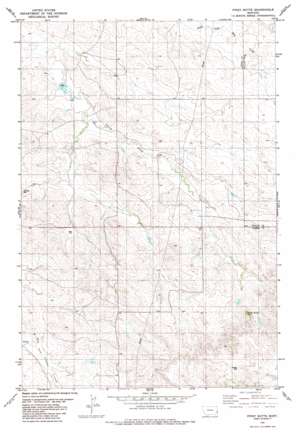
Piney Butte Topo Map Montana
To zoom in, hover over the map of Piney Butte
USGS Topo Quad 46104a5 - 1:24,000 scale
| Topo Map Name: | Piney Butte |
| USGS Topo Quad ID: | 46104a5 |
| Print Size: | ca. 21 1/4" wide x 27" high |
| Southeast Coordinates: | 46° N latitude / 104.5° W longitude |
| Map Center Coordinates: | 46.0625° N latitude / 104.5625° W longitude |
| U.S. State: | MT |
| Filename: | o46104a5.jpg |
| Download Map JPG Image: | Piney Butte topo map 1:24,000 scale |
| Map Type: | Topographic |
| Topo Series: | 7.5´ |
| Map Scale: | 1:24,000 |
| Source of Map Images: | United States Geological Survey (USGS) |
| Alternate Map Versions: |
Piney Butte MT 1981, updated 1981 Download PDF Buy paper map Piney Butte MT 2011 Download PDF Buy paper map Piney Butte MT 2014 Download PDF Buy paper map |
1:24,000 Topo Quads surrounding Piney Butte
> Back to 46104a1 at 1:100,000 scale
> Back to 46104a1 at 1:250,000 scale
> Back to U.S. Topo Maps home
Piney Butte topo map: Gazetteer
Piney Butte: Dams
Hanley Dam elevation 905m 2969′Homer Number 1 Dam elevation 954m 3129′
Ringling Number 1 Dam elevation 990m 3248′
Piney Butte: Summits
Piney Butte elevation 1038m 3405′Piney Butte: Wells
03N57E02AAAD01 Well elevation 960m 3149′03N57E13DDD_01 Well elevation 1026m 3366′
04N57E14DAB_01 Well elevation 978m 3208′
04N57E15ABDA01 Well elevation 931m 3054′
04N57E24BDCB01 Well elevation 916m 3005′
04N57E24CAA_01 Well elevation 959m 3146′
04N58E17CCCB01 Well elevation 933m 3061′
04N58E18CC__01 Well elevation 968m 3175′
04N58E30ADAD01 Well elevation 937m 3074′
04N58E32DADB01 Well elevation 965m 3166′
Piney Butte digital topo map on disk
Buy this Piney Butte topo map showing relief, roads, GPS coordinates and other geographical features, as a high-resolution digital map file on DVD:
Eastern Montana & Western North Dakota
Buy digital topo maps: Eastern Montana & Western North Dakota


