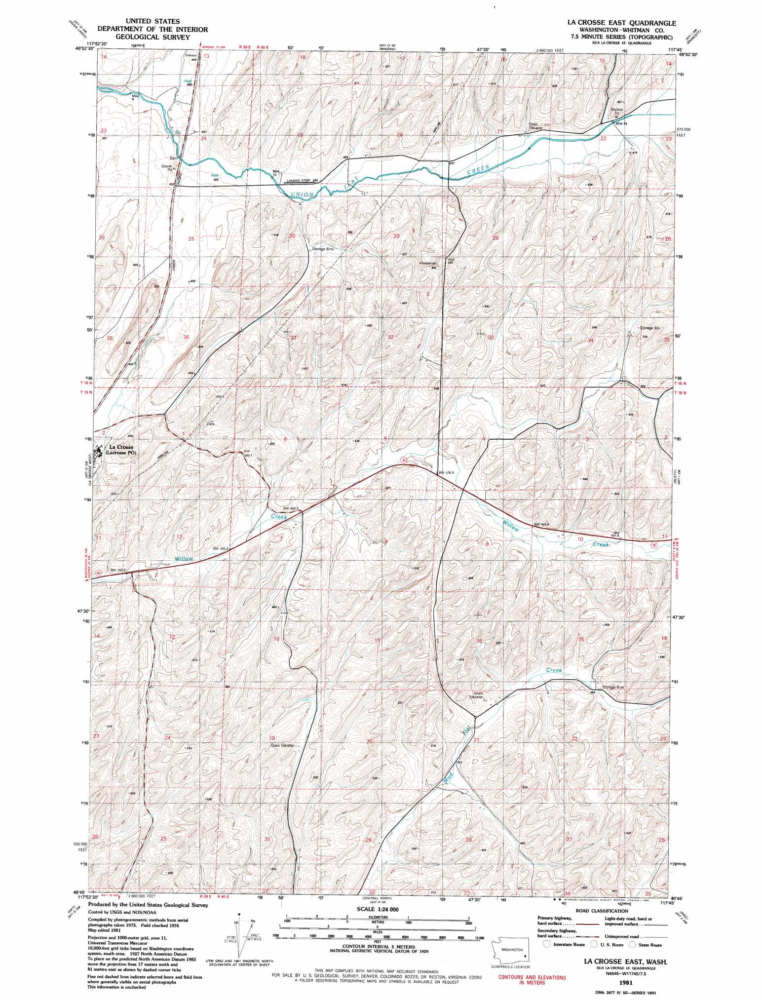
La Crosse East Topo Map Washington
To zoom in, hover over the map of La Crosse East
USGS Topo Quad 46117g7 - 1:24,000 scale
| Topo Map Name: | La Crosse East |
| USGS Topo Quad ID: | 46117g7 |
| Print Size: | ca. 21 1/4" wide x 27" high |
| Southeast Coordinates: | 46.75° N latitude / 117.75° W longitude |
| Map Center Coordinates: | 46.8125° N latitude / 117.8125° W longitude |
| U.S. State: | WA |
| Filename: | o46117g7.jpg |
| Download Map JPG Image: | La Crosse East topo map 1:24,000 scale |
| Map Type: | Topographic |
| Topo Series: | 7.5´ |
| Map Scale: | 1:24,000 |
| Source of Map Images: | United States Geological Survey (USGS) |
| Alternate Map Versions: |
La Crosse East WA 1981, updated 1981 Download PDF Buy paper map La Crosse East WA 2011 Download PDF Buy paper map La Crosse East WA 2013 Download PDF Buy paper map |
1:24,000 Topo Quads surrounding La Crosse East
Macall |
Revere |
Texas Lake |
Ewan |
Saint John |
Benge |
Honn Lakes |
Winona |
Endicott |
Thera |
Rattlesnake Canyon |
La Crosse West |
La Crosse East |
Dusty |
Little Penawawa Creek |
Hooper Lake |
Hay |
Central Ferry |
Ping |
Wades Bar |
Starbuck East |
Delaney |
Dodge |
Falling Springs |
Gould City |
> Back to 46117e1 at 1:100,000 scale
> Back to 46116a1 at 1:250,000 scale
> Back to U.S. Topo Maps home
No gazetteer data is available for the La Crosse East topo map sheet.
La Crosse East digital topo map on disk
Buy this La Crosse East topo map showing relief, roads, GPS coordinates and other geographical features, as a high-resolution digital map file on DVD: