Piscoe Meadow Topo Map Washington
To zoom in, hover over the map of Piscoe Meadow
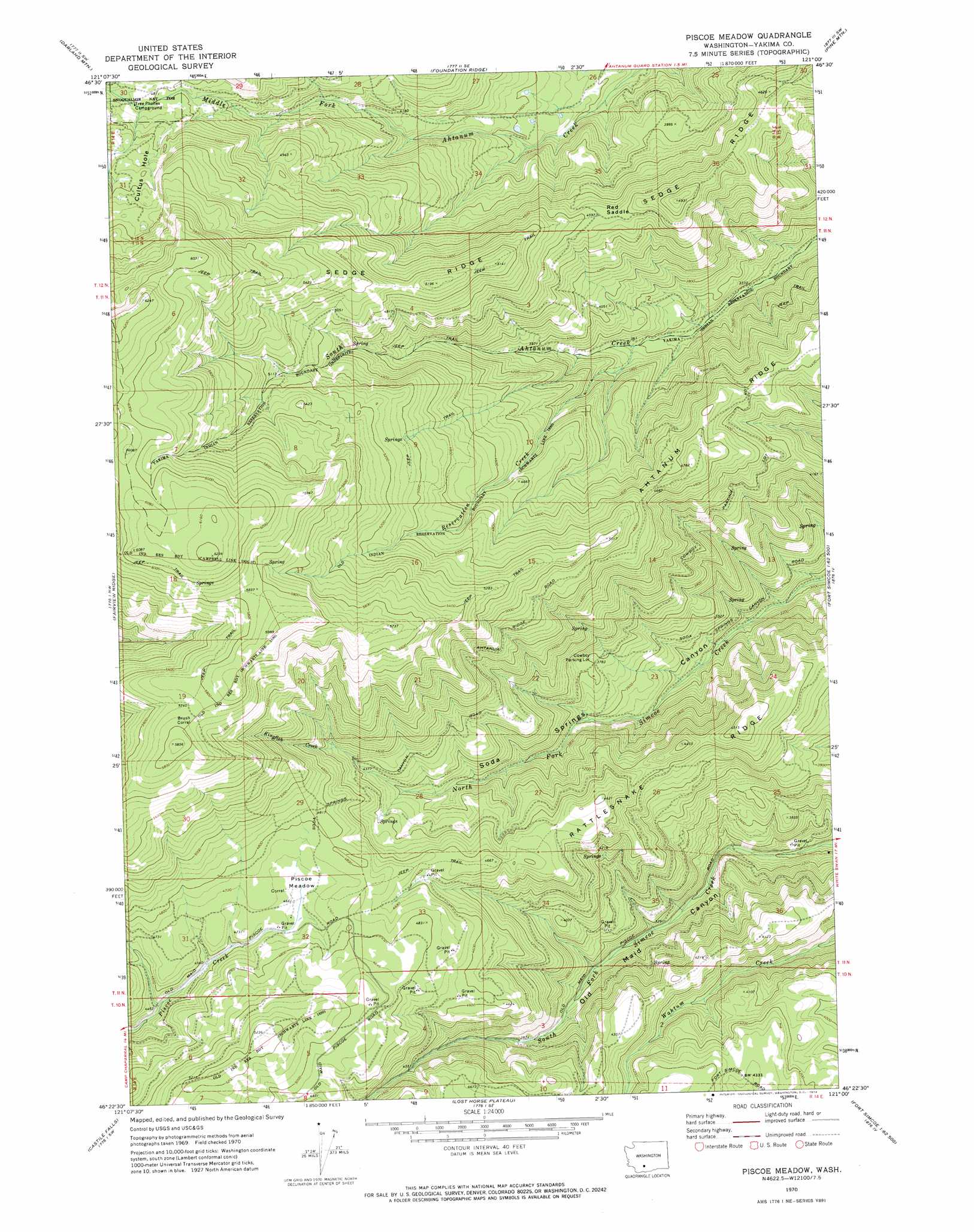
USGS Topo Quad 46121d1 - 1:24,000 scale
| Topo Map Name: | Piscoe Meadow |
| USGS Topo Quad ID: | 46121d1 |
| Print Size: | ca. 21 1/4" wide x 27" high |
| Southeast Coordinates: | 46.375° N latitude / 121° W longitude |
| Map Center Coordinates: | 46.4375° N latitude / 121.0625° W longitude |
| U.S. State: | WA |
| Filename: | o46121d1.jpg |
| Download Map JPG Image: | Piscoe Meadow topo map 1:24,000 scale |
| Map Type: | Topographic |
| Topo Series: | 7.5´ |
| Map Scale: | 1:24,000 |
| Source of Map Images: | United States Geological Survey (USGS) |
| Alternate Map Versions: |
Piscoe Meadow WA 1970, updated 1974 Download PDF Buy paper map Piscoe Meadow WA 2011 Download PDF Buy paper map Piscoe Meadow WA 2014 Download PDF Buy paper map |
1:24,000 Topo Quads surrounding Piscoe Meadow
Spiral Butte |
Rimrock Lake |
Tieton Basin |
Weddle Canyon |
Tieton |
Pinegrass Ridge |
Darland Mountain |
Foundation Ridge |
Pine Mountain |
Tampico |
Jennies Butte |
Fairview Ridge |
Piscoe Meadow |
Yesmowit Canyon |
Medicine Valley |
Windy Point |
Castile Falls |
Lost Horse Plateau |
Willy Dick Canyon |
Fort Simcoe |
Jungle Butte |
Signal Peak |
Poland Butte |
Mckays Butte |
Camas Patch |
> Back to 46121a1 at 1:100,000 scale
> Back to 46120a1 at 1:250,000 scale
> Back to U.S. Topo Maps home
Piscoe Meadow topo map: Gazetteer
Piscoe Meadow: Flats
Piscoe Meadow elevation 1431m 4694′Piscoe Meadow: Gaps
Red Saddle elevation 1399m 4589′Piscoe Meadow: Ridges
Rattlesnake Ridge elevation 1356m 4448′Piscoe Meadow: Streams
Kingfish Creek elevation 1383m 4537′Reservation Creek elevation 1100m 3608′
Piscoe Meadow digital topo map on disk
Buy this Piscoe Meadow topo map showing relief, roads, GPS coordinates and other geographical features, as a high-resolution digital map file on DVD: