Violette Stream Topo Map Maine
To zoom in, hover over the map of Violette Stream
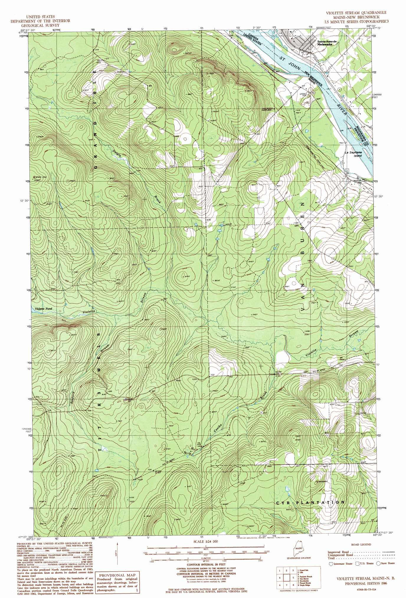
USGS Topo Quad 47068b1 - 1:24,000 scale
| Topo Map Name: | Violette Stream |
| USGS Topo Quad ID: | 47068b1 |
| Print Size: | ca. 21 1/4" wide x 27" high |
| Southeast Coordinates: | 47.125° N latitude / 68° W longitude |
| Map Center Coordinates: | 47.1875° N latitude / 68.0625° W longitude |
| U.S. State: | ME |
| Filename: | o47068b1.jpg |
| Download Map JPG Image: | Violette Stream topo map 1:24,000 scale |
| Map Type: | Topographic |
| Topo Series: | 7.5´ |
| Map Scale: | 1:24,000 |
| Source of Map Images: | United States Geological Survey (USGS) |
| Alternate Map Versions: |
Stockholm NE ME 1975, updated 1981 Download PDF Buy paper map Violette Stream ME 1986, updated 1986 Download PDF Buy paper map Violette Stream ME 2011 Download PDF Buy paper map Violette Stream ME 2014 Download PDF Buy paper map |
1:24,000 Topo Quads surrounding Violette Stream
Madawaska |
Grand Isle |
Lille |
||
Saint Agatha |
Paulette Brook |
Violette Stream |
Van Buren |
|
Square Lake East |
Stockholm |
Picard Brook |
Doyle Ridge |
Hamlin |
Hanford |
Mud Lake |
New Sweden |
Fort Fairfield Nw |
Limestone |
> Back to 47068a1 at 1:100,000 scale
> Back to 47068a1 at 1:250,000 scale
> Back to U.S. Topo Maps home
Violette Stream topo map: Gazetteer
Violette Stream: Populated Places
Daigle Mill elevation 194m 636′Parent elevation 144m 472′
Violette Stream: Streams
Caniba Brook elevation 154m 505′Daigle Brook elevation 159m 521′
Sanford Stream elevation 168m 551′
Violette Stream digital topo map on disk
Buy this Violette Stream topo map showing relief, roads, GPS coordinates and other geographical features, as a high-resolution digital map file on DVD:
Maine, New Hampshire, Rhode Island & Eastern Massachusetts
Buy digital topo maps: Maine, New Hampshire, Rhode Island & Eastern Massachusetts