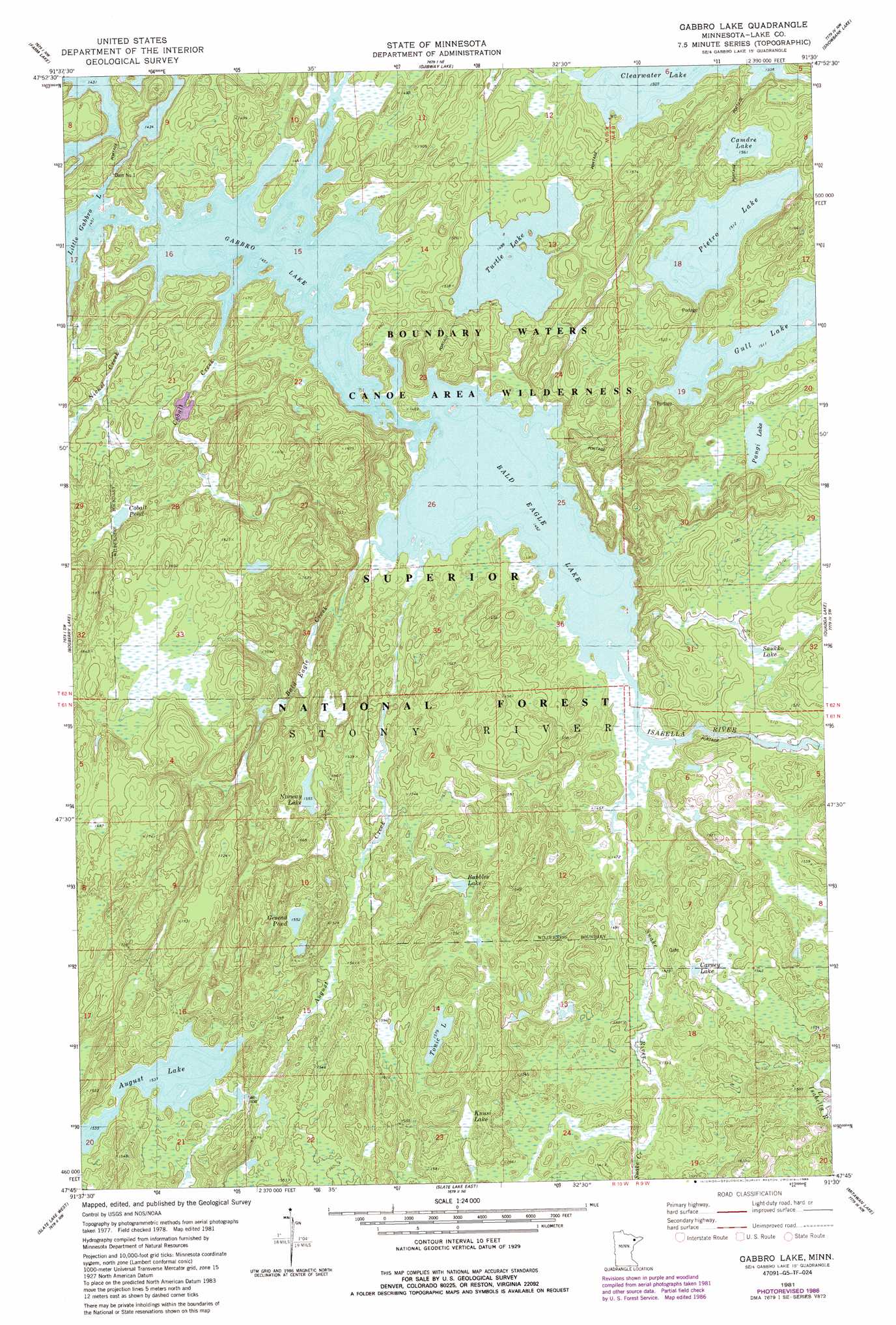
Gabbro Lake Topo Map Minnesota
To zoom in, hover over the map of Gabbro Lake
USGS Topo Quad 47091g5 - 1:24,000 scale
| Topo Map Name: | Gabbro Lake |
| USGS Topo Quad ID: | 47091g5 |
| Print Size: | ca. 21 1/4" wide x 27" high |
| Southeast Coordinates: | 47.75° N latitude / 91.5° W longitude |
| Map Center Coordinates: | 47.8125° N latitude / 91.5625° W longitude |
| U.S. State: | MN |
| Filename: | o47091g5.jpg |
| Download Map JPG Image: | Gabbro Lake topo map 1:24,000 scale |
| Map Type: | Topographic |
| Topo Series: | 7.5´ |
| Map Scale: | 1:24,000 |
| Source of Map Images: | United States Geological Survey (USGS) |
| Alternate Map Versions: |
Gabbro Lake MN 1981, updated 1982 Download PDF Buy paper map Gabbro Lake MN 1981, updated 1986 Download PDF Buy paper map Gabbro Lake MN 2011 Download PDF Buy paper map Gabbro Lake MN 2013 Download PDF Buy paper map Gabbro Lake MN 2016 Download PDF Buy paper map |
| FStopo: | US Forest Service topo Gabbro Lake is available: Download FStopo PDF Download FStopo TIF |
1:24,000 Topo Quads surrounding Gabbro Lake
Fourtown Lake |
Basswood Lake West |
Basswood Lake East |
Ensign Lake West |
Ensign Lake East |
Ely |
Farm Lake |
Ojibway Lake |
Snowbank Lake |
Lake Insula |
Kangas Bay |
Bogberry Lake |
Gabbro Lake |
Quadga Lake |
Isabella Lake |
Babbitt Ne |
Slate Lake West |
Slate Lake East |
Mitawan Lake |
Sawbill Landing |
Babbitt Se |
Greenwood Lake West |
Greenwood Lake East |
Isabella Station |
Isabella |
> Back to 47091e1 at 1:100,000 scale
> Back to 47090a1 at 1:250,000 scale
> Back to U.S. Topo Maps home
Gabbro Lake topo map: Gazetteer
Gabbro Lake: Dams
Dam Number One elevation 446m 1463′Gabbro Lake Number 1 Dam elevation 451m 1479′
Gabbro Lake: Forests
Superior National Forest elevation 482m 1581′Gabbro Lake: Lakes
August Lake elevation 469m 1538′Bald Eagle Lake elevation 443m 1453′
Bubbles Lake elevation 471m 1545′
Camdre Lake elevation 476m 1561′
Carney Lake elevation 470m 1541′
Cobalt Pond elevation 475m 1558′
Gabbro Lake elevation 443m 1453′
Gesend Pond elevation 473m 1551′
Kuusi Lake elevation 474m 1555′
Norway Lake elevation 475m 1558′
Pangi Lake elevation 465m 1525′
Pietro Lake elevation 461m 1512′
Saukko Lake elevation 460m 1509′
Tonic Lake elevation 482m 1581′
Turtle Lake elevation 457m 1499′
Gabbro Lake: Reservoirs
Gabbro Lake Number 1 elevation 451m 1479′Gabbro Lake: Streams
August Creek elevation 444m 1456′Bald Eagle Creek elevation 443m 1453′
Cobalt Creek elevation 443m 1453′
Isabella River elevation 443m 1453′
Nickel Creek elevation 443m 1453′
Snake Creek elevation 460m 1509′
Snake River elevation 443m 1453′
Gabbro Lake digital topo map on disk
Buy this Gabbro Lake topo map showing relief, roads, GPS coordinates and other geographical features, as a high-resolution digital map file on DVD: