Gerhard Corner Topo Map Montana
To zoom in, hover over the map of Gerhard Corner
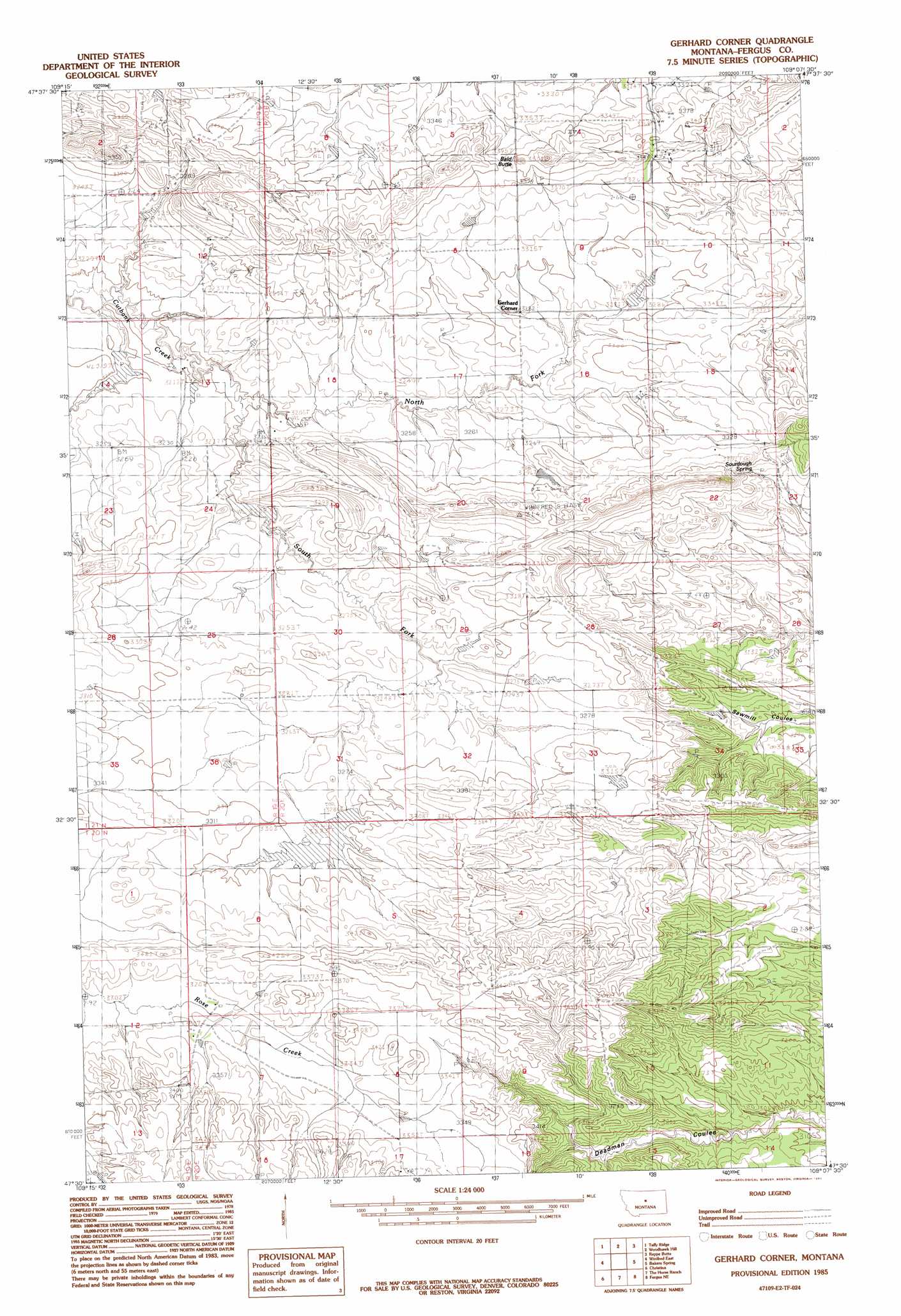
USGS Topo Quad 47109e2 - 1:24,000 scale
| Topo Map Name: | Gerhard Corner |
| USGS Topo Quad ID: | 47109e2 |
| Print Size: | ca. 21 1/4" wide x 27" high |
| Southeast Coordinates: | 47.5° N latitude / 109.125° W longitude |
| Map Center Coordinates: | 47.5625° N latitude / 109.1875° W longitude |
| U.S. State: | MT |
| Filename: | o47109e2.jpg |
| Download Map JPG Image: | Gerhard Corner topo map 1:24,000 scale |
| Map Type: | Topographic |
| Topo Series: | 7.5´ |
| Map Scale: | 1:24,000 |
| Source of Map Images: | United States Geological Survey (USGS) |
| Alternate Map Versions: |
Gerhard Corner MT 1985, updated 1985 Download PDF Buy paper map Gerhard Corner MT 2011 Download PDF Buy paper map Gerhard Corner MT 2014 Download PDF Buy paper map |
1:24,000 Topo Quads surrounding Gerhard Corner
Ragland Bench |
Leroy |
Bird Rapids |
Sturgeon Island |
Cow Island |
Gallatin Rapids |
Taffy Ridge |
Woodhawk Hill |
Reppe Butte |
Baker Monument |
Winifred West |
Winifred East |
Gerhard Corner |
Bakers Spring |
Thompson Coulee |
Hilger Nw |
Christina |
The Horse Ranch |
Fergus Ne |
Roy Nw |
Kendall |
Hilger |
Armells |
Fergus |
Roy |
> Back to 47109e1 at 1:100,000 scale
> Back to 47108a1 at 1:250,000 scale
> Back to U.S. Topo Maps home
Gerhard Corner topo map: Gazetteer
Gerhard Corner: Dams
Benes Bank Dam elevation 1005m 3297′Robert Bold Number 1 Dam elevation 999m 3277′
Robert Bold Number 2 Dam elevation 1002m 3287′
Gerhard Corner: Post Offices
Gerhard Post Office (historical) elevation 997m 3270′Gerhard Corner: Springs
Sourdough Spring elevation 1001m 3284′Gerhard Corner: Streams
North Fork Cutbank Creek elevation 973m 3192′South Fork Cutbank Creek elevation 973m 3192′
Gerhard Corner: Summits
Bald Butte elevation 1060m 3477′Gerhard Corner: Wells
20N20E17ABBD01 Well elevation 1025m 3362′21N19E13BDD_01 Well elevation 970m 3182′
Gerhard Corner digital topo map on disk
Buy this Gerhard Corner topo map showing relief, roads, GPS coordinates and other geographical features, as a high-resolution digital map file on DVD: