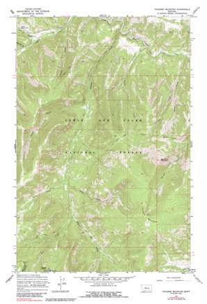
Thunder Mountain Topo Map Montana
To zoom in, hover over the map of Thunder Mountain
USGS Topo Quad 47110a8 - 1:24,000 scale
| Topo Map Name: | Thunder Mountain |
| USGS Topo Quad ID: | 47110a8 |
| Print Size: | ca. 21 1/4" wide x 27" high |
| Southeast Coordinates: | 47° N latitude / 110.875° W longitude |
| Map Center Coordinates: | 47.0625° N latitude / 110.9375° W longitude |
| U.S. State: | MT |
| Filename: | o47110a8.jpg |
| Download Map JPG Image: | Thunder Mountain topo map 1:24,000 scale |
| Map Type: | Topographic |
| Topo Series: | 7.5´ |
| Map Scale: | 1:24,000 |
| Source of Map Images: | United States Geological Survey (USGS) |
| Alternate Map Versions: |
Thunder Mountain MT 1967, updated 1970 Download PDF Buy paper map Thunder Mountain MT 1967, updated 1987 Download PDF Buy paper map Thunder Mountain MT 1995, updated 1997 Download PDF Buy paper map Thunder Mountain MT 2011 Download PDF Buy paper map Thunder Mountain MT 2014 Download PDF Buy paper map |
| FStopo: | US Forest Service topo Thunder Mountain is available: Download FStopo PDF Download FStopo TIF |
1:24,000 Topo Quads surrounding Thunder Mountain
> Back to 47110a1 at 1:100,000 scale
> Back to 47110a1 at 1:250,000 scale
> Back to U.S. Topo Maps home
Thunder Mountain topo map: Gazetteer
Thunder Mountain: Streams
Deer Creek elevation 1608m 5275′Iron Creek elevation 1354m 4442′
Lick Creek elevation 1352m 4435′
Pilgrim Creek elevation 1313m 4307′
Virgin Creek elevation 1349m 4425′
Thunder Mountain: Summits
Big Horn Mountain elevation 2338m 7670′Mount Pilgrim elevation 2201m 7221′
Thunder Mountain elevation 2476m 8123′
Thunder Mountain: Valleys
Circle Gulch elevation 1447m 4747′Goblin Gulch elevation 1561m 5121′
Holter Gulch elevation 1362m 4468′
Sawmill Gulch elevation 1373m 4504′
Tobins Gulch elevation 1325m 4347′
Urvi Gulch elevation 1564m 5131′
Thunder Mountain digital topo map on disk
Buy this Thunder Mountain topo map showing relief, roads, GPS coordinates and other geographical features, as a high-resolution digital map file on DVD:


