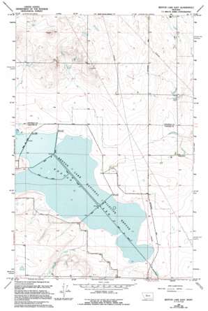
Benton Lake East Topo Map Montana
To zoom in, hover over the map of Benton Lake East
USGS Topo Quad 47111f3 - 1:24,000 scale
| Topo Map Name: | Benton Lake East |
| USGS Topo Quad ID: | 47111f3 |
| Print Size: | ca. 21 1/4" wide x 27" high |
| Southeast Coordinates: | 47.625° N latitude / 111.25° W longitude |
| Map Center Coordinates: | 47.6875° N latitude / 111.3125° W longitude |
| U.S. State: | MT |
| Filename: | o47111f3.jpg |
| Download Map JPG Image: | Benton Lake East topo map 1:24,000 scale |
| Map Type: | Topographic |
| Topo Series: | 7.5´ |
| Map Scale: | 1:24,000 |
| Source of Map Images: | United States Geological Survey (USGS) |
| Alternate Map Versions: |
Benton Lake East MT 1965, updated 1968 Download PDF Buy paper map Benton Lake East MT 1965, updated 1994 Download PDF Buy paper map Benton Lake East MT 2011 Download PDF Buy paper map Benton Lake East MT 2014 Download PDF Buy paper map |
1:24,000 Topo Quads surrounding Benton Lake East
> Back to 47111e1 at 1:100,000 scale
> Back to 47110a1 at 1:250,000 scale
> Back to U.S. Topo Maps home
Benton Lake East topo map: Gazetteer
Benton Lake East: Dams
Kodak Dam elevation 1143m 3750′Toy Box Dam elevation 1131m 3710′
Benton Lake East: Lakes
Benton Lake elevation 1105m 3625′Benton Lake East: Parks
Benton Lake National Wildlife Refuge elevation 1104m 3622′Benton Lake East: Populated Places
Benton Lake (historical) elevation 1109m 3638′Benton Lake East: Streams
Lake Creek elevation 1106m 3628′Benton Lake East: Wells
22N03E22AACB02 Well elevation 1105m 3625′22N03E22AACC07 Well elevation 1108m 3635′
22N03E22ABCC12 Well elevation 1111m 3645′
22N03E22ABDB08 Well elevation 1110m 3641′
22N03E22ACAC13 Well elevation 1122m 3681′
22N03E22ACCD14 Well elevation 1123m 3684′
22N03E22ADAB03 Well elevation 1106m 3628′
22N03E22ADBB11 Well elevation 1119m 3671′
22N03E22ADCB04 Well elevation 1120m 3674′
22N03E22CAAA15 Well elevation 1126m 3694′
22N03E22CAAB18 Well elevation 1126m 3694′
22N03E22CACD17 Well elevation 1134m 3720′
22N03E22CDAA16 Well elevation 1132m 3713′
22N03E22DBAA09 Well elevation 1121m 3677′
22N03E22DBCA19 Well elevation 1127m 3697′
22N03E26CDCB01 Well elevation 1126m 3694′
Benton Lake East digital topo map on disk
Buy this Benton Lake East topo map showing relief, roads, GPS coordinates and other geographical features, as a high-resolution digital map file on DVD:


