Banks Topo Map North Dakota
To zoom in, hover over the map of Banks
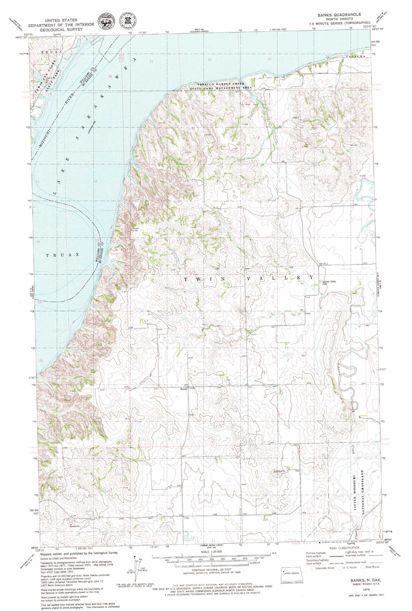
USGS Topo Quad 48103a2 - 1:24,000 scale
| Topo Map Name: | Banks |
| USGS Topo Quad ID: | 48103a2 |
| Print Size: | ca. 21 1/4" wide x 27" high |
| Southeast Coordinates: | 48° N latitude / 103.125° W longitude |
| Map Center Coordinates: | 48.0625° N latitude / 103.1875° W longitude |
| U.S. State: | ND |
| Filename: | O48103A2.jpg |
| Download Map JPG Image: | Banks topo map 1:24,000 scale |
| Map Type: | Topographic |
| Topo Series: | 7.5´ |
| Map Scale: | 1:24,000 |
| Source of Map Images: | United States Geological Survey (USGS) |
| Alternate Map Versions: |
Banks ND 1978, updated 1979 Download PDF Buy paper map Banks ND 1997, updated 2001 Download PDF Buy paper map Banks ND 2011 Download PDF Buy paper map Banks ND 2014 Download PDF Buy paper map |
| FStopo: | US Forest Service topo Banks is available: Download FStopo PDF Download FStopo TIF |
1:24,000 Topo Quads surrounding Banks
Spring Brook |
Epping |
Ray |
Ray Se |
Tioga Sw |
Stockyard Creek |
Gamache Creek |
Cussicks Spring |
Red Mike Hill |
Charlson Nw |
Lake Jessie |
Chris Creek |
Banks |
Tobacco Garden Bay |
Charlson Sw |
Watford City Nw |
Watford City Ne |
Timber Prong Creek |
Demicks Lake |
Keene |
Arnegard |
Watford City |
Schafer |
Schafer Se |
Johnsons Corner |
> Back to 48103a1 at 1:100,000 scale
> Back to 48102a1 at 1:250,000 scale
> Back to U.S. Topo Maps home
Banks topo map: Gazetteer
Banks: Parks
Lewis and Clark State Park elevation 579m 1899′Banks: Populated Places
Banks elevation 637m 2089′Banks: Streams
Clear Creek elevation 586m 1922′Long Creek elevation 561m 1840′
Short Creek elevation 561m 1840′
Banks digital topo map on disk
Buy this Banks topo map showing relief, roads, GPS coordinates and other geographical features, as a high-resolution digital map file on DVD:
Eastern Montana & Western North Dakota
Buy digital topo maps: Eastern Montana & Western North Dakota